I learned of the Pacific Crest Trail while hiking in the Cascades with the Scouts as a young teen. The idea of hiking a trail spanning the entire length of the continental United States instantly stuck in my mind. After moving from Washington to Texas hiking fell out my life but the idea of doing a thru-hike never quite did. At age 25 I began hiking again. My close friend Alex started joining me and together we hiked large sections of the AT and completed the Long Trail. In 2018 we embarked on our biggest challenge yet – the Pacific Crest Trail. 2650 miles stretching from Mexico to Canada.
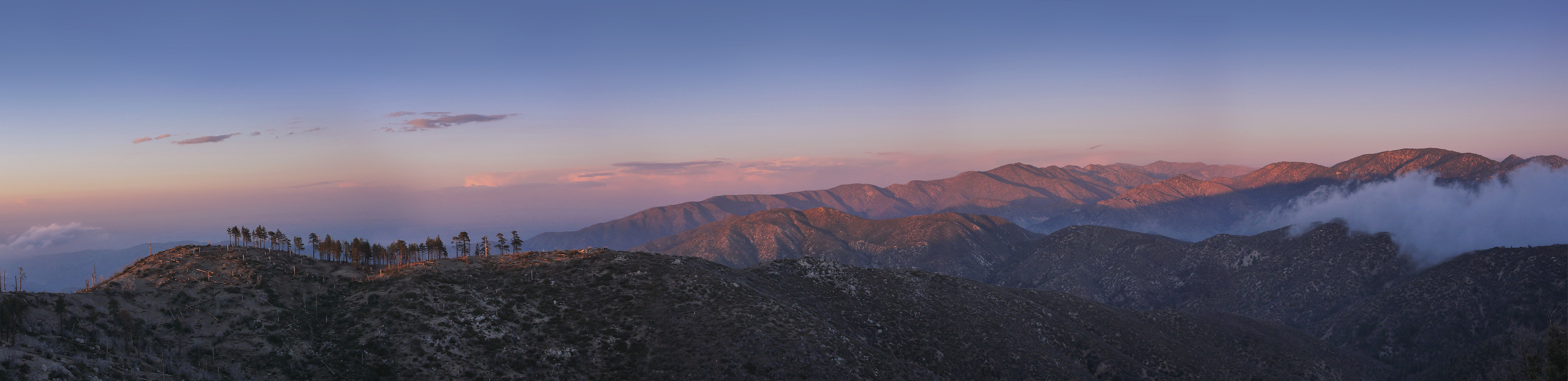
This post is broken up into 3 sections for easier reading. Part one Keep Scrolling.
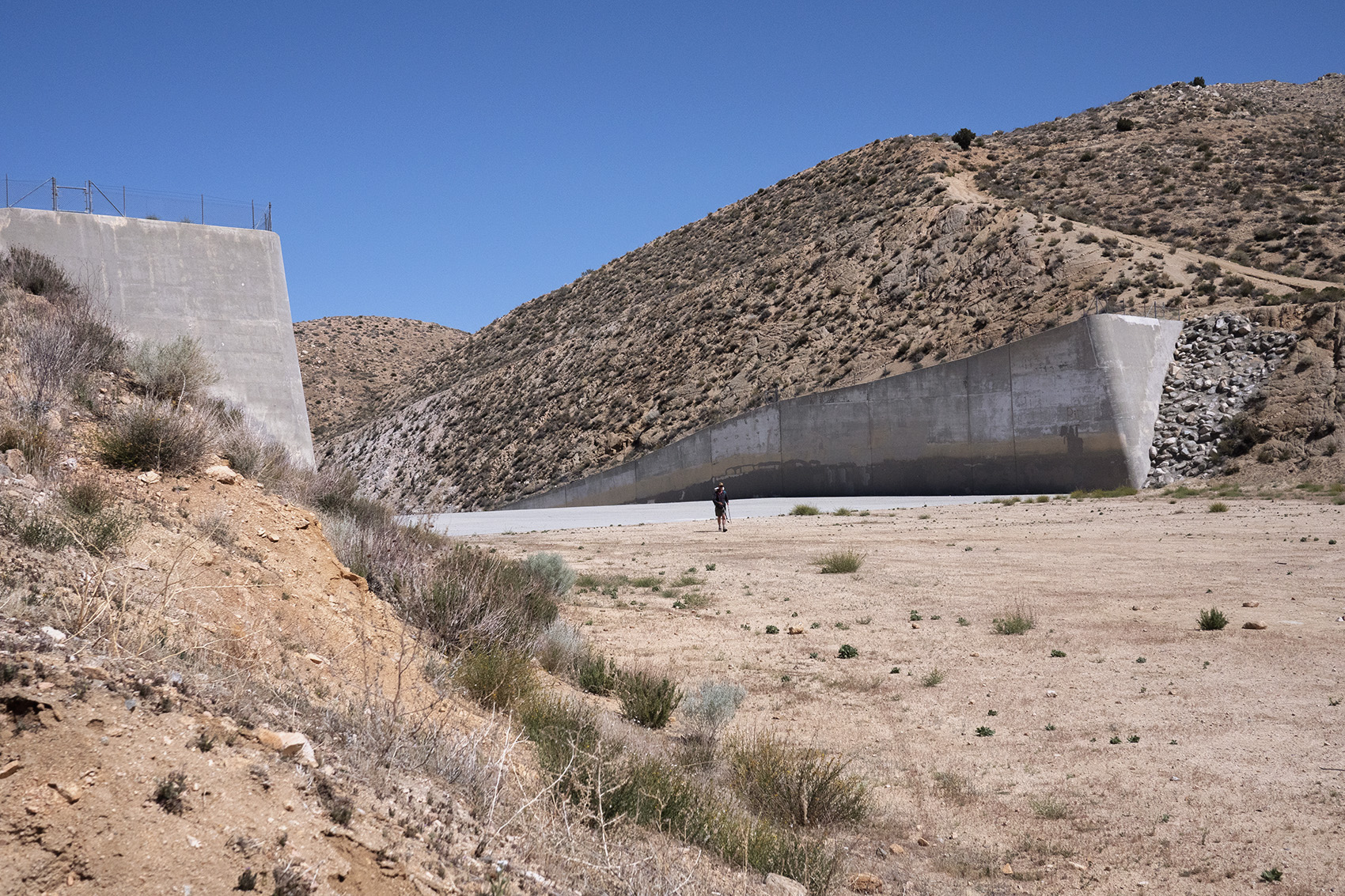
Part 2 (Big Bear Lake to Agua Dulce) Part 3 (Agua Dulce to Kennedy Meadows)
Day 0
NYC to San Diego
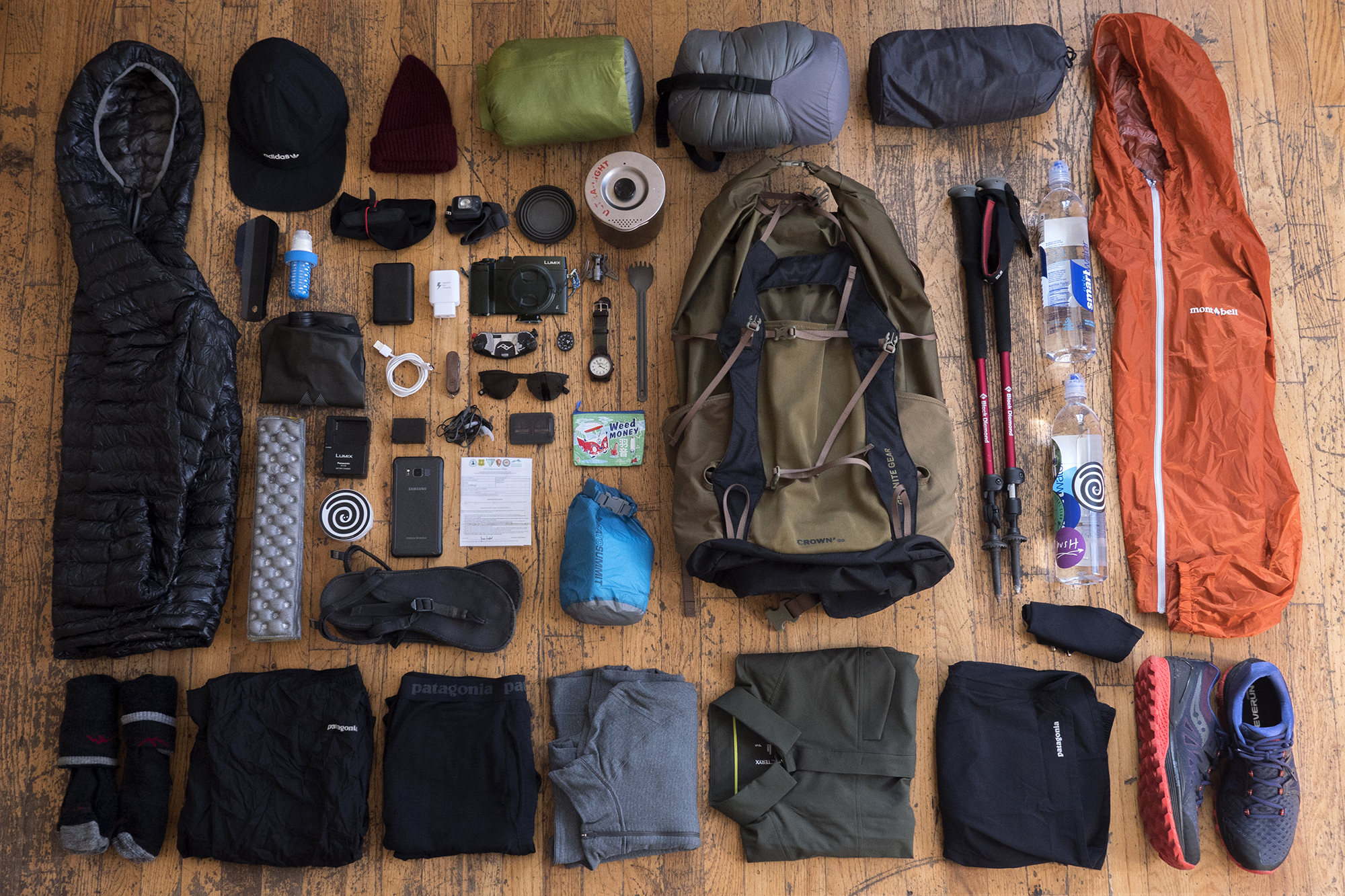
I finished packing up food for the first week of the trail just hours before boarding the plane to San Diego. Of course I had way too much and ended up leaving the majority with my girlfriend back in Brooklyn. She was happy to repackage and send it out as needed and I was happy that she would play a role in my mostly selfish journey. Our departure was sad but felt ok and gave me confidence this relationship would survive the coming months apart.
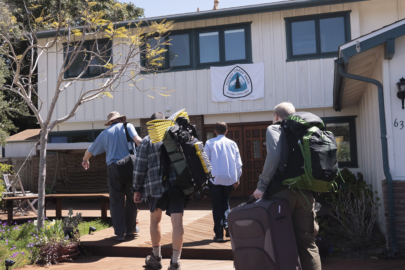
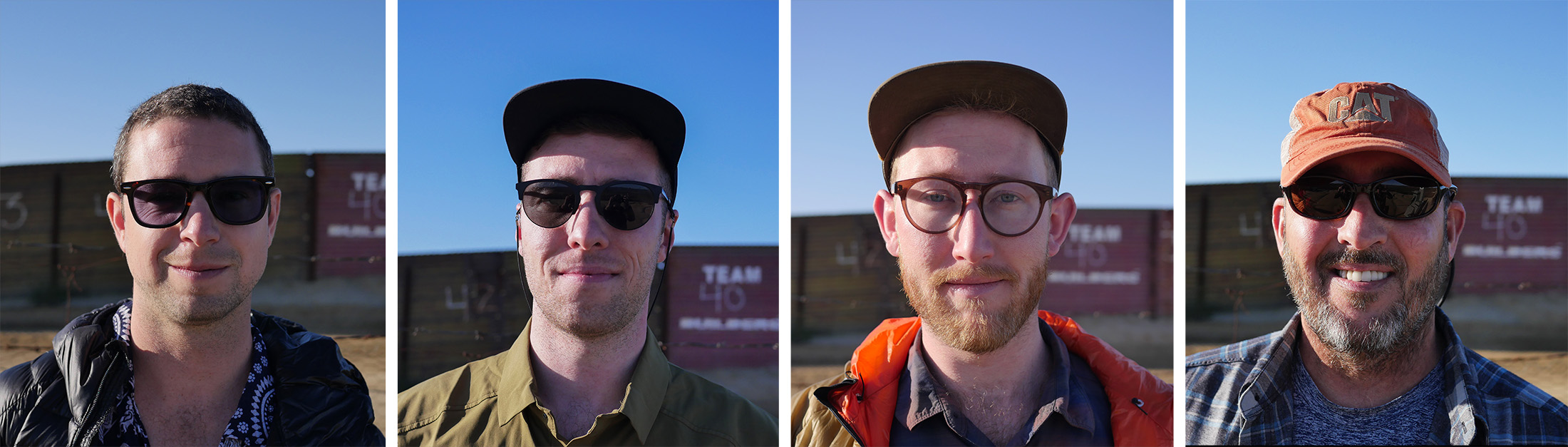
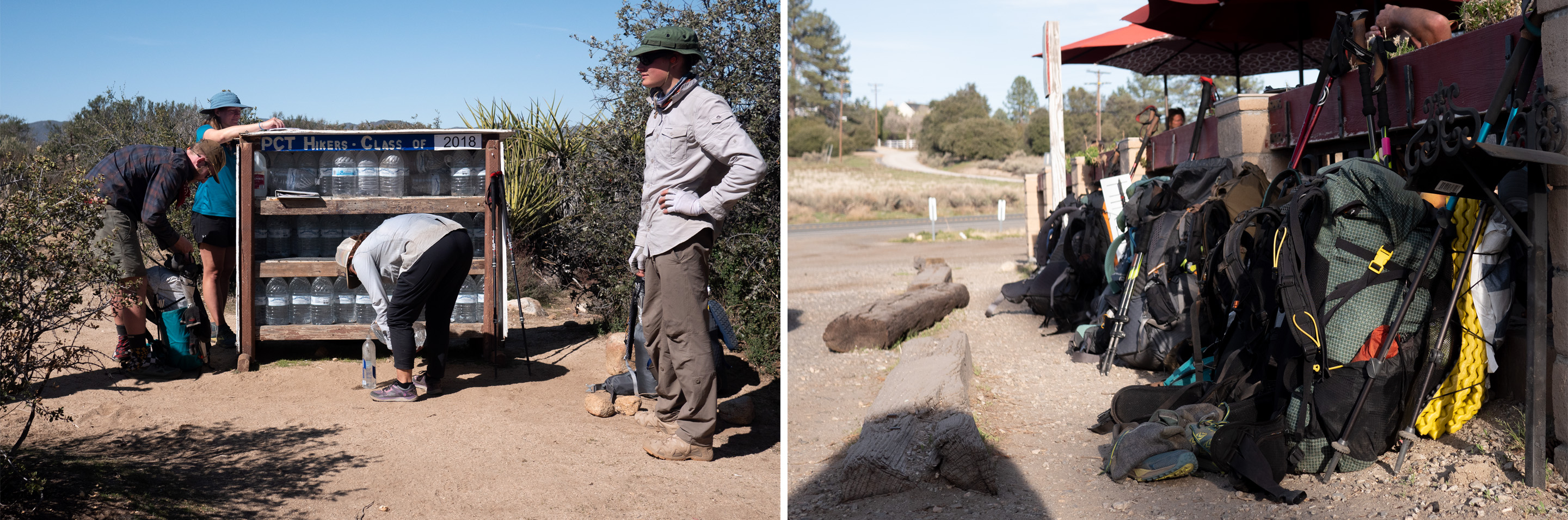
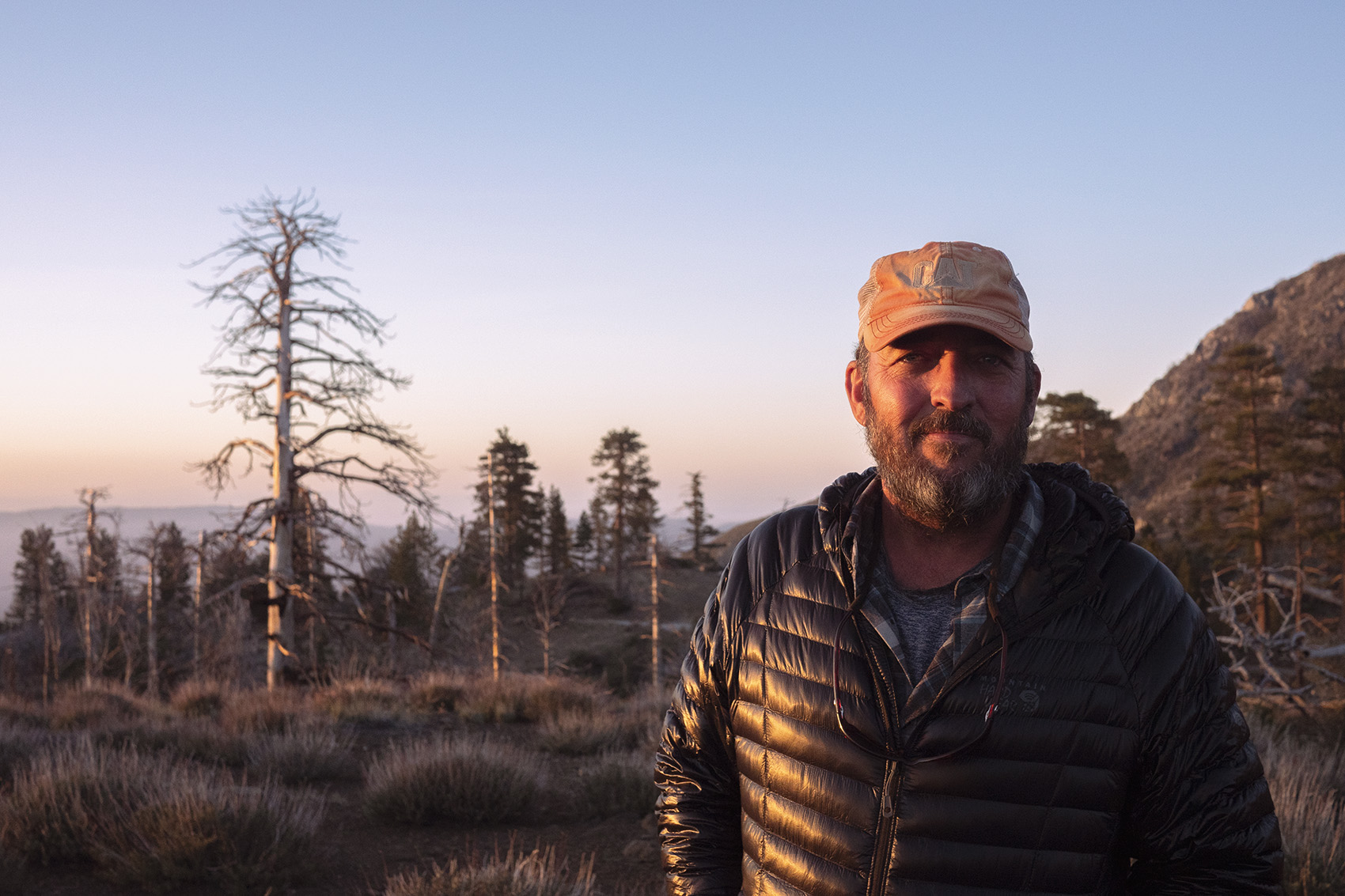
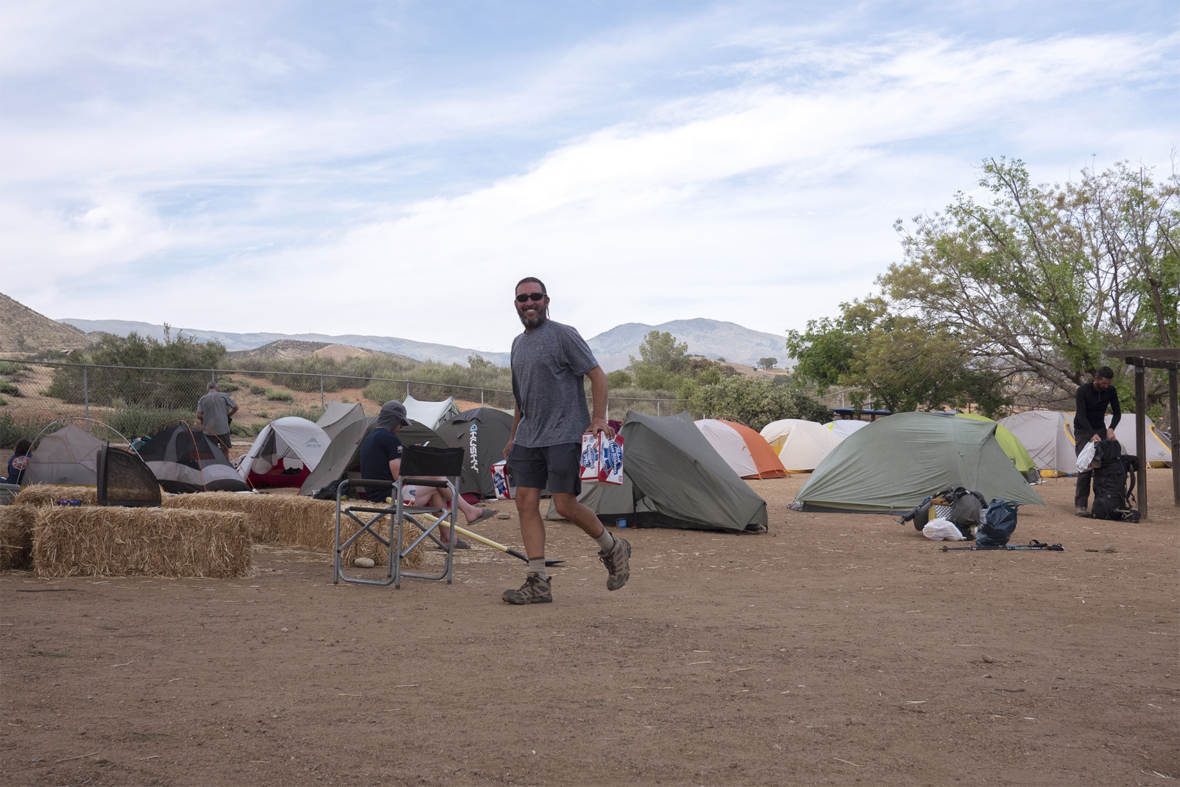
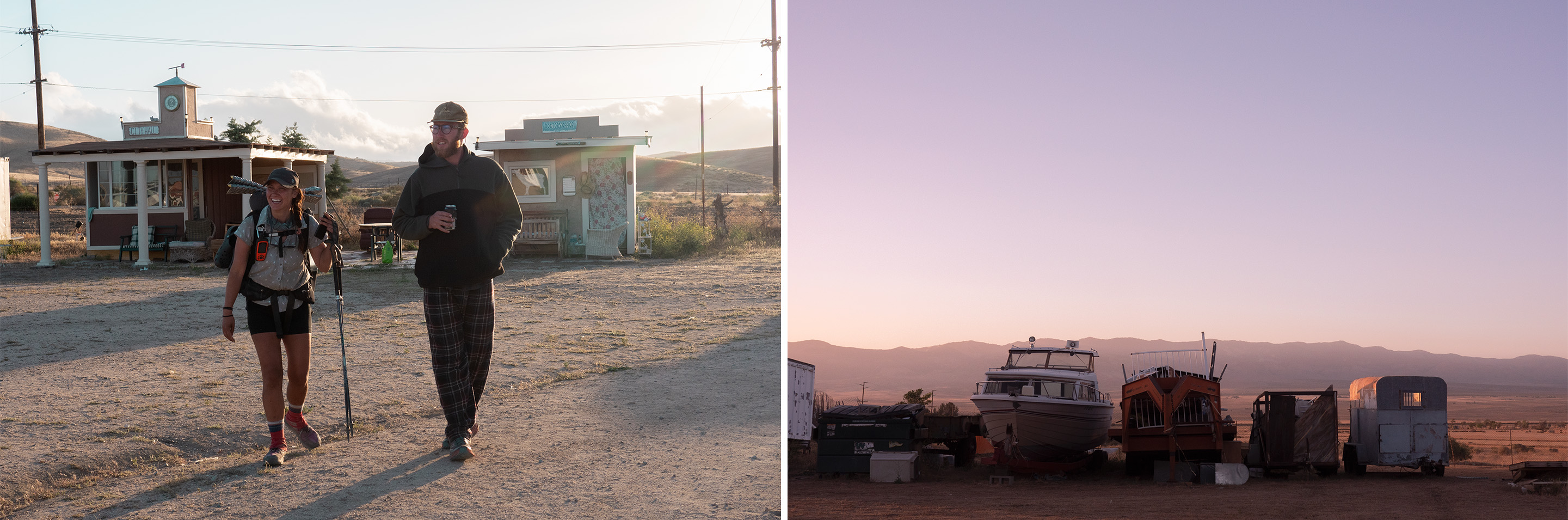
Landing in San Diego, decked out in trail clothes with only my pack, I met my Dad who was beyond excited to get started. Dad was one year into retirement. He had spent 30 years in the military and hiking the PCT was the first big thing he decided to do with his new found freedom. He introduced me to hiking and brought up the idea of doing a thru-hike many times over the years so having him join us made perfect sense. We spent the rest of the day checking out the legal pot scene and comparing gear choices. The next morning we caught a ride to Scout and Frodos, a couple who turned their home into a basecamp for the Pacific Crest Trail. Scout and Frodo were an older couple who hiked the trail years prior and fell in love with it. Each year they open their home to thousands of hikers all with the same goal, to complete the PCT. The operation they run is truly amazing. Giving bed, food, trail advice, and even small bits of gear to anyone who dreams of hiking from Mexico to Canada. The sense of nervous excitement was strong as strangers mingled and talked about the trail. I did my best to avoid conversations on gear and gravitated toward people talking about anything else. At some point Dad and I snuck out to hit a nearby bar.
Day 1 | Section 1: The Desert
March 28th | Mile 20 | 20 Hiked
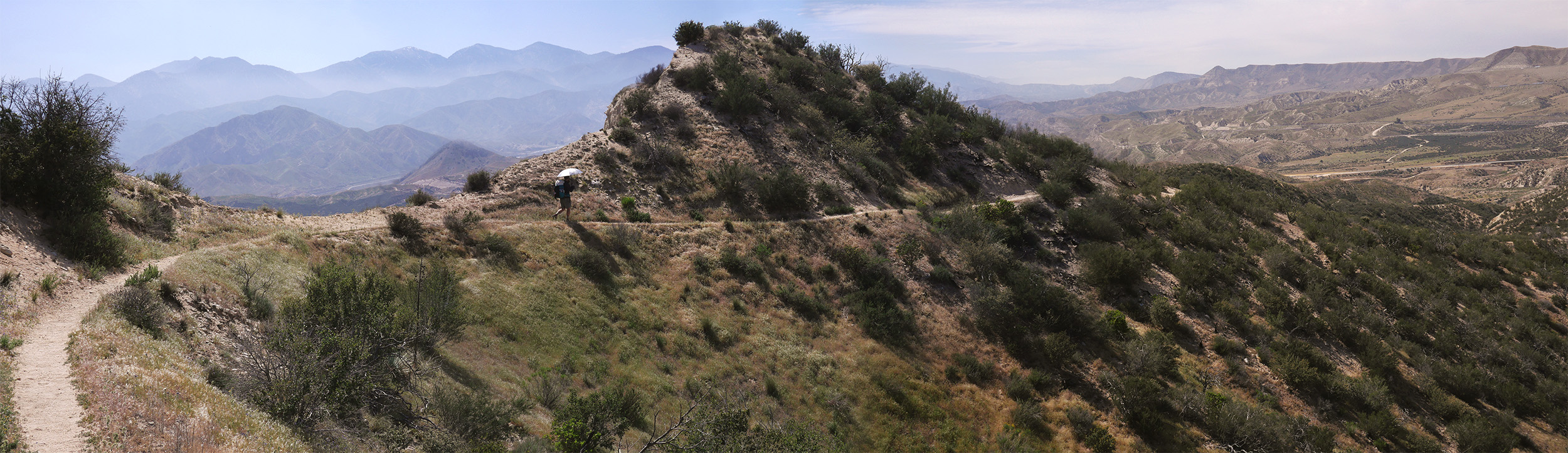
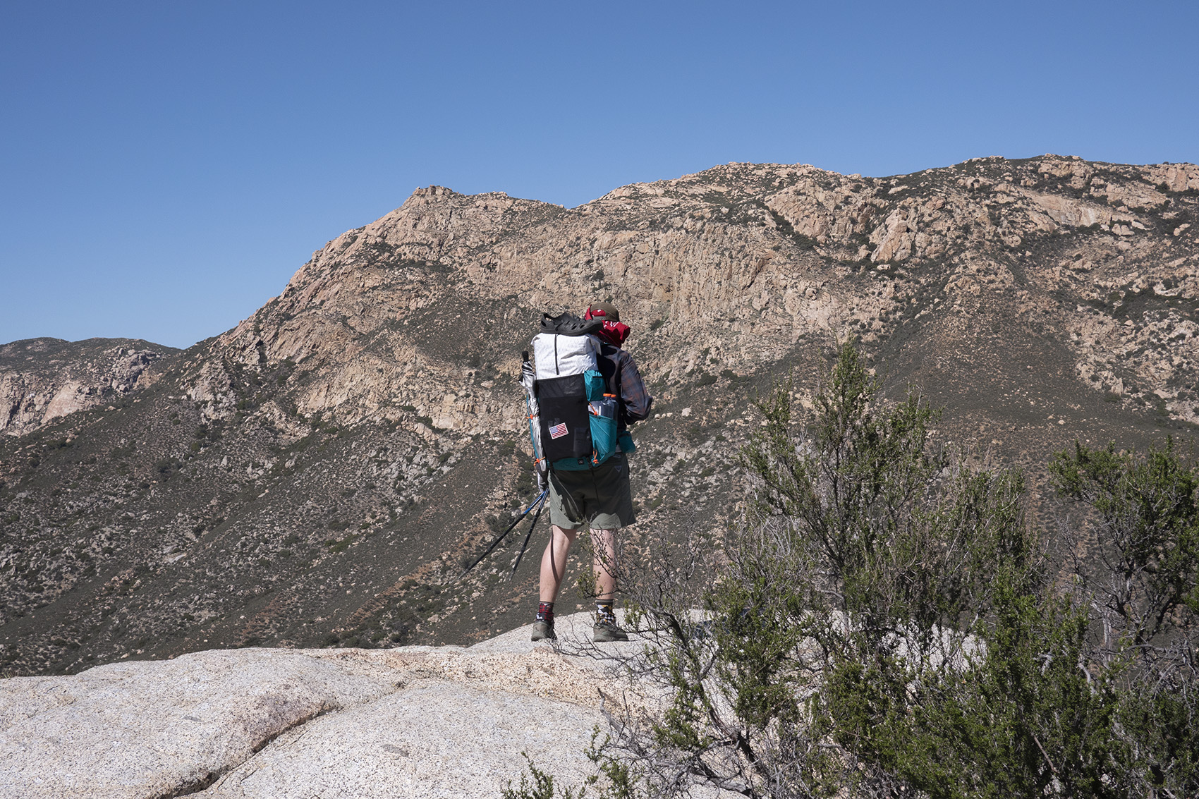
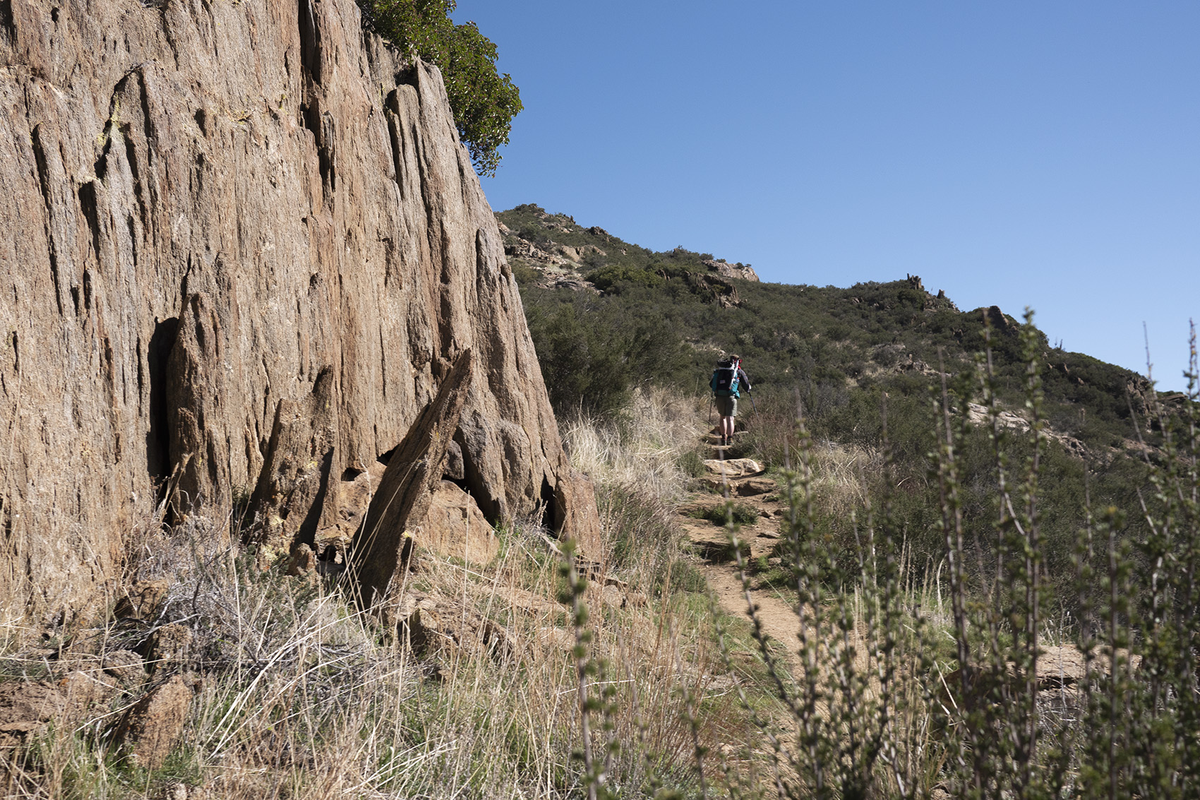
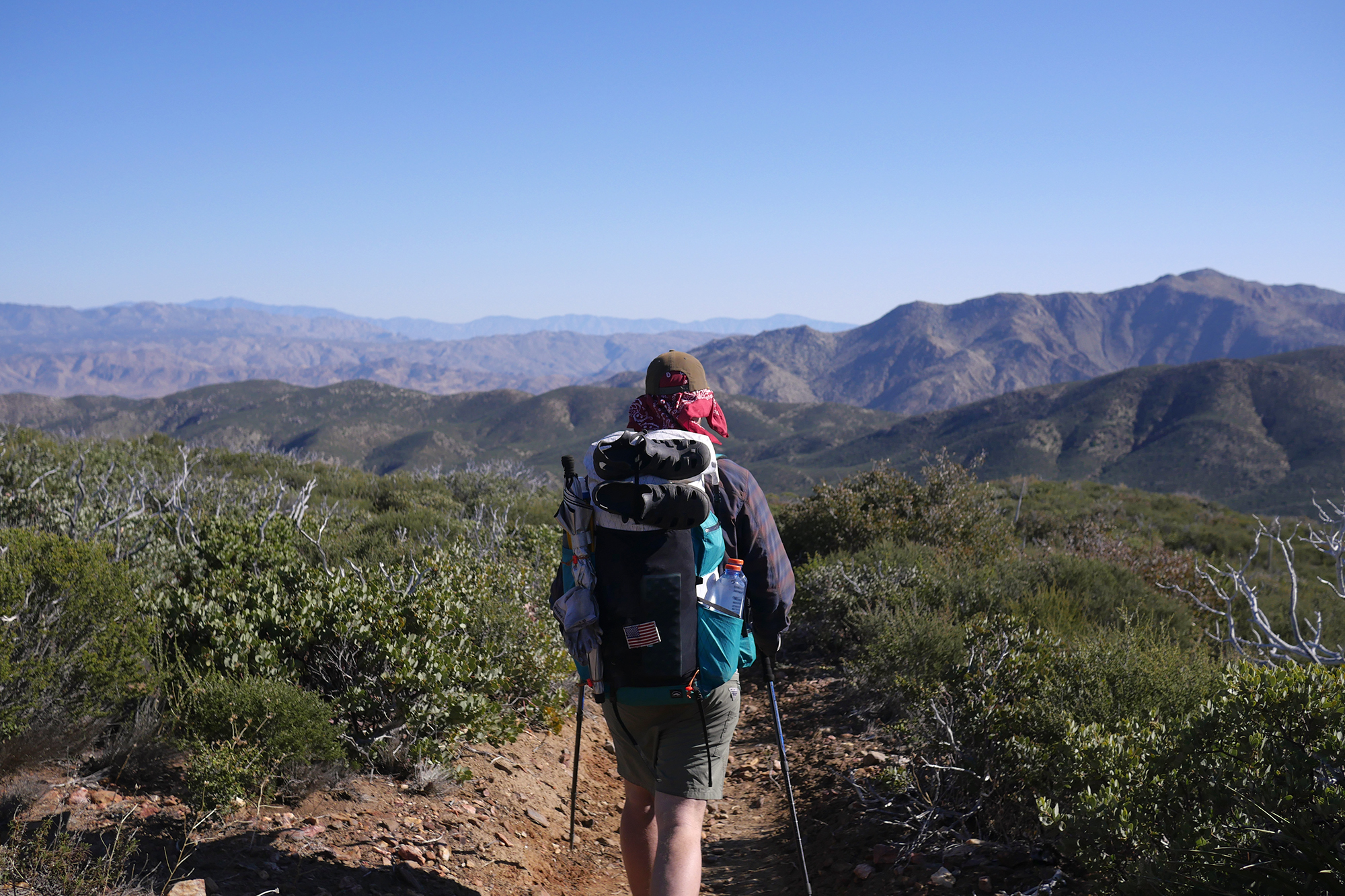
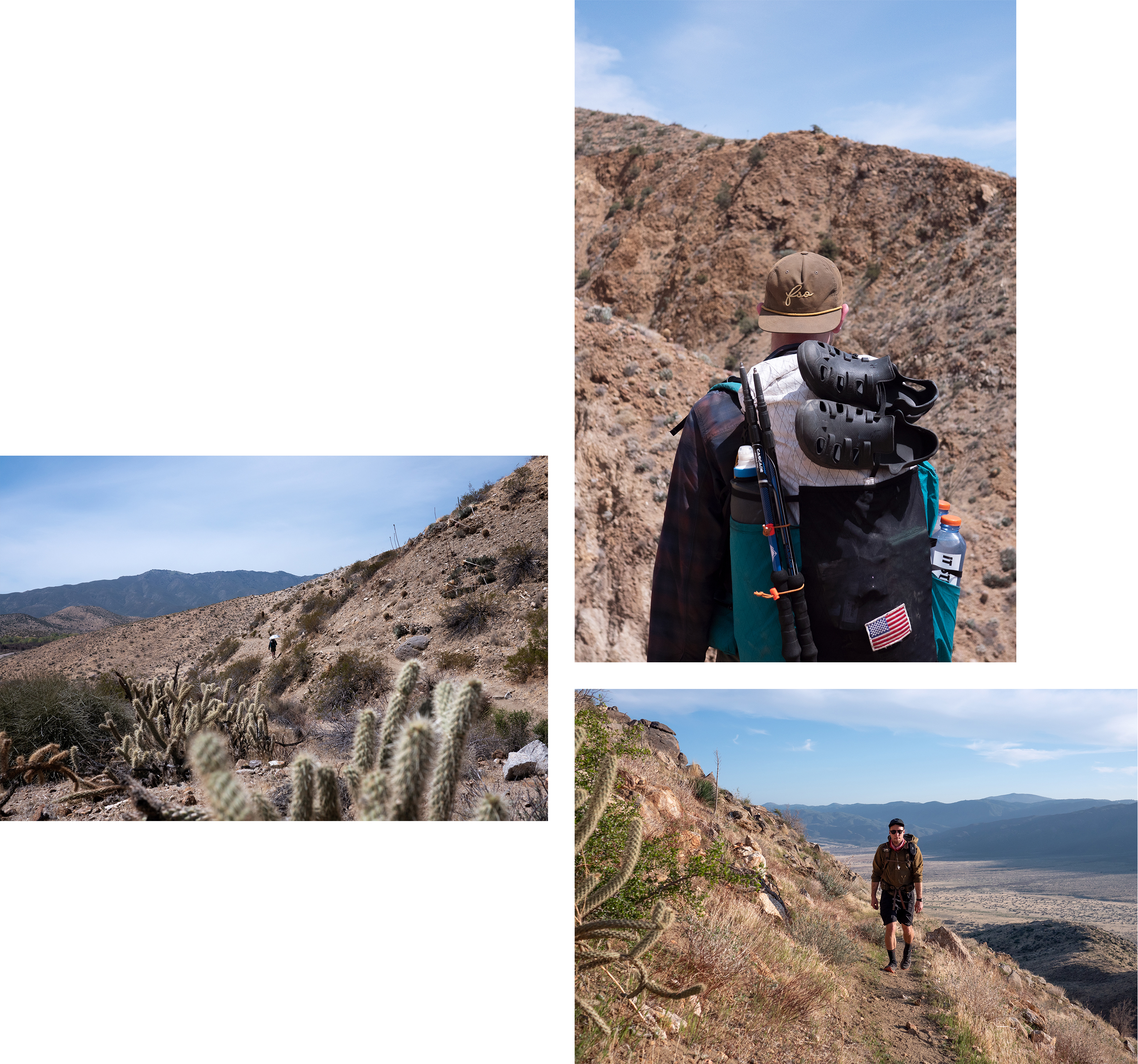
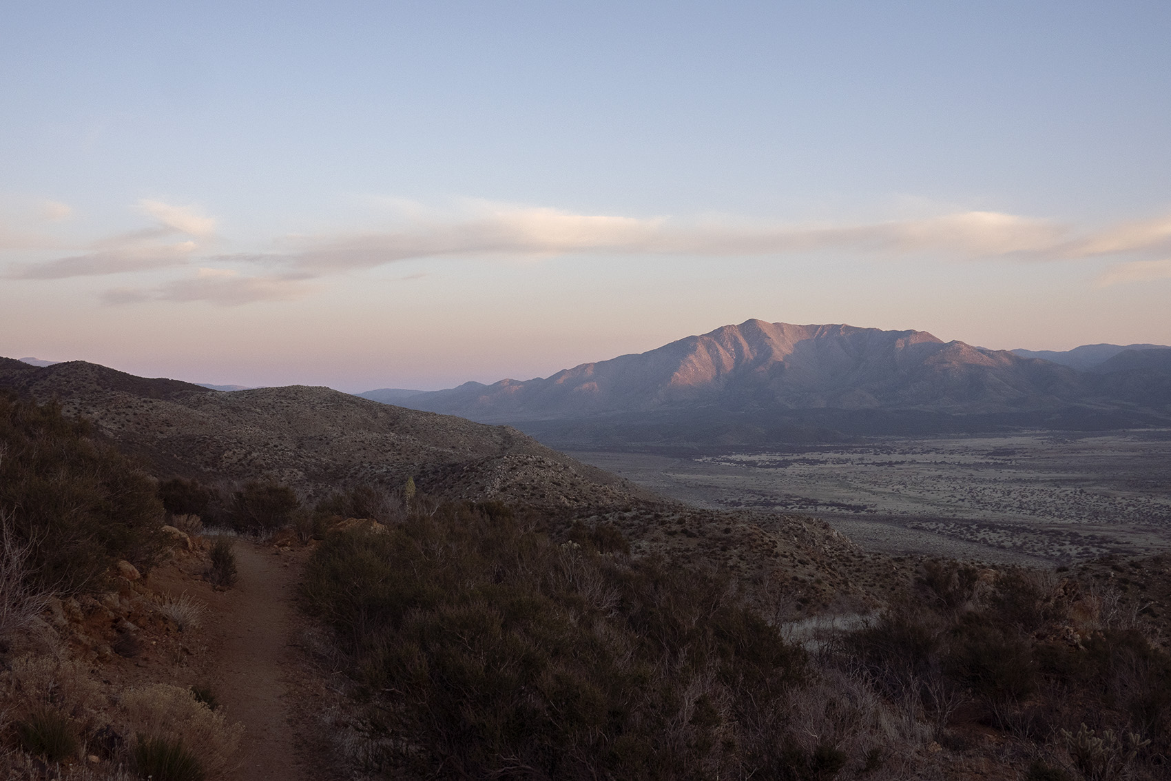
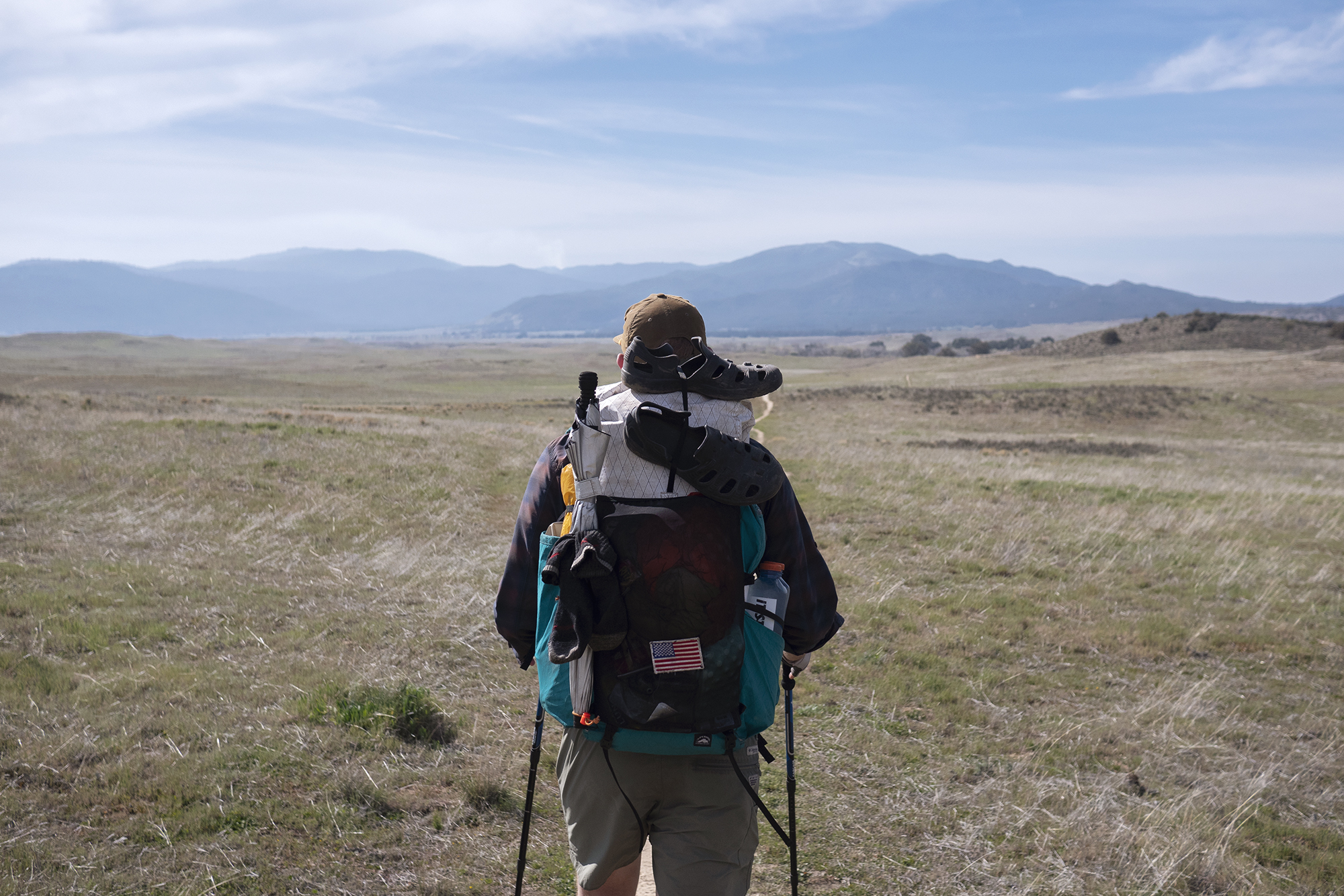
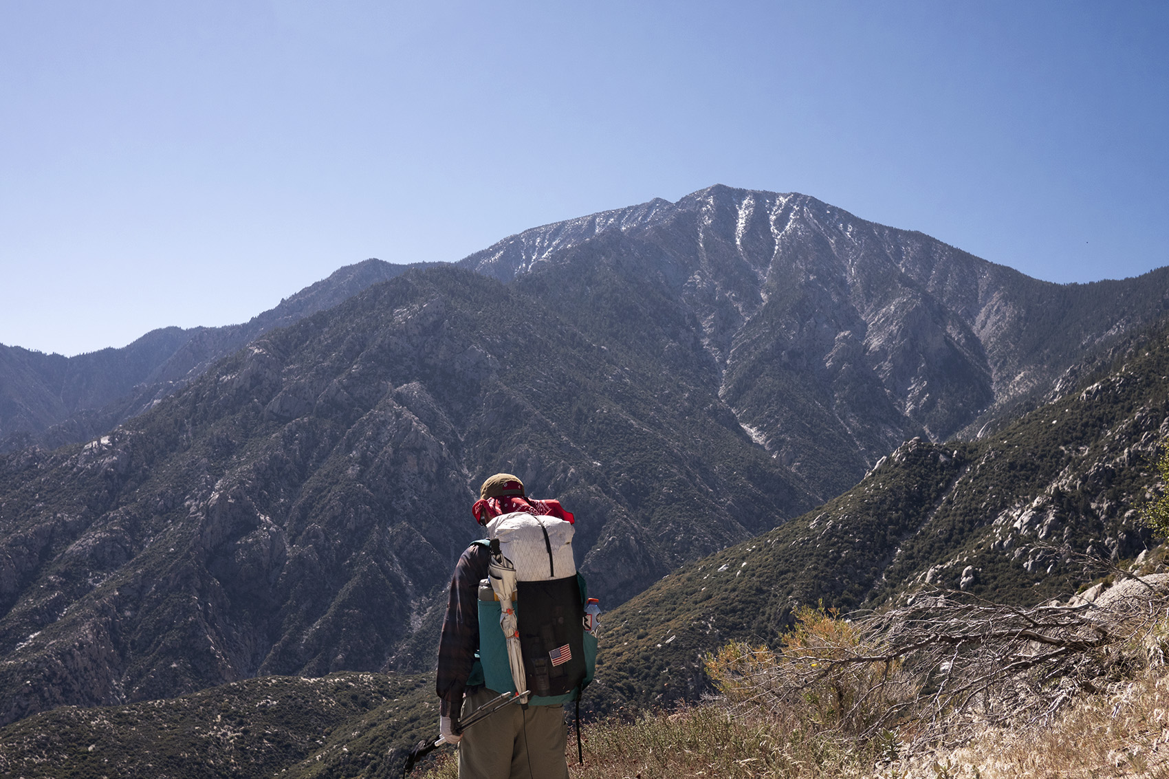
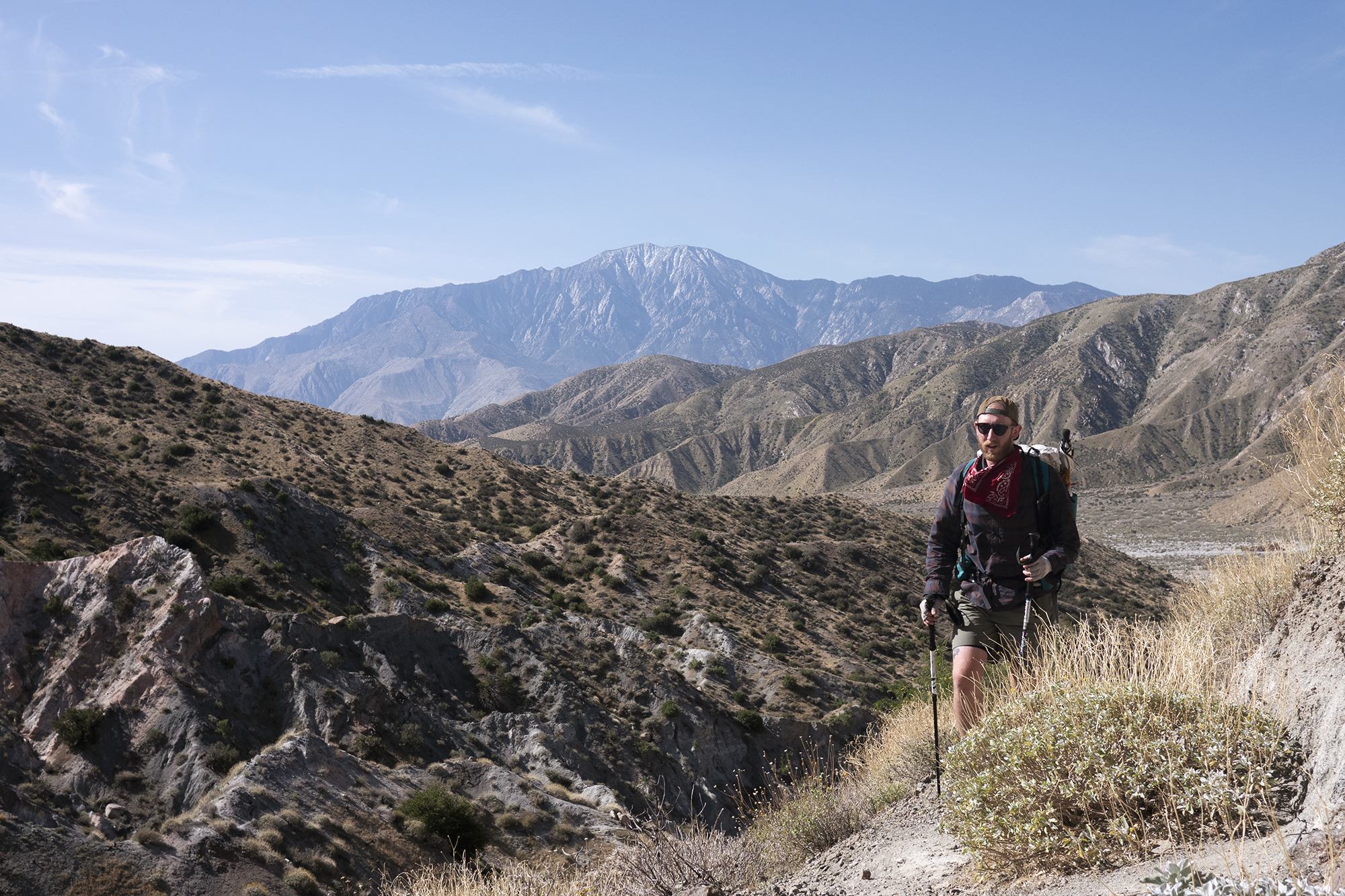
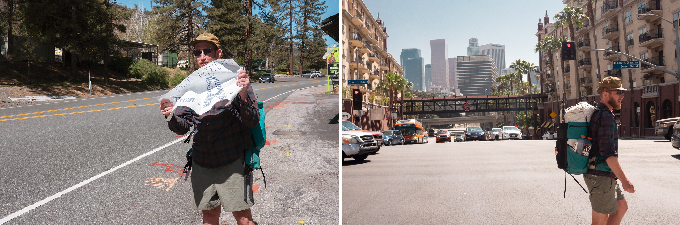
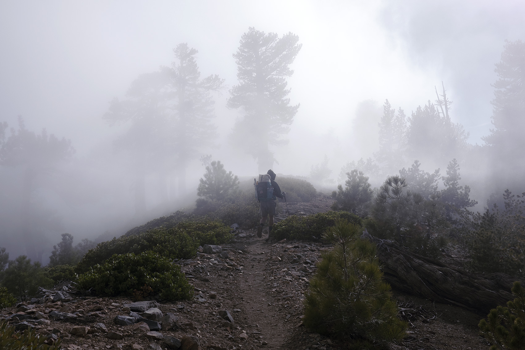
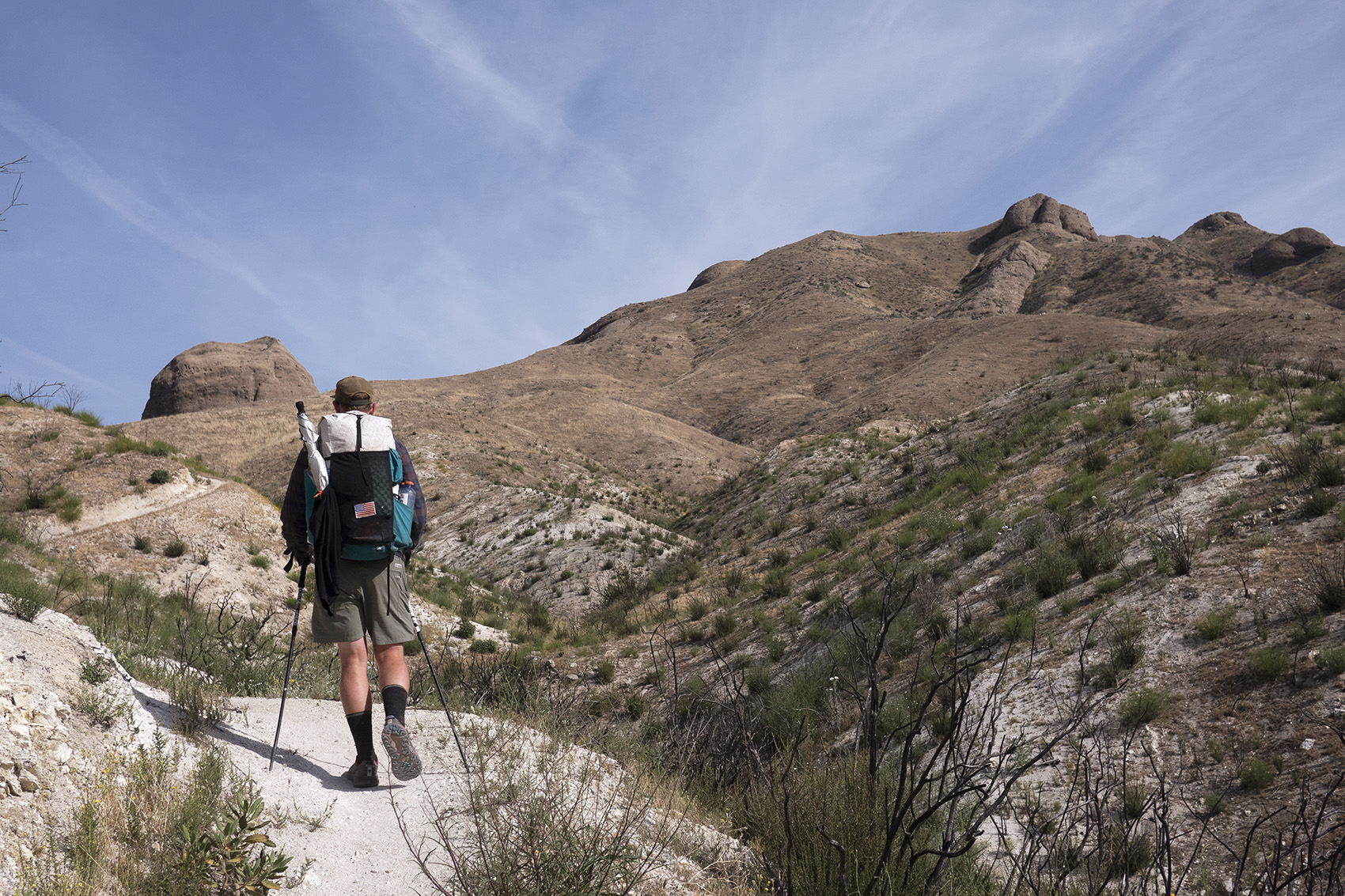
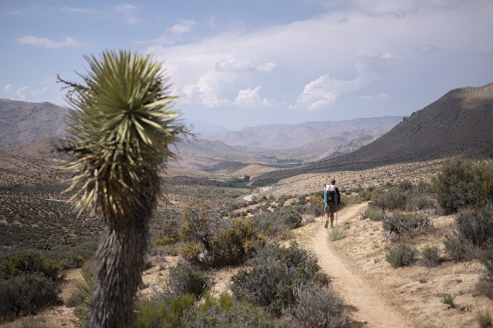
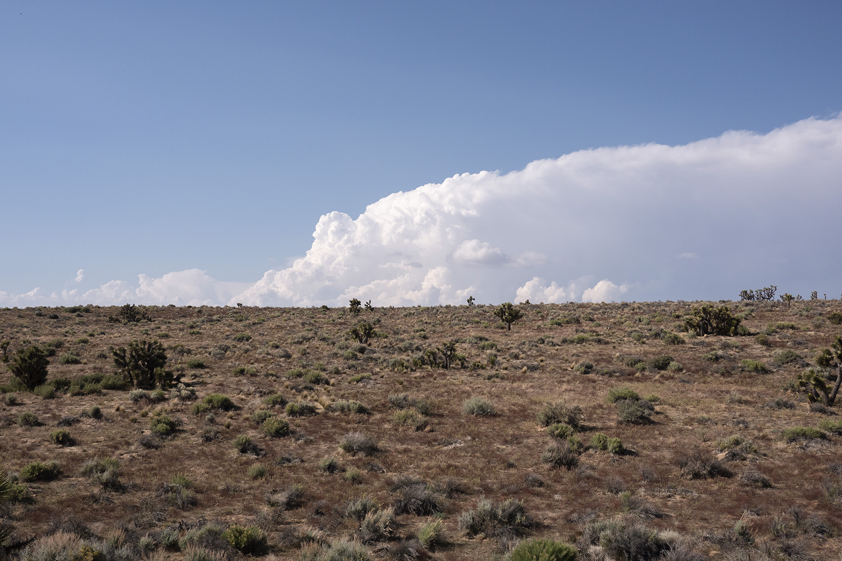
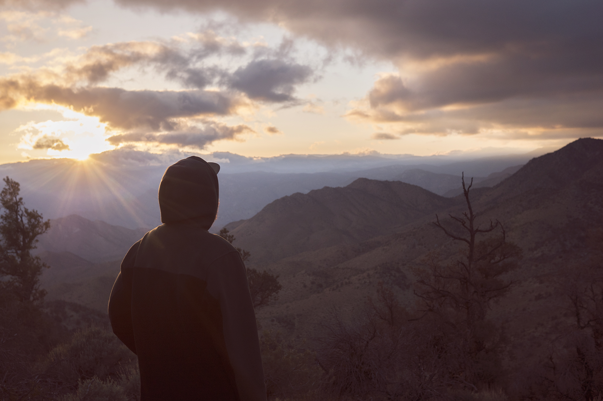
Waking before dawn the next morning every hiker at Scout and Frodo’s grabbed their packs and were transported to Campo, the Southern Terminus of the Pacific Crest Trail. On the ride out our driver pointed out pieces of the trail on the horizon. Barren brushy hills lit up by the rising sun. This part of California was new to me and I had no idea what to expect. All I did know was there were 700 miles of so called desert before the Sierra Mountains and I really wanted to get to the Sierra.
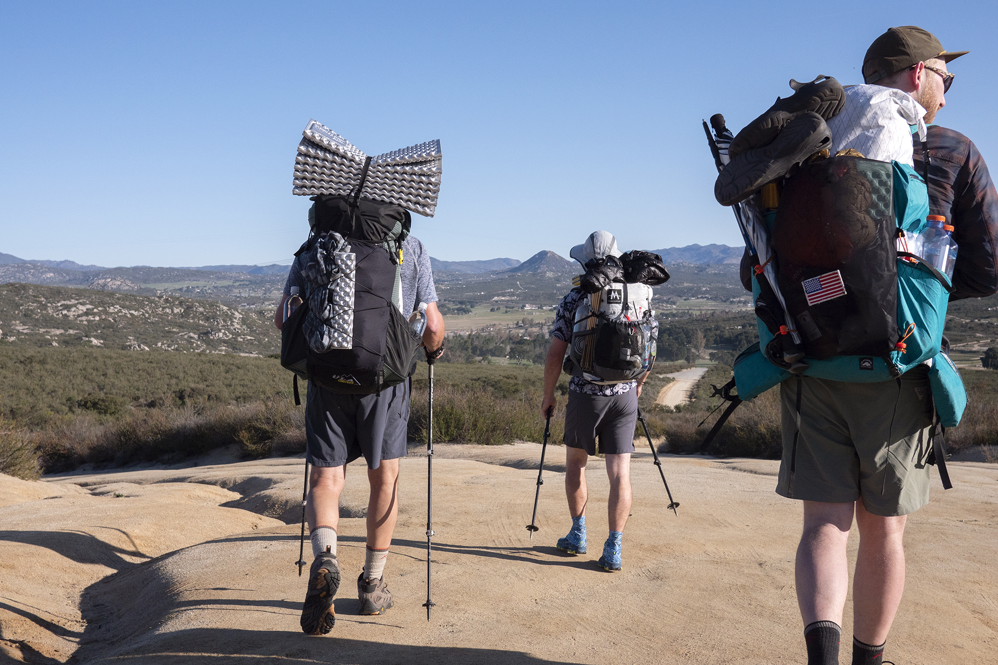
The caravan of assorted vans and trucks stopped just short of the Terminus Monument. Everyone grabbed their gear and slowly walked up the small hill to the Monument. Photos were taken and luck was wished. The nervous energy was heavy and I watched one women drop her camera and wreck an expensive looking lens. Eventually people started heading down the trail. The start of a Thru Hike unlike a marathon has no official start. You just start walking with no clear goal in mind aside for the vague idea of walking thousands of miles. My Dad and I were last to file out waiting on Alex who had stayed the night with Dan, a friend who was hiking the trail as well. When Dan and Alex showed up we quickly took our terminus shots and started hiking.
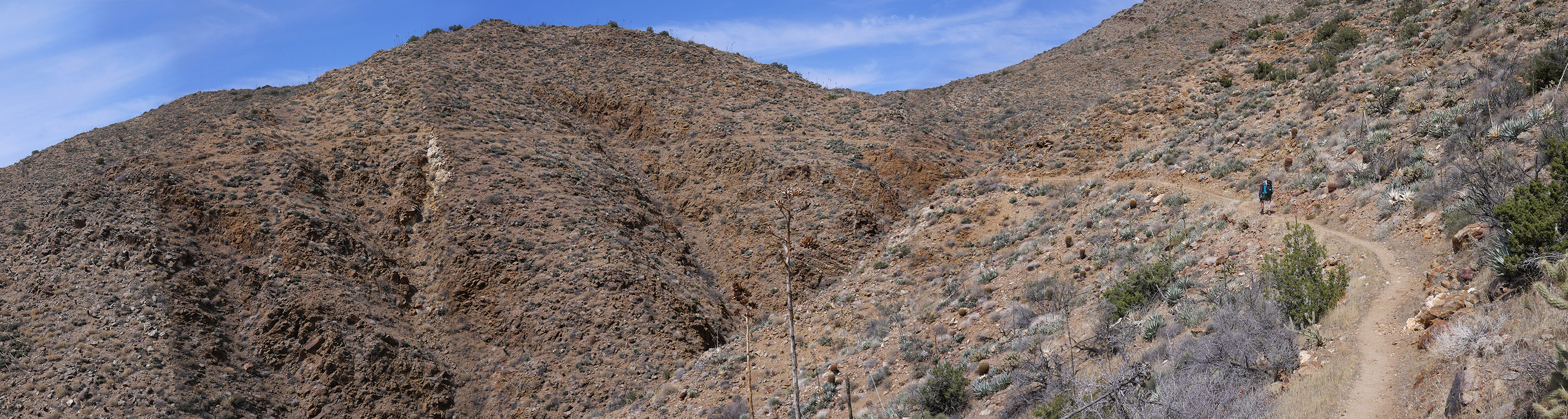
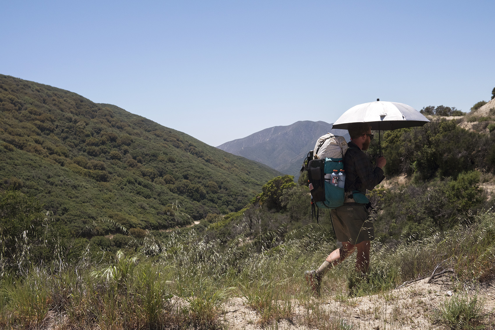
The weather was perfect, sun shining but not too hot. Coming off a foot injury earlier in the year I was nervous taking my first steps down the trail. I knew the only thing that would stop me from completing this hike was a serious injury. Thankfully we hiked the first few miles together and our excited conversation kept my mind from dark thoughts. The terrain was what you might expect in the Southern Californian desert if you’ve ever been. Having never been myself I was surprised by how hilly it was. This was a welcomed surprise as the idea of hiking a totally flat plane for 700 miles sounded like hell. Elevation change felt like a sign we were closer to the Sierra. Of course being this far South that was an insane thought but it was one that would recur every time the elevation grew.
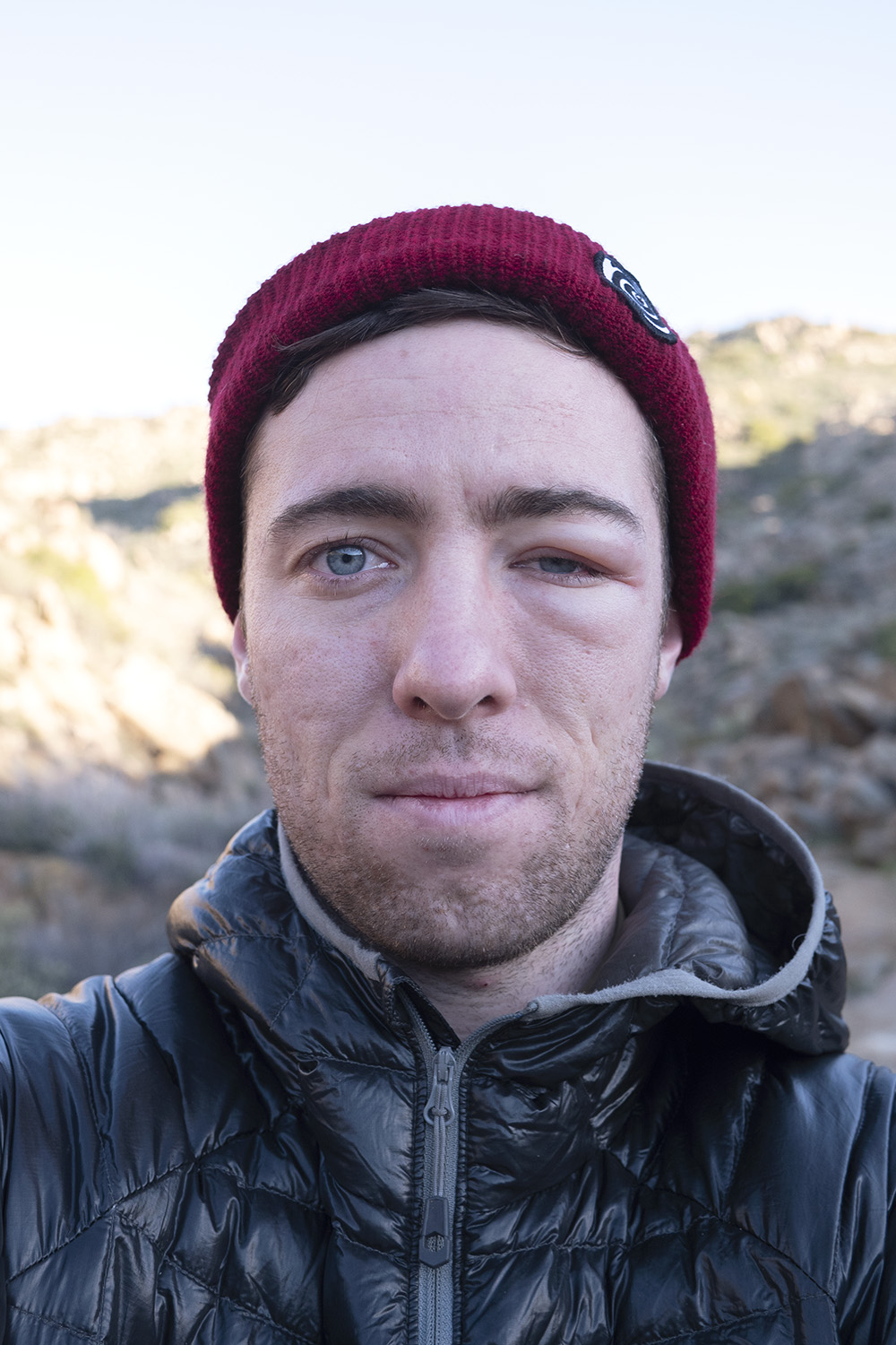
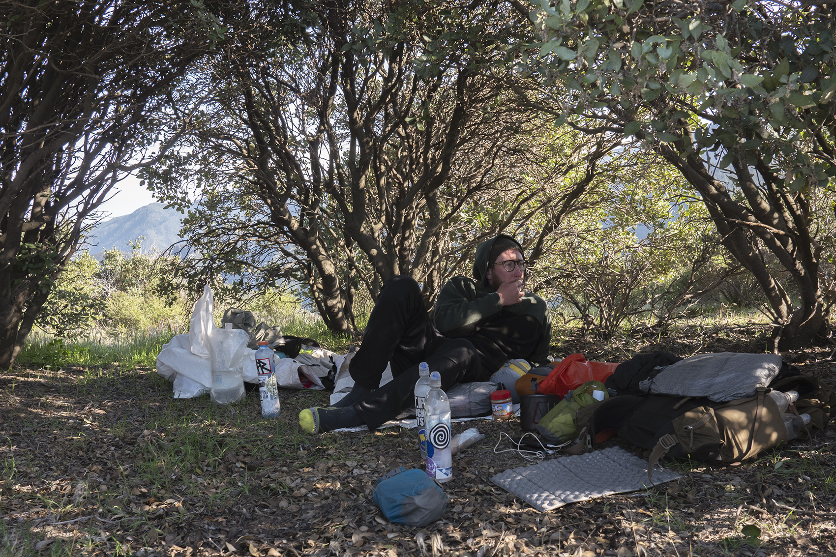
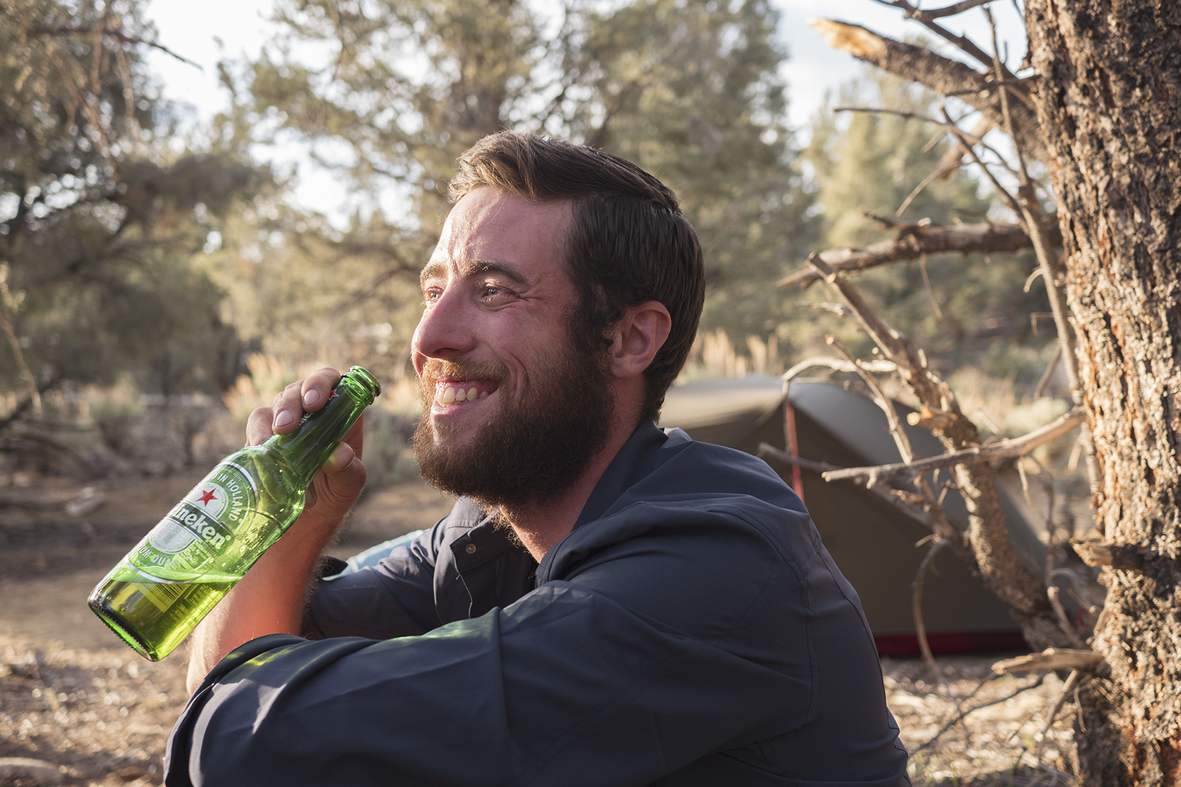
Around 6 miles in Alex and I stopped for lunch and plopped down directly in the sun. Dan came up the trail to see us totally exposed to the sun’s harsh rays ready to take a break. He laughed and said he was pushing on to a shade spot. First lesson of the desert learned. I set out after lunch to hike alone and had barely made it a 100ft before feeling a sharp pain near my eye. It took me off guard and I panicked for a moment before realizing it was a bee. I took off running down the trail like a madman and came across another hiker. She asked me what was going on and I frantically explained that I was stung by a bee between curses of pain. She instinctually pulled out a pair of tweezers and plucked out the stinger. We laughed about how ridiculous it was to be stung in the eye on day one and decided I would have to take a bee related trail name. “Beezus” was what I finally settled on.

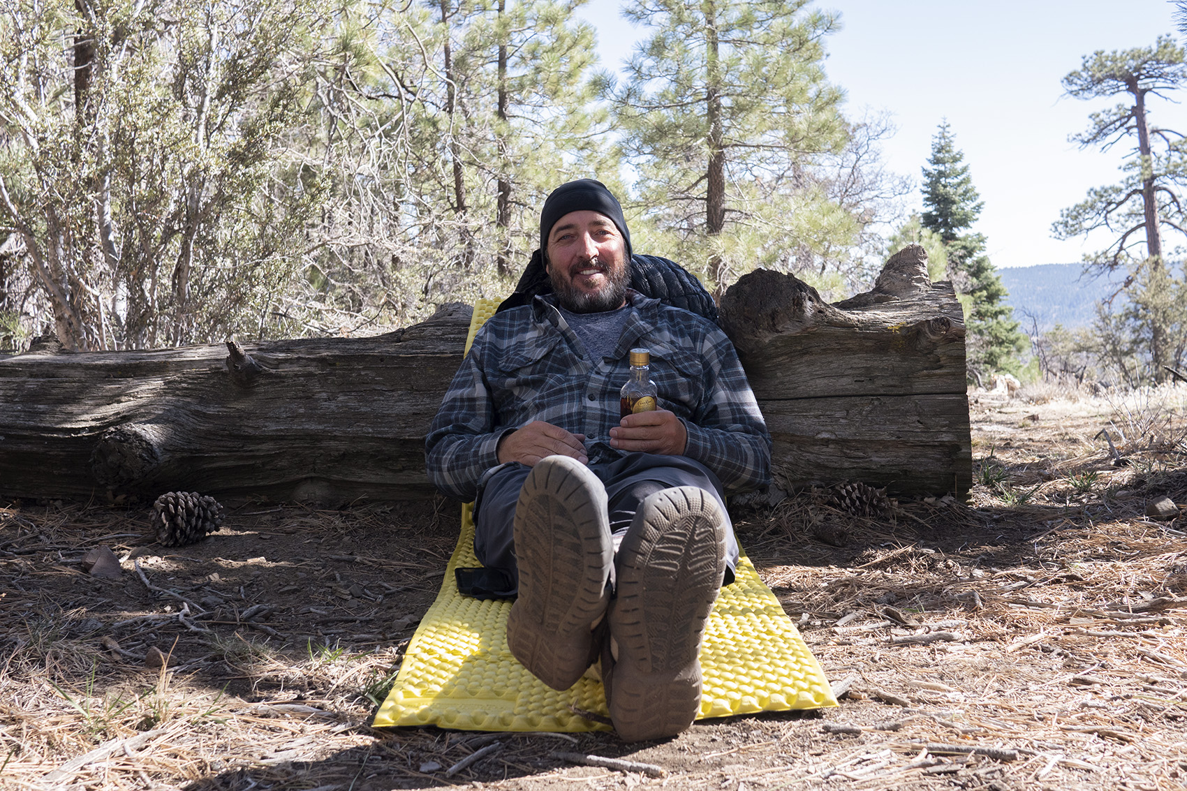
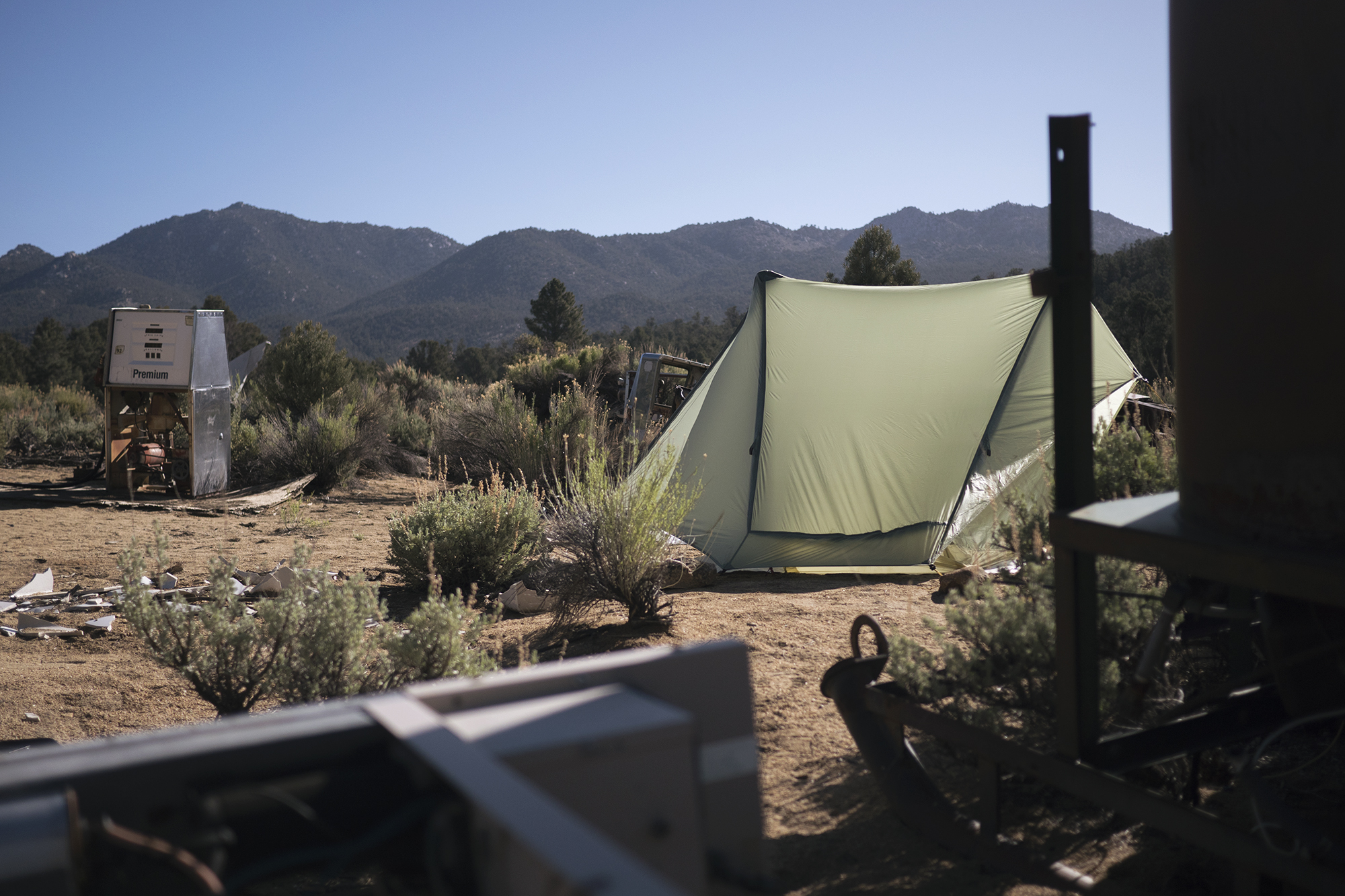
We made it Hauser creek 15 miles in, around 4pm and debated stopping or pushing another 5 to Lake Morena. We were almost out of water and despite Hauser creeks name it was nothing more than a dry valley. The hike out was tough and I felt wrecked coming into Lake Morena. Thankfully the Lake was a legit car camping site with a general store down the street. Beer was bought, tents set up and my aching foot placed on ice. This was not the start of the PCT I had imagined but knowing that luxuries would soon fade I indulged myself.
Day 2
Mile 29 | 9 Hiked | Lake Morena
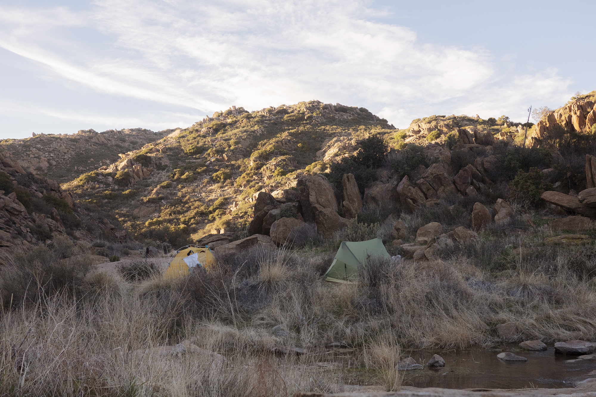
I went to sleep sore and aching which made me worry about the hike ahead. We woke up late and had breakfast at the convenience store before getting back on trail around 10. My dad wasn’t far behind but far enough that waiting for him would waste most of our day. At this point in the hike I was too eager and anxious to slow down and let him catch up. The day started out flat and relaxed with no real elevation change till we hit Interstate 8. From there we started climbing back into the desert hills. Immediately I started to feel my achilles tense up. Achilles tendonitis was problem I’ve had on past hikes and was a huge fear before starting the PCT. At 9 miles I found Alex looking down into a small valley at a beautiful campsite along Kitchen Creek. We were both beat from the long first day and decided camping near water in a remote area would be better than pushing to Mt Laguna and getting even further ahead of Dad. We scrambled down into the canyon and set up for the night. The sunset lit up our rocky canyon as we ate dinner, feet dipped in the tranquil creek. This was what I imagined the PCT would be.
Day 3
Mile 41 | 12 Hiked
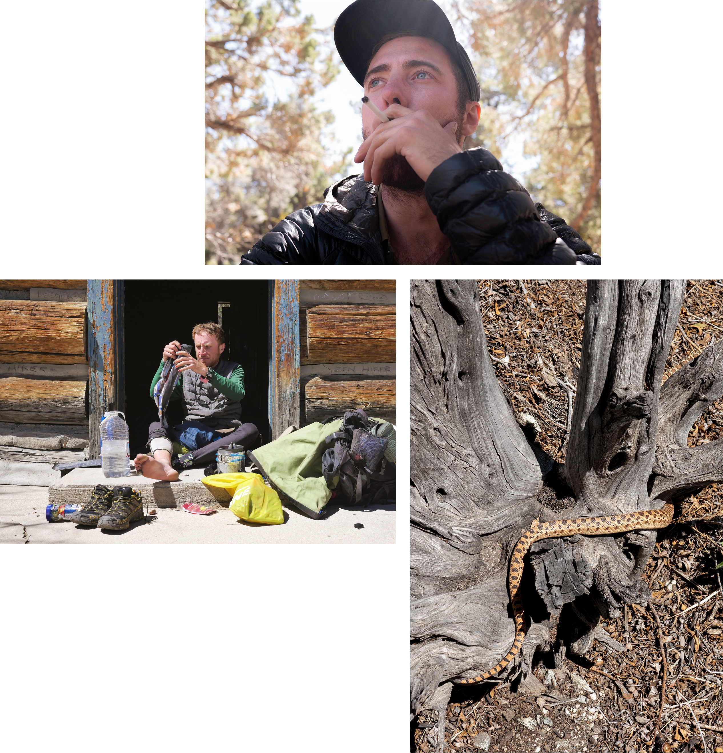
My eye had swollen shut from the bee sting. Apparently bee stings can have a delayed effect. This was distressing and I wasn’t sure if it was a larger issue that might need to be checked out. All I could do for now though was laugh it off and take some selfies.
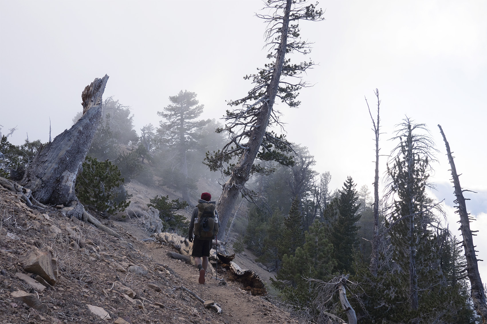
The trail climbed further above the desert floor and at one point entered a shady pine forest. Again I started to dream that we were that much closer to the mountains and the barren desert might be at an end. Our day ended at the small town of Mt Laguna where another non primitive camp was located, Burnt Rancheria. This felt like a perfect place to let my dad catch up, do a small resupply and eat a proper meal. It turned out to be where most other hikers were resupplying as well and we spent the evening around a fire drinking beer and making new friends.
Day 4
Mile 46 | 5 Hiked | Mt Laguna
We slept in that morning thinking my dad would not arrive till later in the afternoon. Before we even get our tents packed up though he strolled into camp. Breakfast was had at the local diner and we hit the store for a resupply after. On our way back to camp we ran into some trail angels handing out beer and food. This was the second trail magic we had encountered in the past two days. It was nice to get trail magic and stay in plush campgrounds but I was starting to feel a little spoiled. Would the entire PCT be this way? Would we ever truly be in nature or are we just hiking from town to town?
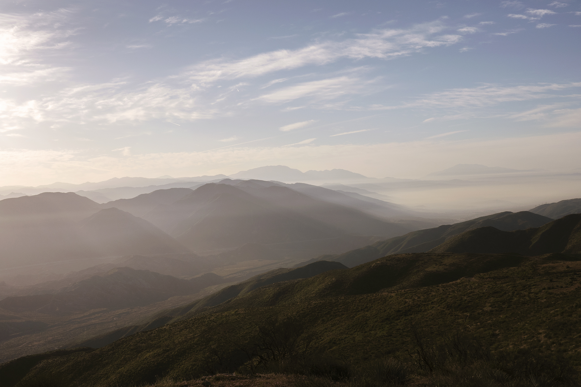
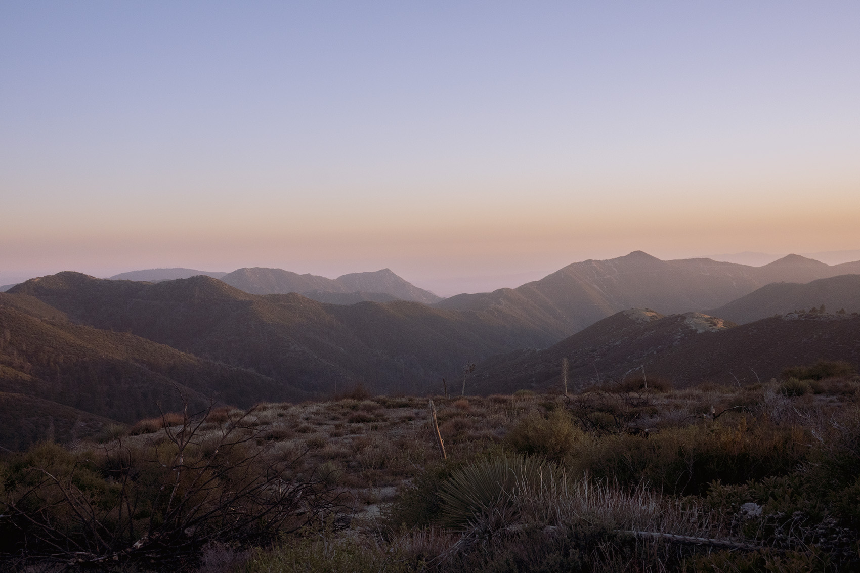
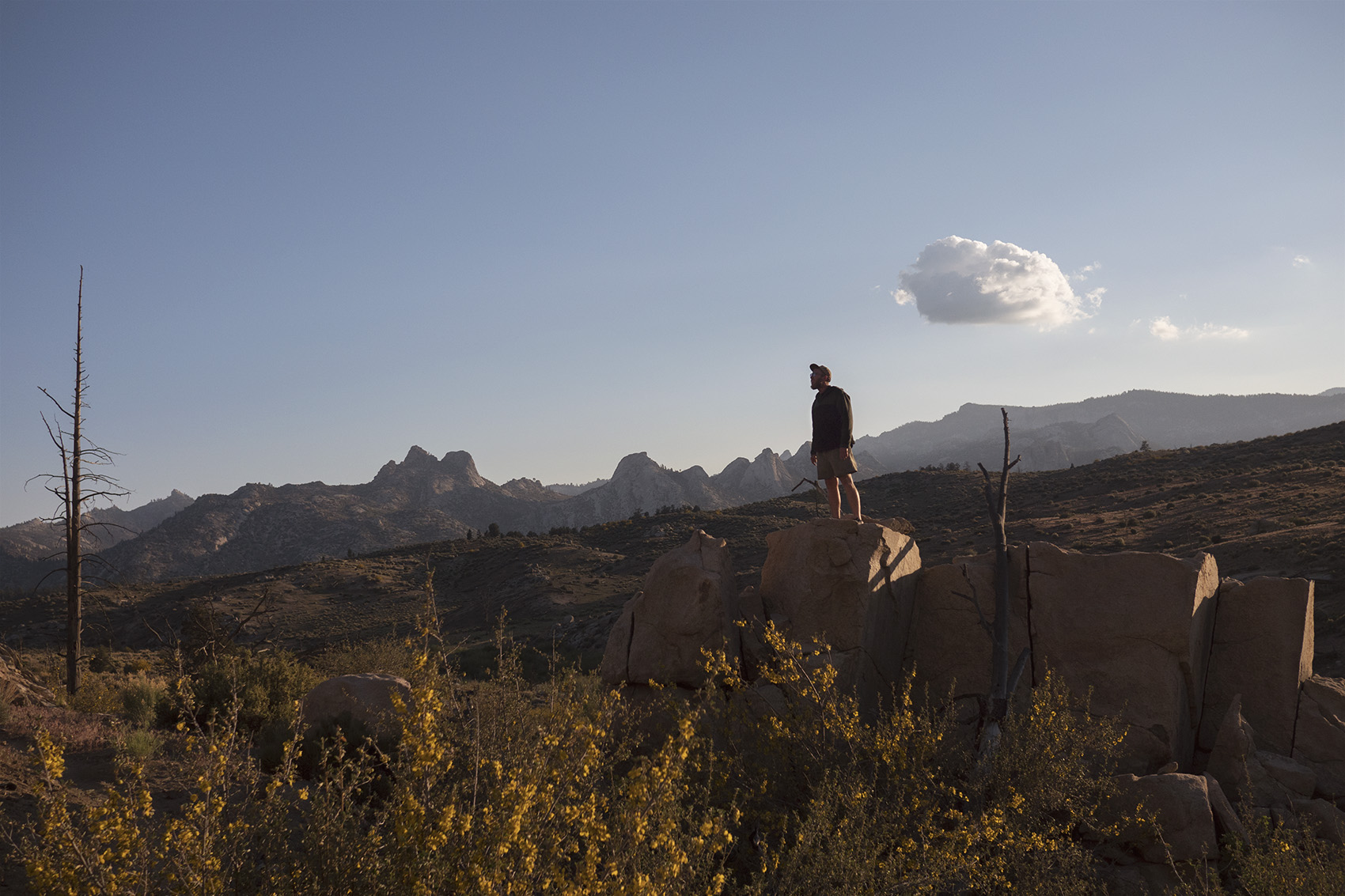
In an attempt to escape the pull of town food and beer we got back on trail at 3pm. Dad had already walked 8 miles so we planned on only going another 5. As soon as we left camp the trail entered a large valley with solid sized mountains on all sides. At the end of this small valley was an incredible view of the Laguna Mountains towering above the desert floor far below. I never expected “the desert” section of the PCT to be so grand with mountains that rivaled those back home on the East Coast. We set up camp amongst the brushy bushes that dotted the mountain side. In front of us the trail was outstretched for miles amongst these high desert mountains.
Day 5
Mile 59 | 14 Hiked
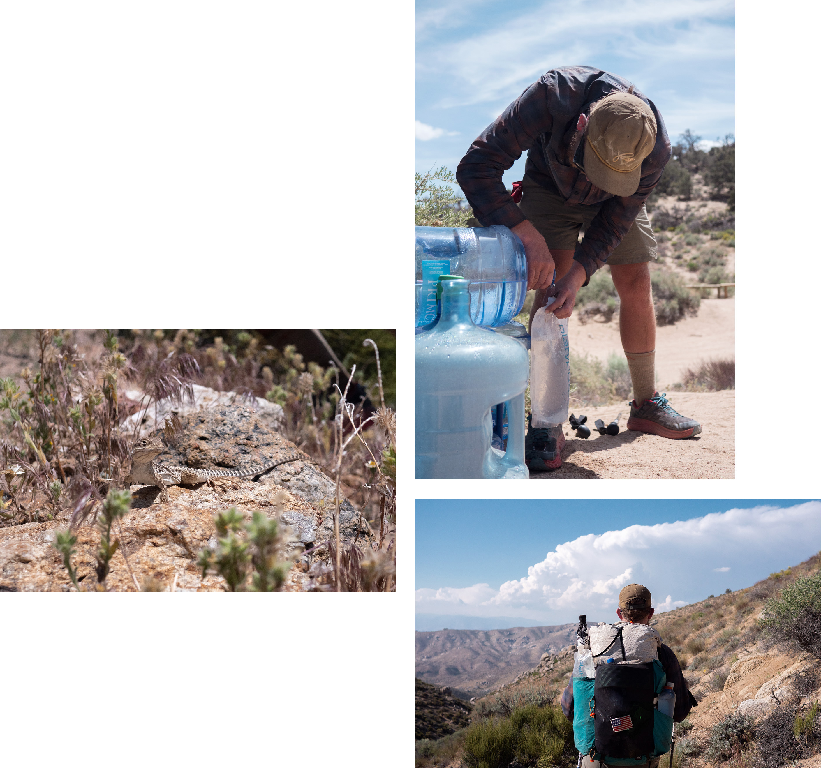
A short but windy descent from camp the next morning made for an exciting start to the day. Still very high in the Laguna Mountains we walked winding paths above the desert floor. The terrain was wide open and you could see the trail for miles ahead. Only small bushes and large boulders covered these mountains offering no shade. It was Easter Sunday and a women with no pack hiking the opposite direction stopped me, handed me a pack of Peeps and wished me good luck on my hike. This was probably the only time in my adult life that I’ve truly enjoyed a Peep. Late in the afternoon we reached the Sunset Trailhead which contained the last water source before a 17 mile dry stretch. We decided it would be best to camp here and set out with full water the next day.
Day 6
Mile 77 | 17 Hiked | Scissors Crossing
Fully loaded with water we set out the next morning hoping to hike 17 miles to Scissors Crossing. Slowly we descended from the green bushy mountains toward the desert floor. We did our best to avoid walking into cacti and other spiky plants that dotted the trail. Above us an occasional fighter jet would roar past breaking the silence. The view from atop these desert mountains looked like one you might see from a plane window. Getting to the flat floor below took up a majority of the day and I was exhausted when I finally reached it. This flat windswept plane of desert went for another 3 miles before reaching Scissors Crossing where the trail crosses the highway. I was greeted under the highway with a beer from Alex and Dan who had both beat me here. Apparently my dad had too and hitched into the nearby town of Julien. Our old friend Dan had been in town the day before and brought the beer out to catch us. Hitches were being offered by the locals and I decided to go into town and stay the night with my dad.
Day 7
Mile 91 | 15 Hiked
Alex hitched into Julien the next morning after hearing rumors of free pie and beer. The local pie shop did indeed give free slices to hikers and Carmen’s the home of a local trail angel offered free beer. We ended up sitting around Carmen’s drinking beer and chatting with other hikers longer than expected and didn’t head back to the trail till 1pm. The majority of hikers on trail were waking up before sunrise or night hiking to beat the midday heat. Alex and I could never seem to wake up before 8am and found ourselves hiking at high noon most days.
The trail went straight back into the lower desert mountains and weaved in and around them for miles. This repetition made my progress feel slow. The sun was going down and I made it to camp with minimal daylight left. I felt exhausted as I cooked dinner in the dark before passing out.
Day 8
Mile 104 | 14 Hiked
Waking in the dry desert and having to hike a quarter mile down a side trail to get water was an unpleasant way to start the day. On top of that Alex and Dan were talking up plans of pushing 20+ miles to Warner Springs. I knew my body wouldn’t be able to handle that and it would mean leaving my Dad far behind once again. Alex and I debated what to do as we hiked and came to the realization that trying to keep up with Dan would burn us out.
The stress of earlier vanished after passing the 100 mile marker. For Alex and I this wasn’t a huge deal having done longer hikes in the past but for my Dad it was true achievement. Eventually these makeshift makers that showed up every 100 miles on the PCT would become almost silly but this one felt really good. Cactus and boulders faded as we entered farm land late in the day and the trail wandered through grassy pastures. Dad ended up stopping early and Alex and I pushed another 3 miles. Keeping a group of hikers together was turning out to be nearly impossible.
Day 9
Mile 112 | 8 Hiked | Warner Springs
Eagle Rock is one of those PCT landmarks you know about well before you start your hike. At just over 100 miles in it’s a major milestone most thru hikers make it to. From photos I had seen online I always pictured it in the middle of a rocky desert. In reality it’s located in the middle of a massive green pasture complete with grazing cattle. Not far after Eagle Rock we reached the small town of Warner Springs. Originally I had planned to grab a resupply box at the post office and maybe a quick lunch but that plan was changed once we saw what Warner had to offer. The town had set up a small trailer on the edge of a football field complete with everything a weary PCT hiker needs to recharge. Showers, camping, laundry, hiker food and another trailer that was a traveling gear shop. (2 Foot Adventures) The property looked like a hiker trash summer camp and was a great place to hangout for the afternoon. Dad was unable to resist the comforts and ended up staying the night here. Alex and I decided to push down trail a few miles and escape the inevitable hangover that comes with a day in town.
Day 10
Mile 127 | 15 Hiked
Another day of hiking up and down through arid desert hills passed by in a blur. I say this figuratively and literally since I found myself hiking alone with a lot of marijuana and only joint papers to smoke it with. Instead of an occasional hit I was smoking an entire jay every break I took. Maybe excessive but It seemed fitting given the environment.
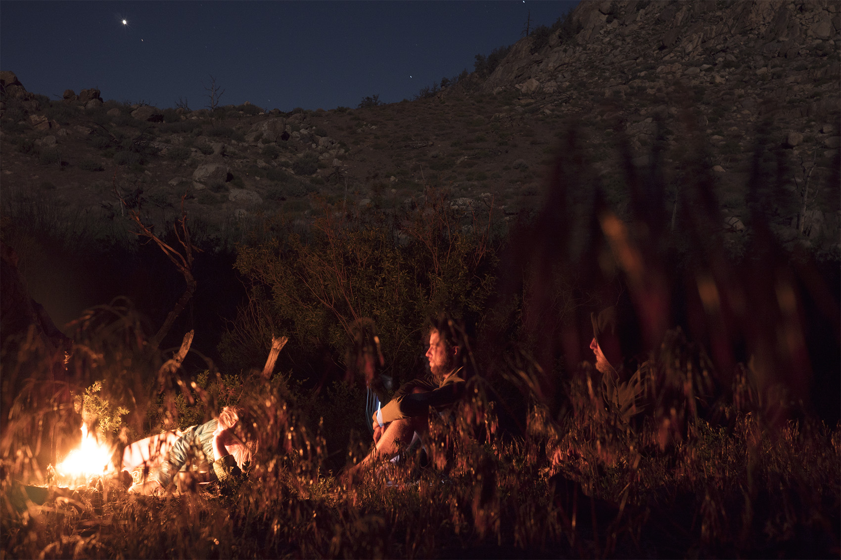
We were becoming accustomed to large dry stretches of trail without water so a 15 miler was typical. Today’s water source was a peculiar one that had been discussed quite a bit before arriving. We were told Mike’s Place was a group of people hanging out in desert making the best pizza on trail and managing a crucial water tank. I arrived at the perimeter of Mike’s Place late in the afternoon. A crude hand painted sign greets you with directions to the water tank. The tank also covered in finger painted messages lays outside of the fenced in property and if you wanted to you could just fill up and go. Of course I was more curious than that and Alex had beat me here so I proceeded onward. More signs lined the barbed wire fence strewn with broken christmas lights. “Welcome Hikers” “No Charging” “Donations Welcome” As I entered the compound two men greeted me, explained vaguely what was happening and that no, they were not Mike. These men handed me a warm beer and offered a freshly packed bong hit.
There was a small one story home and garage that looked either abandoned or very poorly kept. The yard was filled with an assortment of junkyard vehicles, motorhomes, boats, ATVs. Mike’s is hard to explain and one of the more bizarre stops of the PCT. From what I could gather it’s essentially a group of squatters living on their friend Mike’s property drinking, smoking and occasionally making pizza for thru hikers. When the beer ran out they complained about the lack of donations from ungrateful hikers. To be fair it did seem like most hikers grabbed a beer, pizza slice, water and then left as quickly as possible. To be fair to the hikers these guys looked rough and were visibly drunk all day. Despite that, they were mostly friendly and genuinely wanted to be helpful.
Day 11
Mile 138 | 12 Hiked
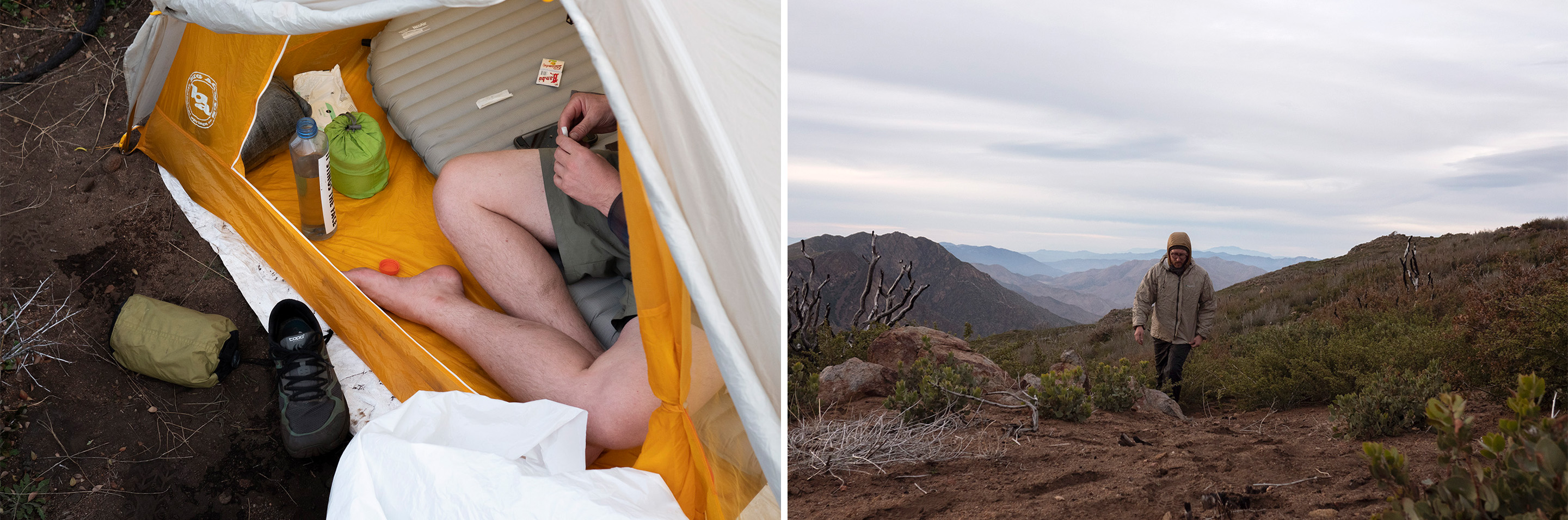
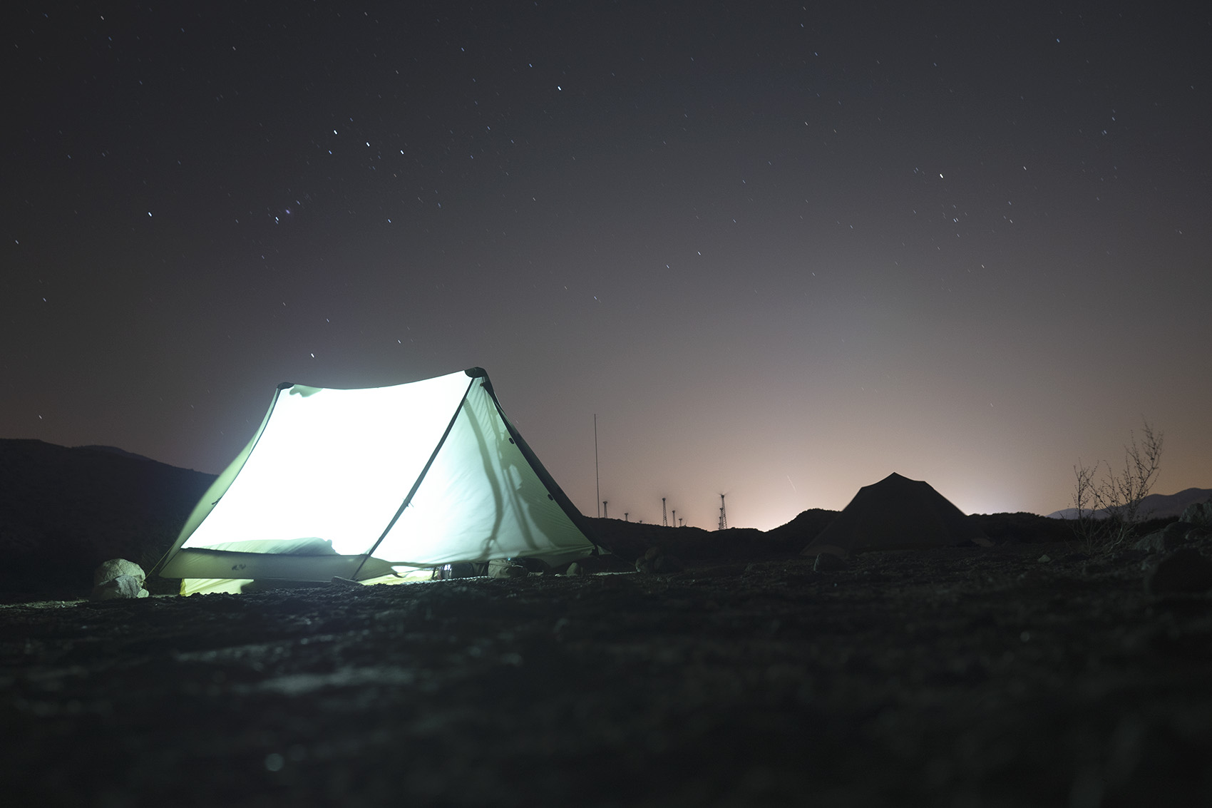
My dad didn’t make it to Mike’s place the day before and after waiting around for a while we decided to leave without him in the hopes he would catch up later. The trail descended out of the hills and back to the desert floor. The wind blew through these valleys harder than I would have expected for such low elevation. Again we didn’t want to get too far ahead of my dad so we ended the day early around 3pm only hiking 12 miles. The wind ripped my shelter stakes out of the loose sand and it took me a while to get set up. When I finally got in my tent to escape the sun I found it did little to shield me. It was more like getting into a greenhouse. Lying in my shelter, sweating with little water left for the day I started to feel a little crazy.
Day 12
Mile 151 | 13 Hiked
Dad ended up catching us the next morning and was bummed we had hiked further than previously agreed upon. The desert was starting to get to all of us and a night alone had made him start questioning why he was out here at all. He had his own goals but one of them was to be with me on this journey and day after day he found himself setting up camp alone. I felt bad about this but I also didn’t think Alex and I were pushing unreasonable miles. There had to be a compromise but it wouldn’t be found anytime soon. 13 miles ahead was Paradise Cafe a famed restaurant just off trail. Cold beer and burgers were all the motivation we needed to quickly crush those miles.
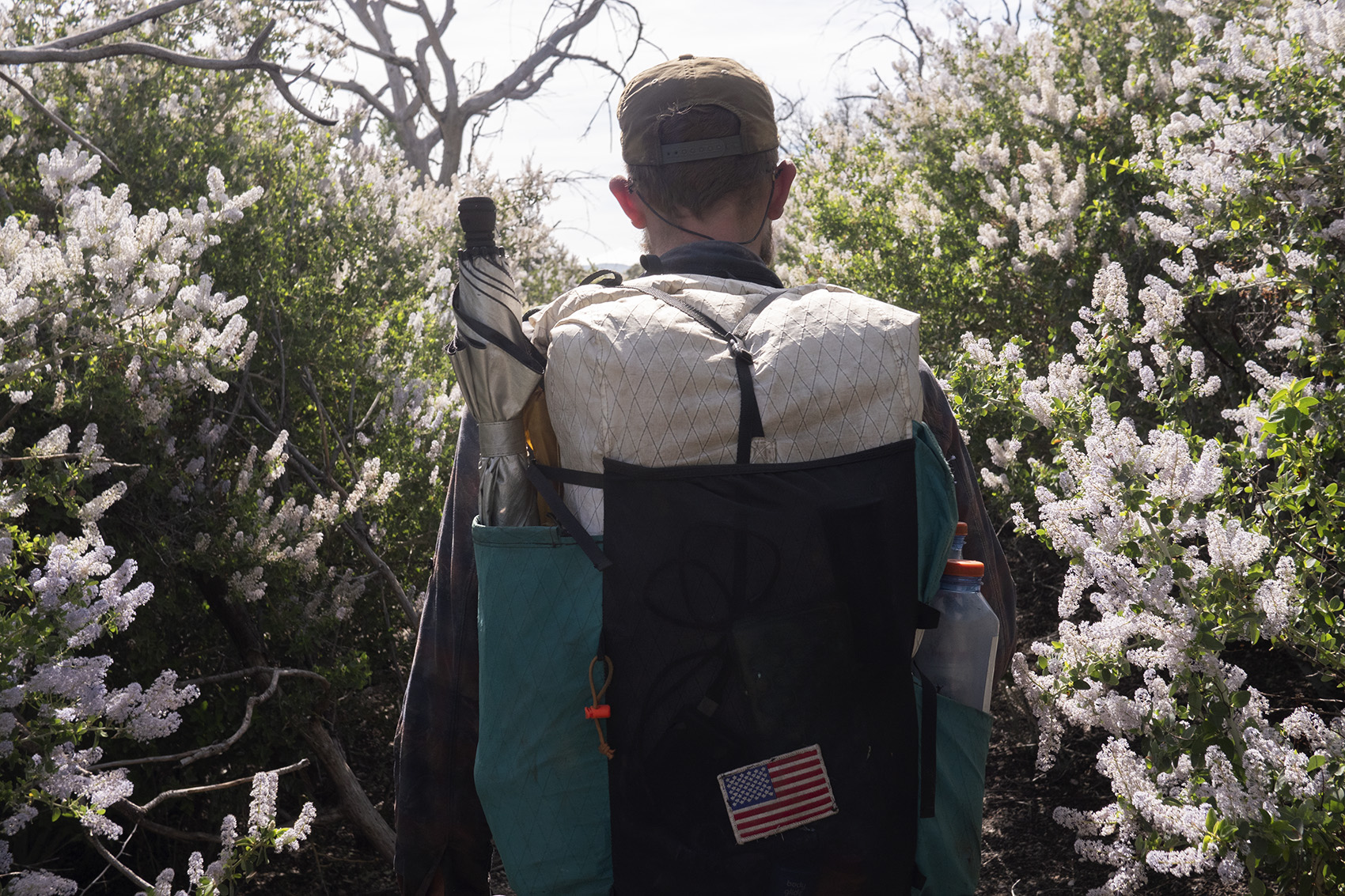
The trail was once again hilly with blooming flowers dotting the sides of the trail. Spring was arriving and it showed even in these dry arid sections. Two water caches helped to make the day easier and before we knew it we were enjoying beer and food at Paradise Cafe. My dad in need of a break decided he was skipping the next 20+ miles of trail and going straight to Idyllwild a town we planned to resupply at. Apparently the justification for this was that the trail was closed 13 miles ahead and the only way into Idyllwild was via a side trail. This was frustrating since I knew it would put him ahead of us again but I figured he would wait there. Paradise Cafe let’s hikers sleep on their porch which sounded like a fine idea to us.
Day 13
Mile 165 | 14 Hiked
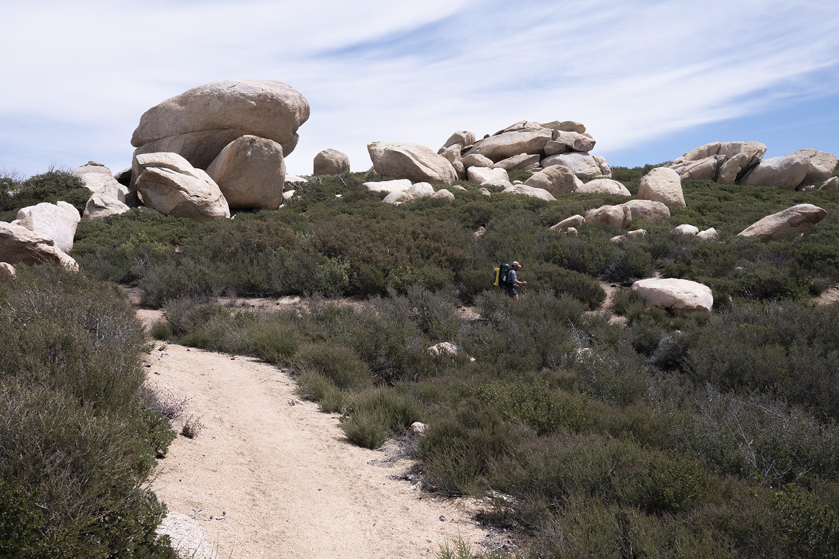
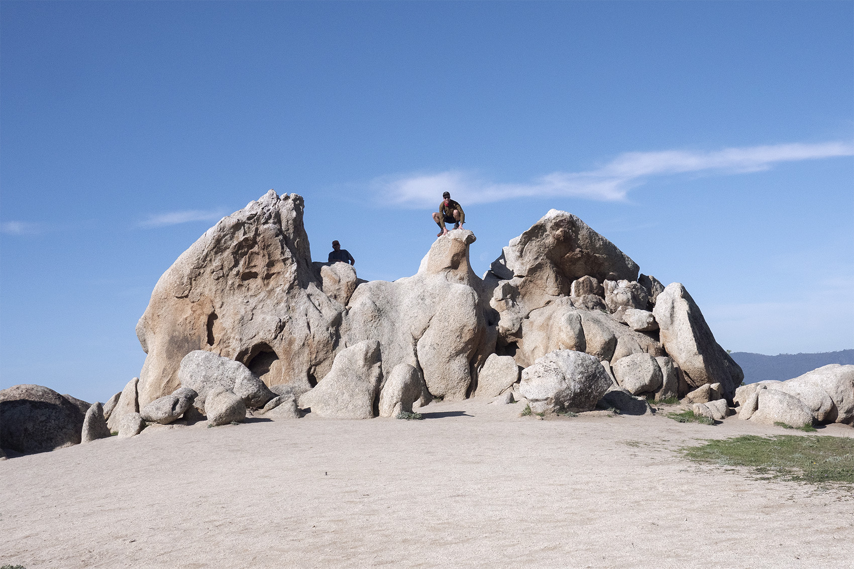
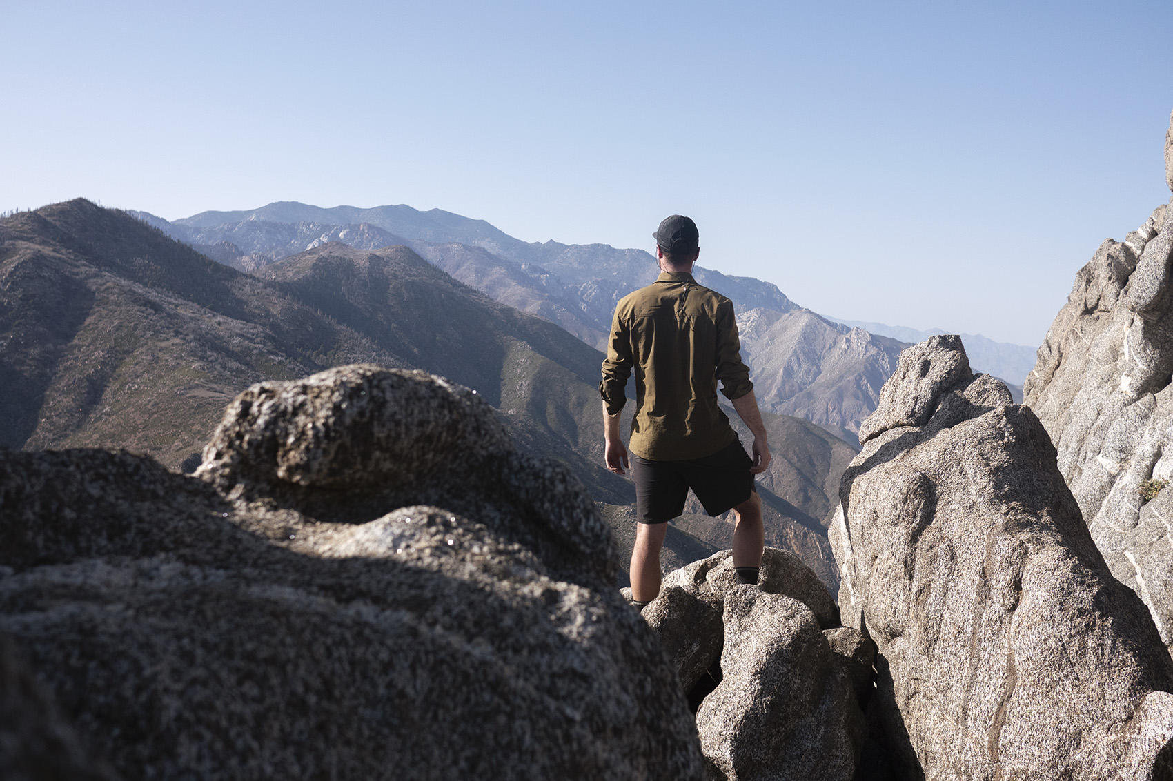
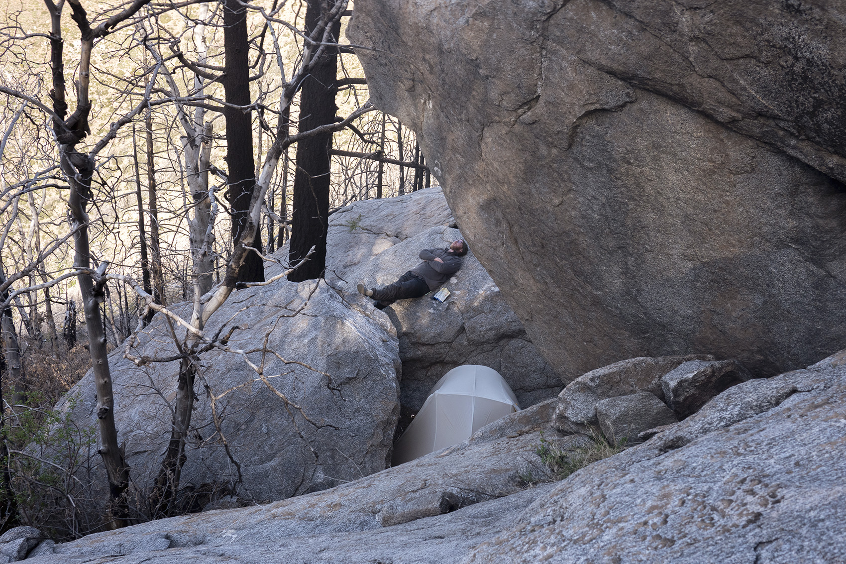
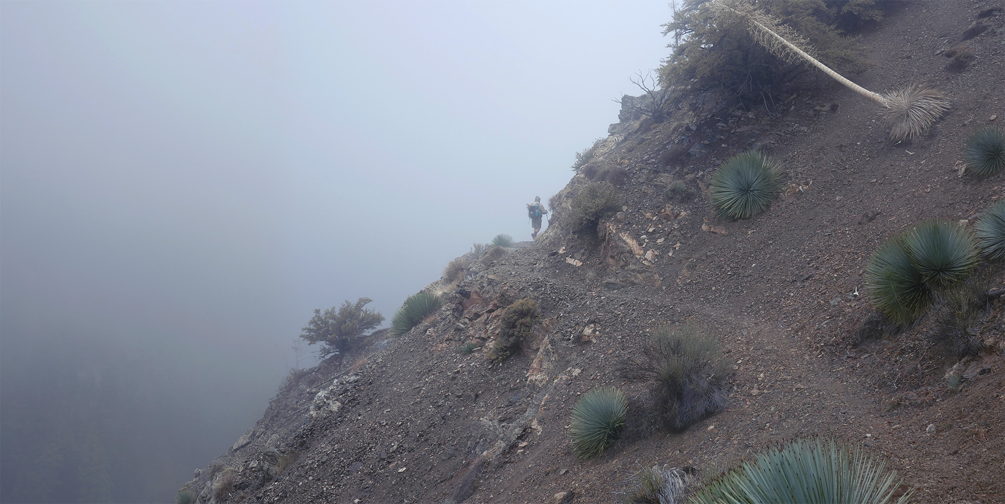
Sleeping on the porch of a roadside cafe was about as pleasant of a night as it sounds. Within the first few miles of trail today the scenery began to change. The desert faded and large rock formations amongst tall pine trees covered the trail. Giant boulders were everywhere and I stopped multiple times to climb them. On the horizon was San Jacinto Peak the tallest point in the desert section of the PCT. We would not make it there today but we did start climbing towards it. Now high up we walked a ridgeline getting closer to a trail closure from a previous years burn. Two enormous boulders just within the burn zone felt like a good place to make camp.
Day 14
Side Trail Into Idyllwild | 8 Miles Hiked
Today we would head into Idyllwild for a night off and resupply. Since 10 miles of the trail were closed we had to take a side route into town. Determined to walk an unbroken line from Mexico to Canada meant having to road walk a few miles. This was the first time on trail I ran out of water, just 3 miles before our destination. The destination was town though and the first place we saw a pizza shop. Pizza and beer were consumed followed by checking into a reasonably priced cabin. Sadly my dad had grown tired of waiting for us and was back on trail before we arrived. This was frustrating but since it was his choice we felt less guilty about it.
Day 15 | Idyllwild Zero Day
We spent the next day in town taking a Zero and resting up. The small cute mountain town was filled with other thru hikers and familiar faces. More beers were had and friends made. We even ran into the youtube hiking celebrity Darwin.
Day 16
Mile 179 | 10 Hiked
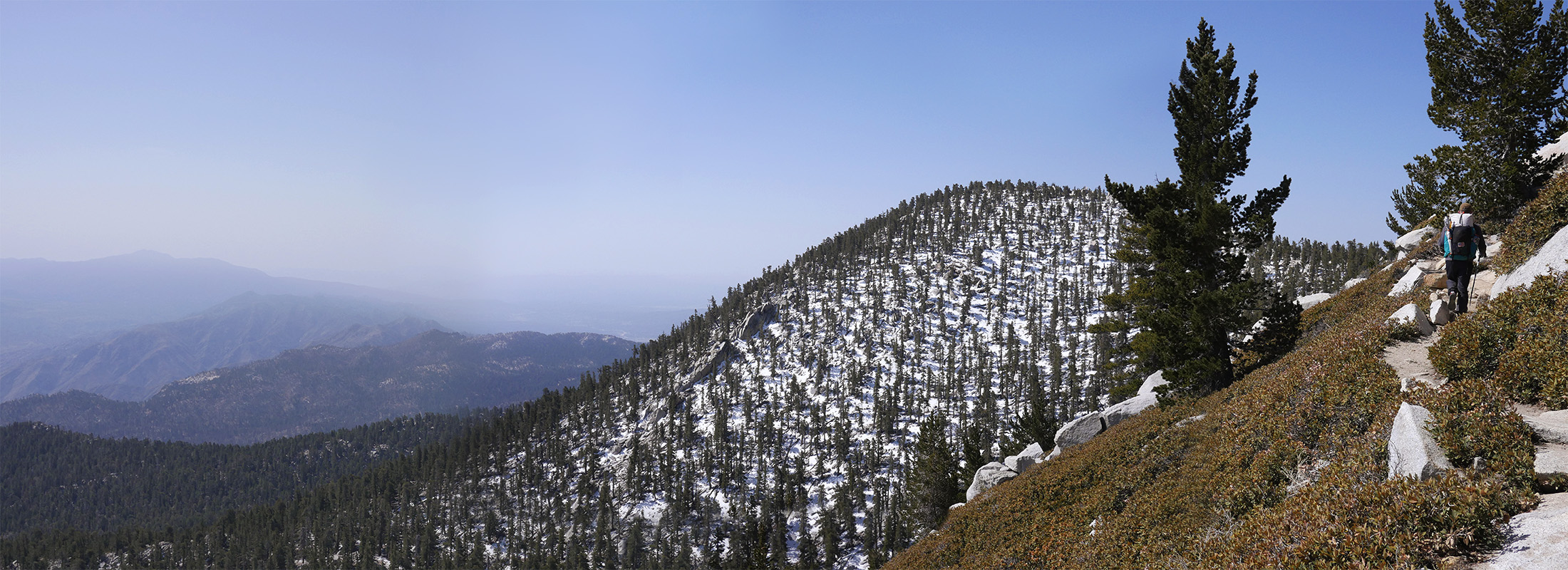
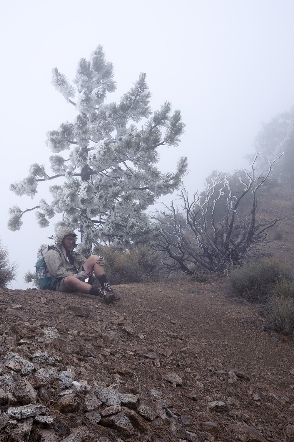
We walked the road out of town a few miles before arriving to a side trail that would take us back to the PCT and toward the summit of San Jacinto. A wind warning was in affect that day as we climbed in elevation. One minute we would be hiking in sunshine and the next engulfed in clouds. The temperature plummeted higher in elevation and I found myself wearing every piece of clouthing for the first time.
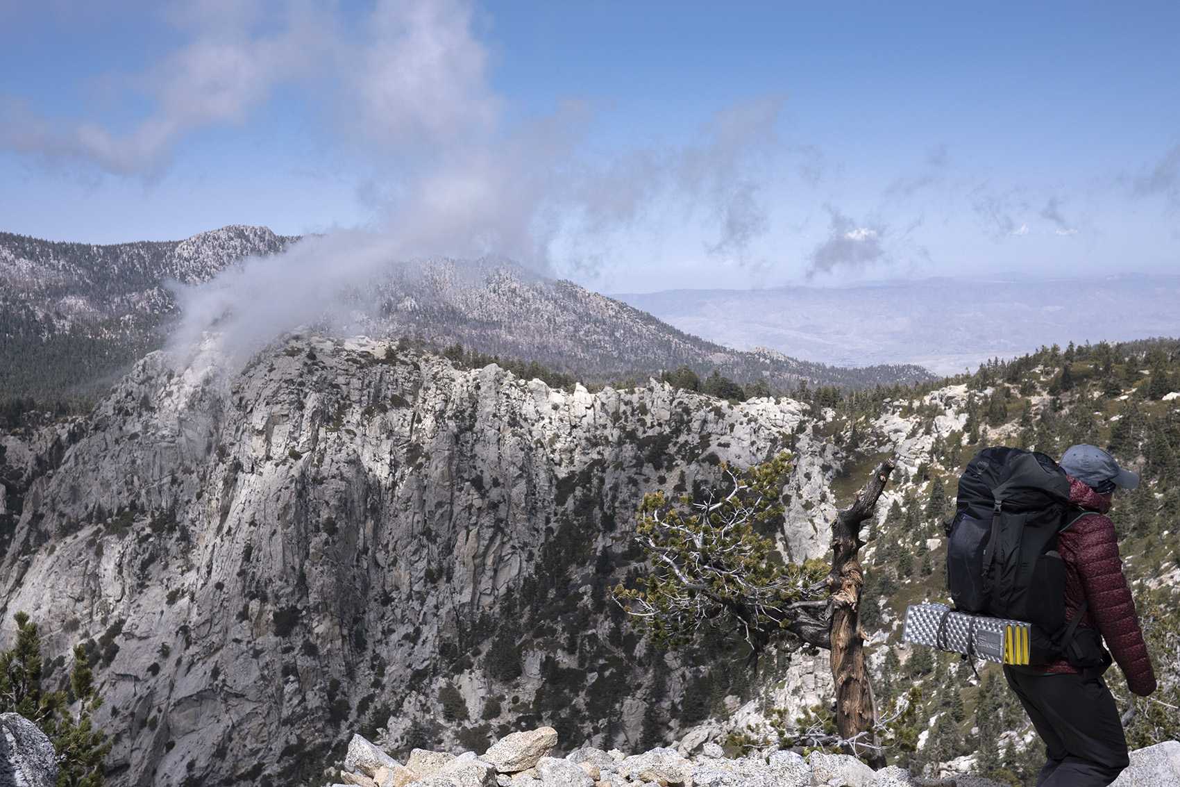
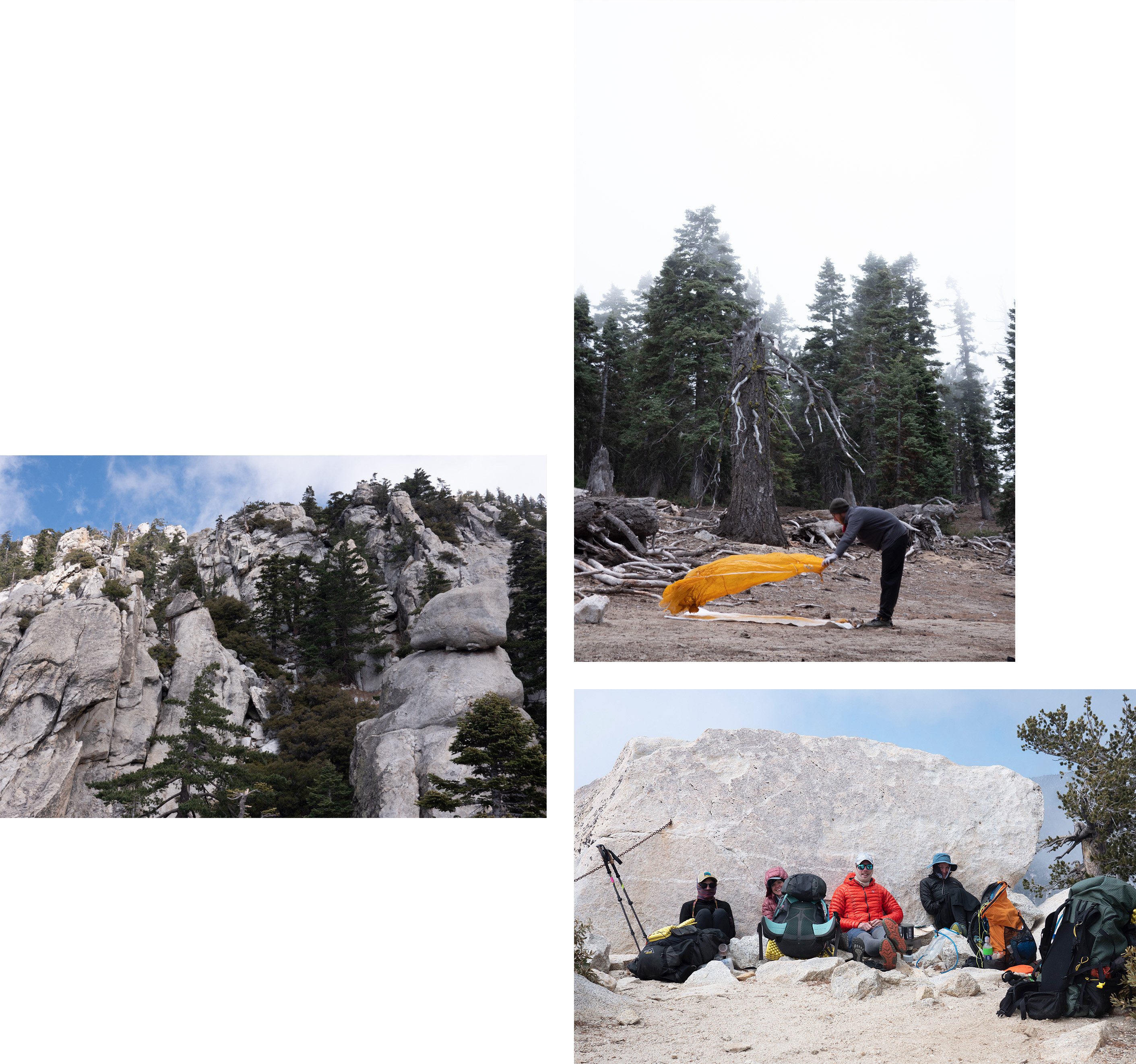
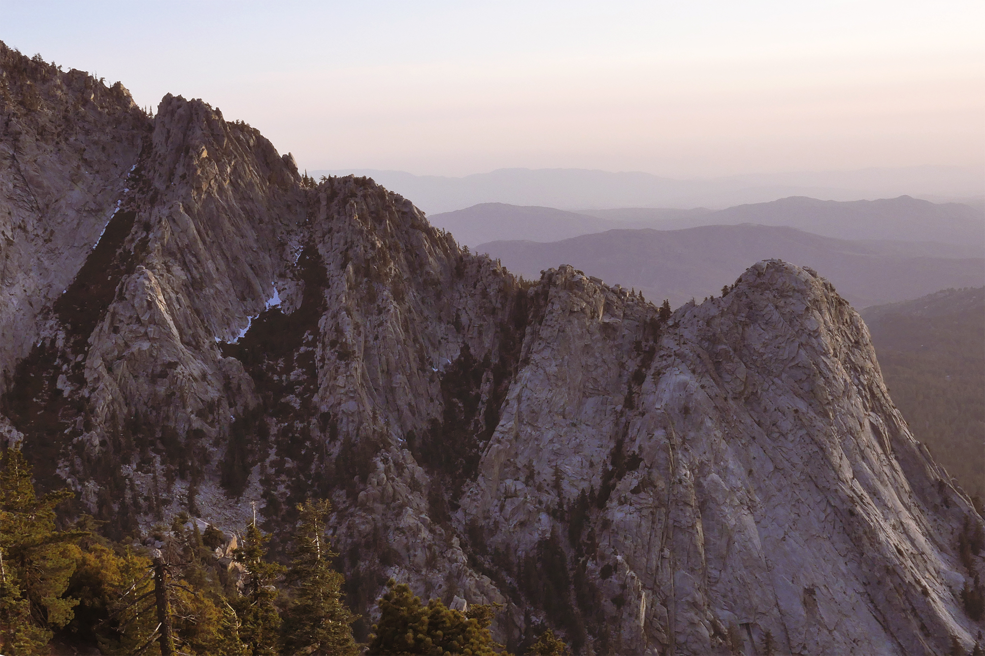
The San Jacinto wilderness was nothing like the dry desert only 20 miles south of us. It felt more like the Sierra with massive pine trees and sheer granite rock formations along its mountain sides. We ran into some hiker friends hunkered down behind a large boulder with puffy jackets on. Among them was Sage who had plucked the bee stinger from my eye on day one. We all had the same idea of reaching the San Jacinto peak that day but decided due to the weather it would be best to wait till morning. Our camp overlooked Tahquitz Peak which resembled the great domes of Yosemite Valley. The temperature dropped into the 20s that night and I struggled to stay warm even with all my clothing on.

Day 17
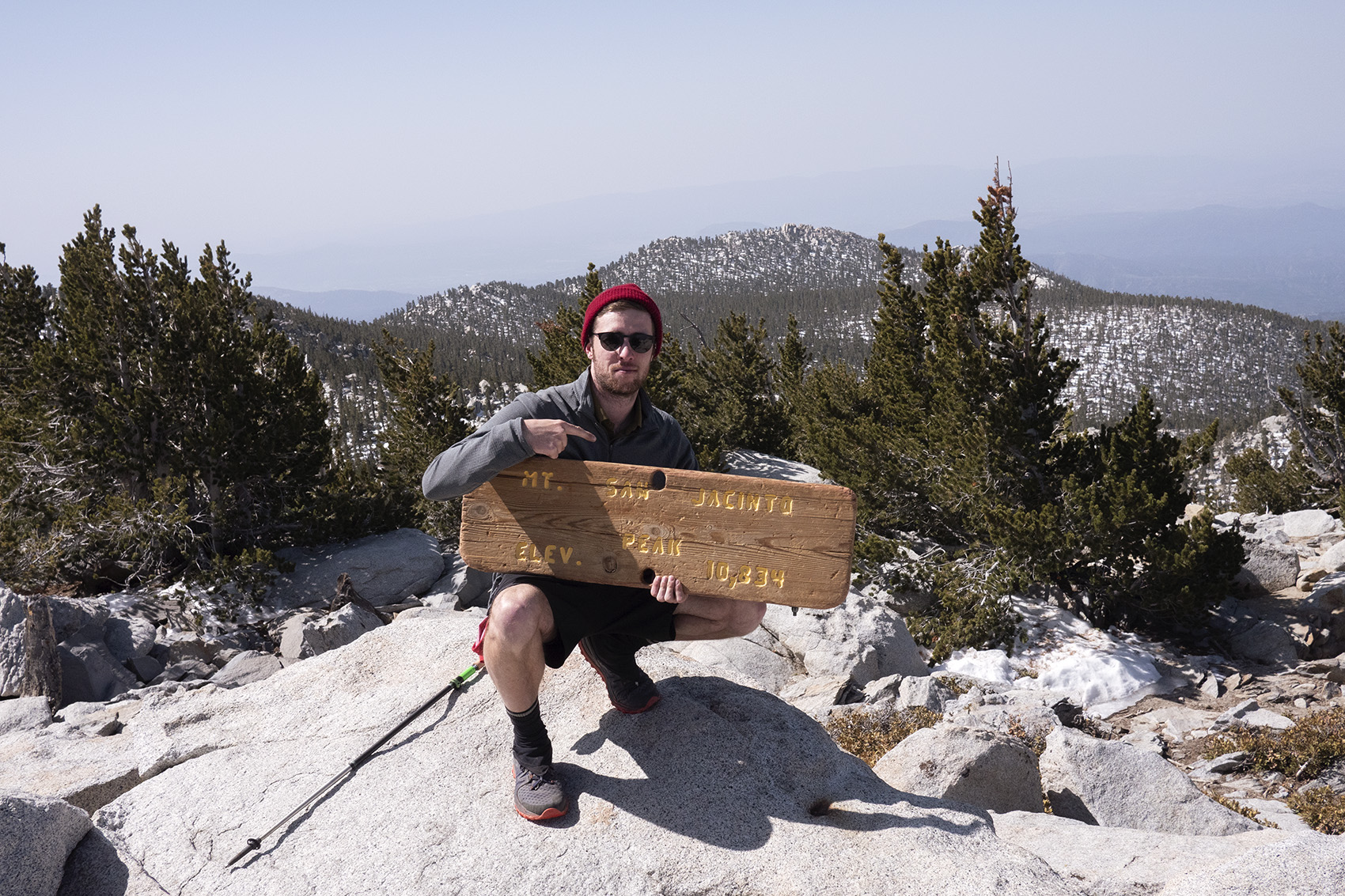
Mile 190 | 15 Hiked | San Jacinto
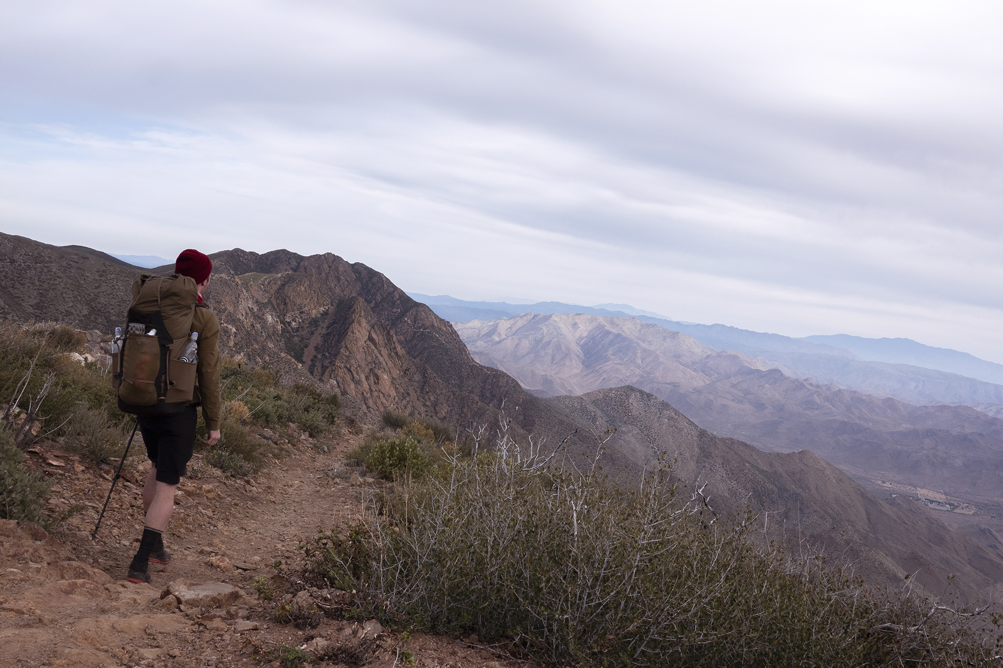
My alarm went off at 4am due to me thinking I would attempt to summit before sunrise. It was freezing out so I slept few more hours till daylight crept in. Even with the sun up it was still freezing outside and I started the day off wearing everything I had. Soon though I was back to shorts and a tee shirt. The elevation change from camp to summit was 2,800 ft and I could feel it. My steps slowed and I struggled to breathe normally. Snow still lined the trail at this elevation and we had our first taste of mountain water. The summit looked down onto the desert valley below where we would end up tomorrow and beyond to the San Gorgonio wilderness. Sad knowing this short section of real mountain terrain would be ending soon. We set up camp amongst the pines after descending 10 miles.
Day 18
Mile 208 | 18 Hiked
Descending the backside of San Jacinto was a 6,500 ft drop in elevation to the desert floor. The pine trees faded and were replaced by large boulders. Some of these boulders rested on the trail looking like they would tumble down the mountain at the first small breeze. An earthquake not unusual for California would be a disaster here. At the base of Jacinto was a small neighborhood and a road that led to the highway. A group of thru hikers pulled up in an Uber and jumped out. They had taken the cab into a nearby rest stop to get In-an-Out which sounded like a wonderful idea to us. We hopped in the cab and proceeded to In-an-Out. After we indulged ourselves we rode back to where we left off and hiked toward the highway before setting up camp. Not far down the road Beyonce was performing at Coachella music festival.
Day 19
Mile 218 | 10 Hiked
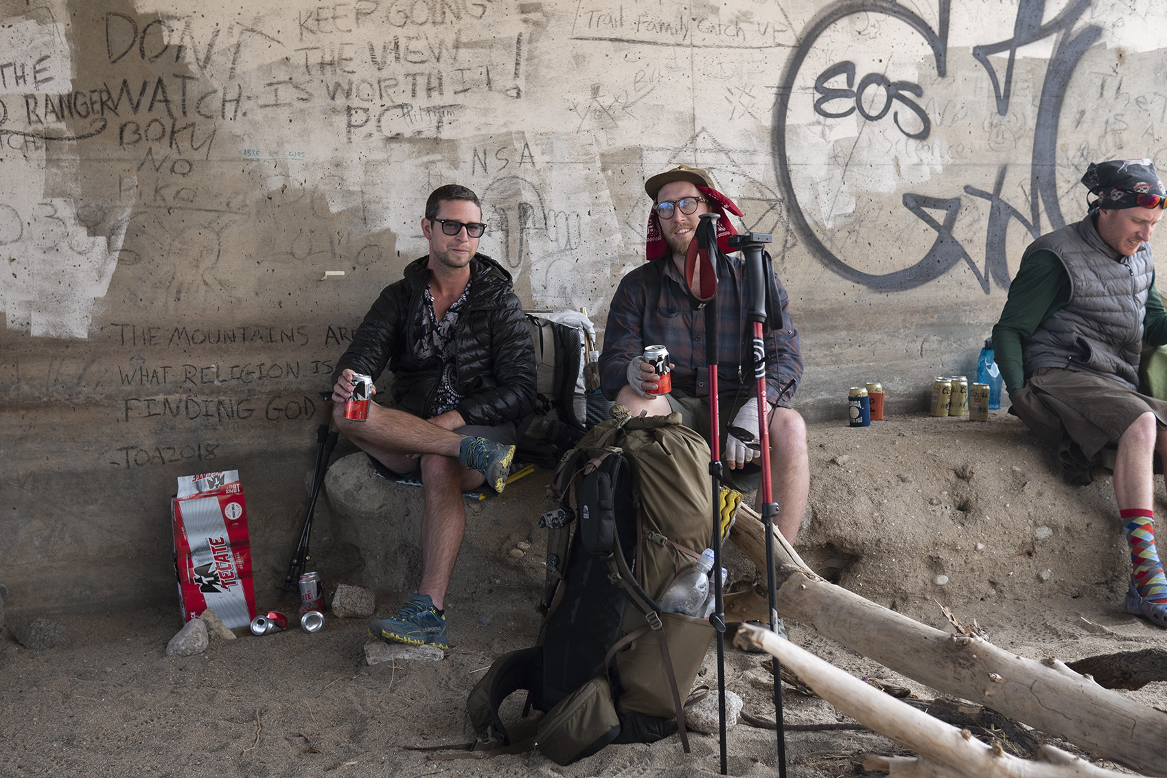
The previous days descent had brought back pain in my right foot. Everytime a more than usual pain occurred my mind drifted to dark thoughts. I never thought of voluntarily quitting since that wasn’t in my nature but I always dwelled on what would break me. Under I-10 was a cache of fruits, water and parked on the other side a trail angel. The angel was “Masshole” a previous PCT thru hiker from Boston who now drove up and down the trail providing small treats. Hanging out under over passes, dining on free food is a delight that only hiker trash and the homeless can know.
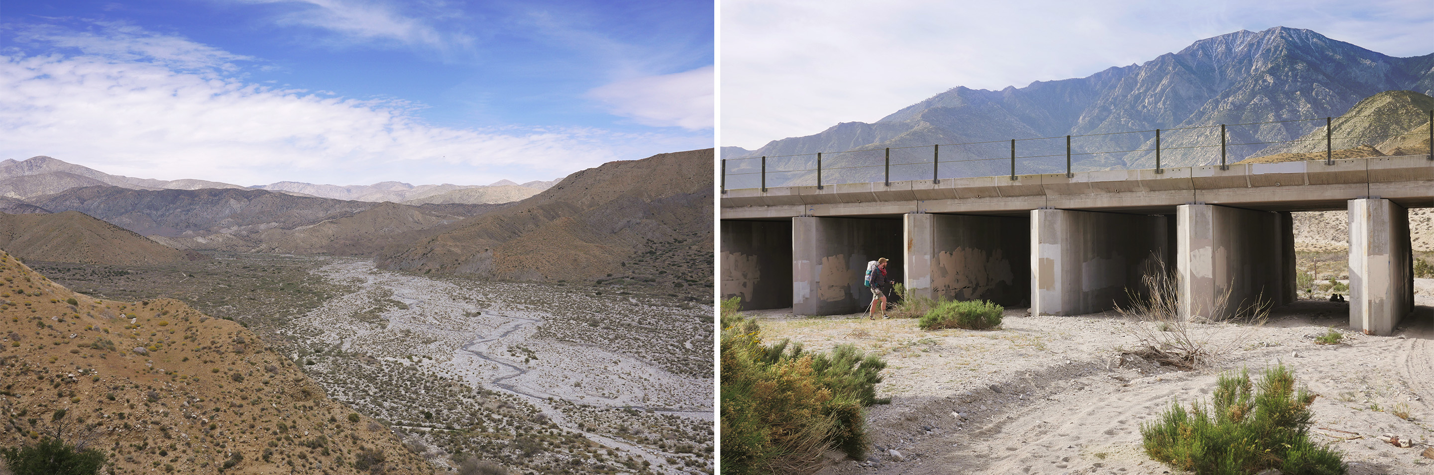
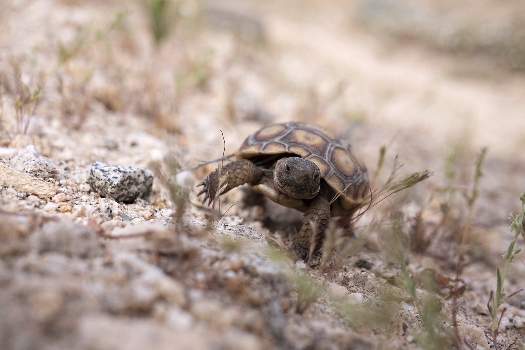
The flat lands that allowed the highway to pass through the desert quickly faded and again we climbed into the hills. A sign warning of rabid dogs in the area put us on edge but we didn’t spot any. We did see a baby desert tortoise which I imagine is a rare sight. On the horizon and all around us were the first of many windmill farms. A steep climb brought us away from civilization and into the San Gorgonio wilderness. Rolling hills covered in light grass for miles made for pleasant walking. We quickly discovered what made the area green as we approached a large canyon. In the center a small river cut through the white rock and was home to White Water Preserve, a well maintained park complete with visitor center. The park allowed thru hikers to camp out in a grassy picnic area which sounded like a good idea to us. Two of Alex’s friends happend to be in the area and stopped by to say hi. They brought beer and asked typical questions one asks of thru hikers. “What do you eat?” “You hike that far each day?” “When did you last shower?” The park was filled with hiker trash by night fall.

Day 20
Mile 235 | 17 Hiked
Following the river allowed us to cary minimal water for the first time since starting the trail. Back home on the East Coast I was used to only carrying two liters of water, out here I was lucky if I only needed 4. When the trail gained elevation the wind picked up substantially knocking you off balance at times. It gave us our first view of Big Bear’s peaks still covered in snow. I knew we were heading to the town of Big Bear but wasn’t sure if we were going over its mountain range. Behind us San Jacinto still loomed large making for a fantastic 360 view. The end of the White River was the entrance to the San Bernardino Wilderness where we made camp.
Day 21
Mile 252 | 18 Hiked
Being near snow capped mountains means colder temperatures. Not bringing gloves was my first big gear regret as I packed up quickly with numb fingers. I hiked out of the river canyon aiming for the sunshine above yearning for it’s warmth. We hiked into our first burn area today. Burn areas would eventually become commonplace but this first one made for a sad sight. On a section of trail where large trees are scarce it’s a shame to see them destroyed. Another first today was seeing a bear. Unfortunately this bear was not wild but inside a cage at a defunct zoo that happened to be along the trail. The day ended at an even stranger sight on trail, a couch. Apparently someone had dragged this couch onto the trail and it was now enjoyed by hiker trash for photo opps and relaxing lunches. I wouldn’t be surprised if a few hikers had slept on it as well.

Day 22 – 23
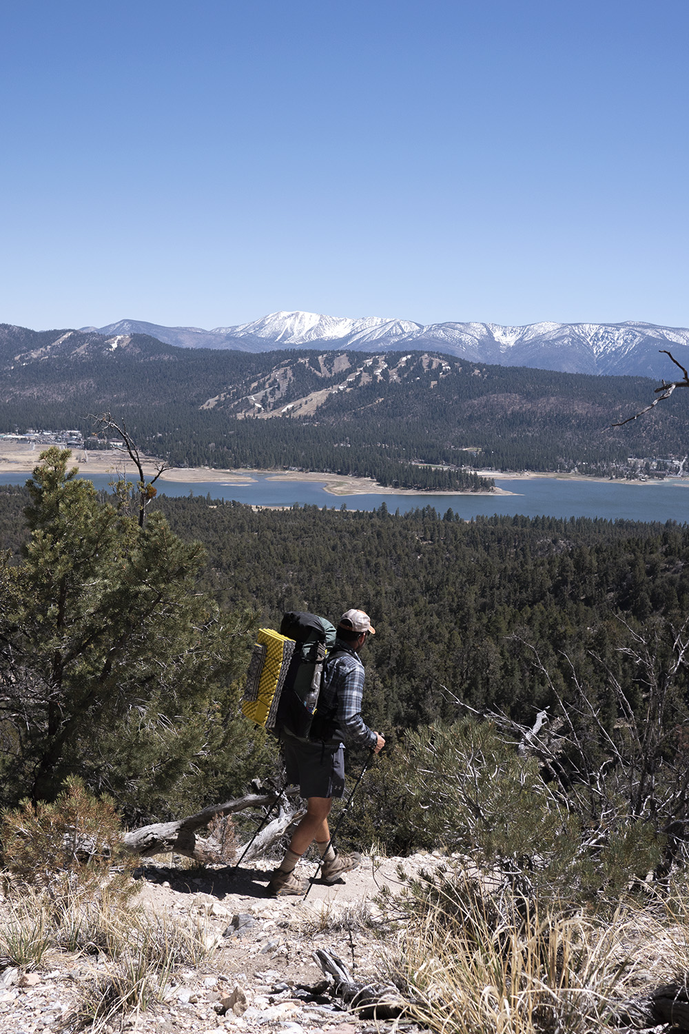
Mile 265 | 13 Hiked | Big Bear Lake
Today was a town day which meant we were hiking fast. Before getting to the road we passed through a desert filled with our first Joshua Trees. This seemed a little off though since it was fairly cold out. We hit the road and got a hitch into Big Bear where we reunited with Dad who had been there for a day already. We ended up taking a zero in town and treating ourselves to good food and drink. It snowed on our zero justifying our decision to not go out that day and felt very fitting in this small Californian ski town.
Day 24
Mile 279 | 12 Hiked
Now back together with a firmer resolve to stick together we got back on trail. The day was a short one as most days leaving town are. Packs fully weighed down with food and liquor, we stopped at the first good looking campsite that had a view. Our view was Big Bear lake and its peaks beyond. Having the mountains in view felt good but it would be short lived.
Day 25
Mile 298 | 19 Hiked
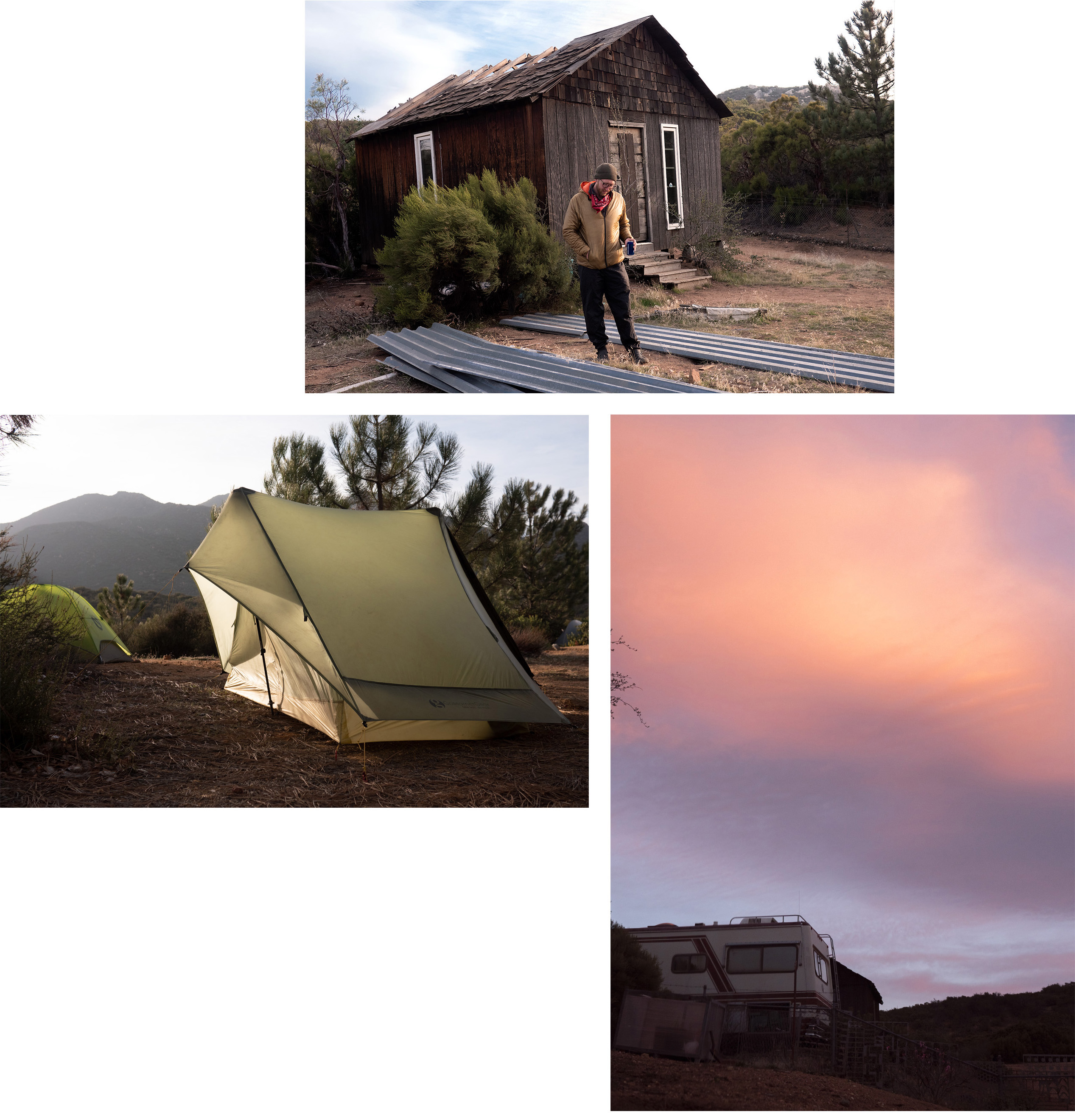
By midday the pine forests of Big Bear were fading and once again we were walking through the hilly, rocky deserts of Southern California. When I think back on this section it’s always one of the stranger transitions. One day we were surrounded by snow capped peaks and the next we’re walking through a sandy desert that eventually led to a large swimming hole oasis. Splinters cabin, the beginning of Deep Creek, would be our home for night. The cabin was non existent but we found a sandy beach on the river’s edge to make camp and dip our feet in.
Day 26
Mile 308 | 10 Hiked | Deep Creek Hot Springs
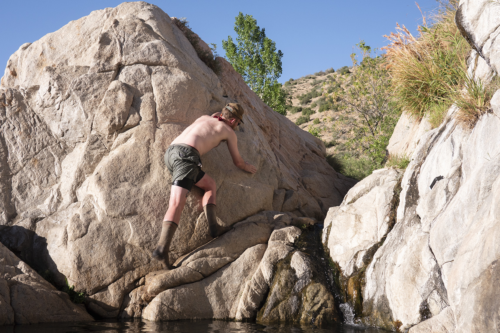
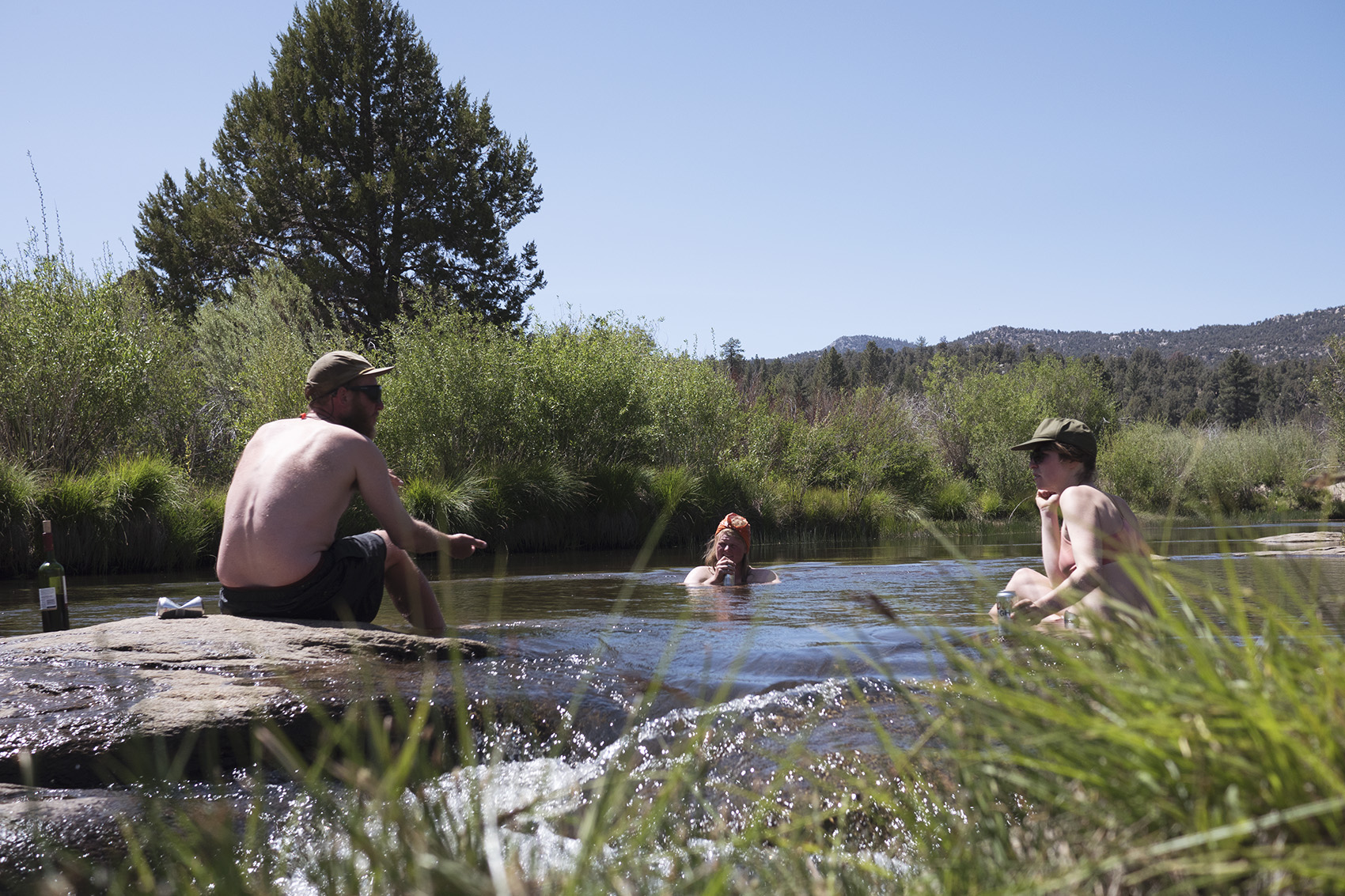
Deep Creek was now far below us in the middle of a rocky canyon. We walked along a narrow shelf above in the hot sun eager to get to the famed Hot Springs further down trail. Other hikers unable to wait had scrambled down to the banks of the river and were jumping off massive boulders. Not doing this myself would be my first big regret of the trail.
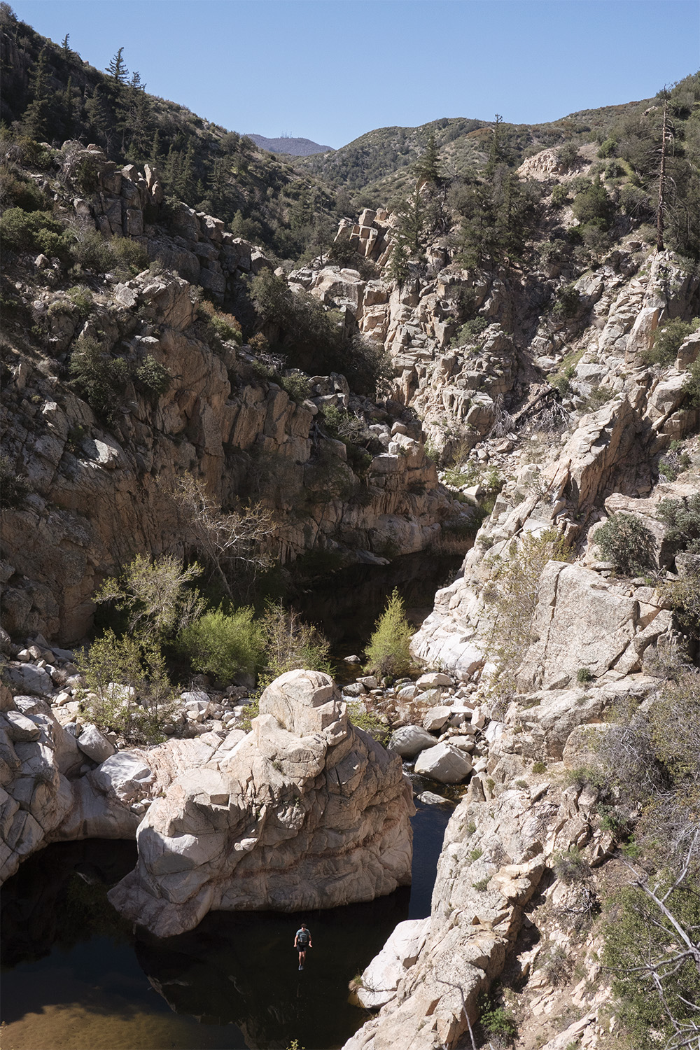
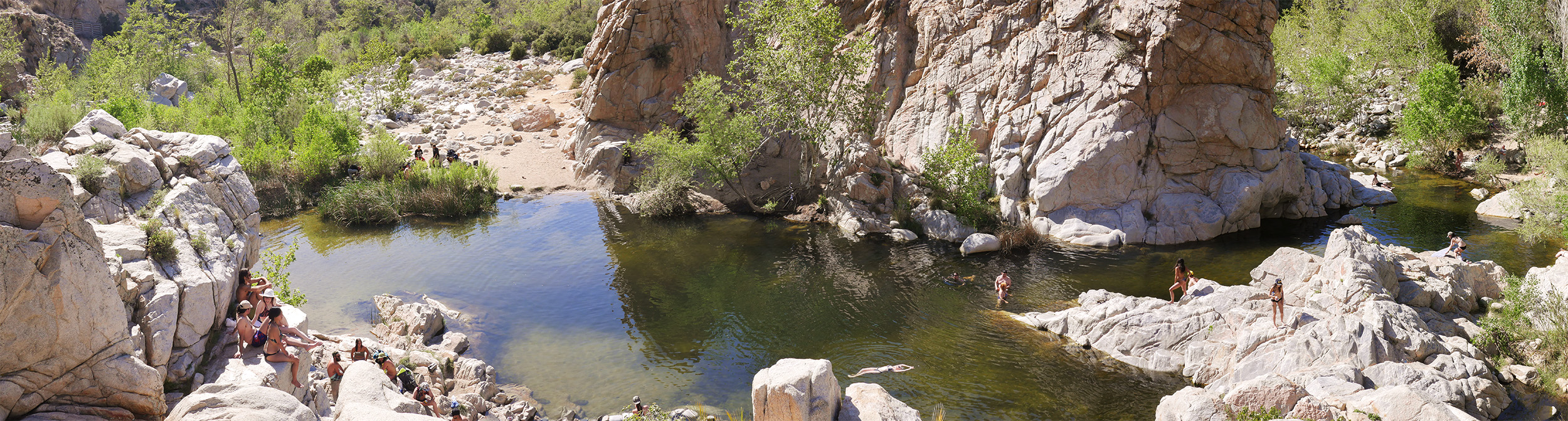
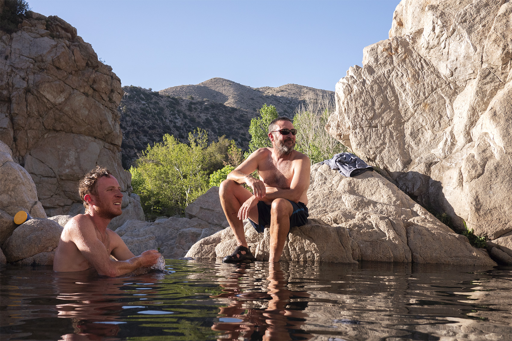
Reaching Deep Creek Hot Springs felt like walking onto a busy beach. Music was playing, Walmart tents were set up, and lots of people were naked. There must have been a hundred people crowding the shore, swimming and relaxing in the hot springs. For good reason, this truly was an oasis in the desert. Shady trees and small rocky cliffs surrounded a large pool of crisp cold water. Surrounding the large pool were hot springs fed by smaller pools nestled between the boulders. The crowd was a mix of day hikers and groups of burnouts mostly naked as clothing is optional. It was the perfect place to take a half day to swim, soak, and partake in the marijuana being shared freely. We cooked our dinner in a large group of thru hikers. Recurring faces were starting to become friends. I was never sure if our starting group would expand but now it seemed like a possibility.
Day 27
Mile 328 | 20 Hiked
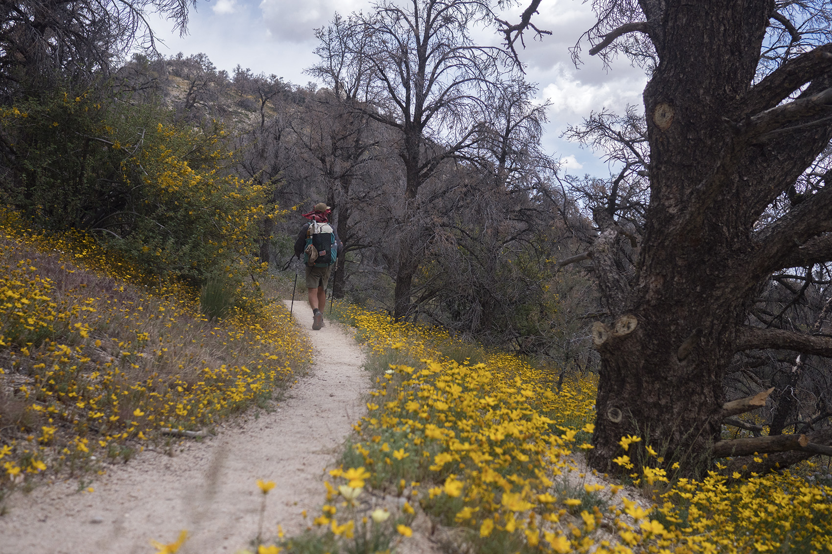
Now firmly in a large bubble of hikers we hiked out of the springs and back into the canyon cliff sides. The creek ended and we were dumped into the rolling desert hills. Here the hills were greener and flowers bloomed from the dead brush. Rumors of a camp where pizza could be delivered began and was quickly everyone’s goal for the day. Although we had hiked and camped with other groups of hikers before this one was large and the most uniquely diverse. An older gentleman I forget the name of would play the recorder as we left each break, creating an amusing medieval vibe while we marched down trail. What wasn’t amusing was the creepy vibe he put off toward the younger women walking with us. At one point I saw him touch a woman’s shoulder commenting on how sweaty she was. I cringed hard seeing this and made a small remark under my breathe. In hindsight, after talking to her about it I wish I would have spoken up.
The same man ended up breaking our large group into two when he offered to buy everyone pizza that evening. Myself and two others were ahead of the pack and ended up a lot further down trail when the man decided to stop at a remote road and order pizza there. Of course everyone including Dad and Alex stopped there as well. I was no longer amused by this recorder piping creeper. Our camp was along a large unexpected lake where we also ended up getting pizza delivered.
Day 28
Mile 342 | 14 Hiked
Waiting for my Dad and Alex to catch up, I slept in and took my time breaking down camp. When they arrived I was ready to go but my dad decided he would rather hang out at the lake for a while with a few other hikers. Alex and I wanted to keep it moving and figured he would catch us by the end of the day.
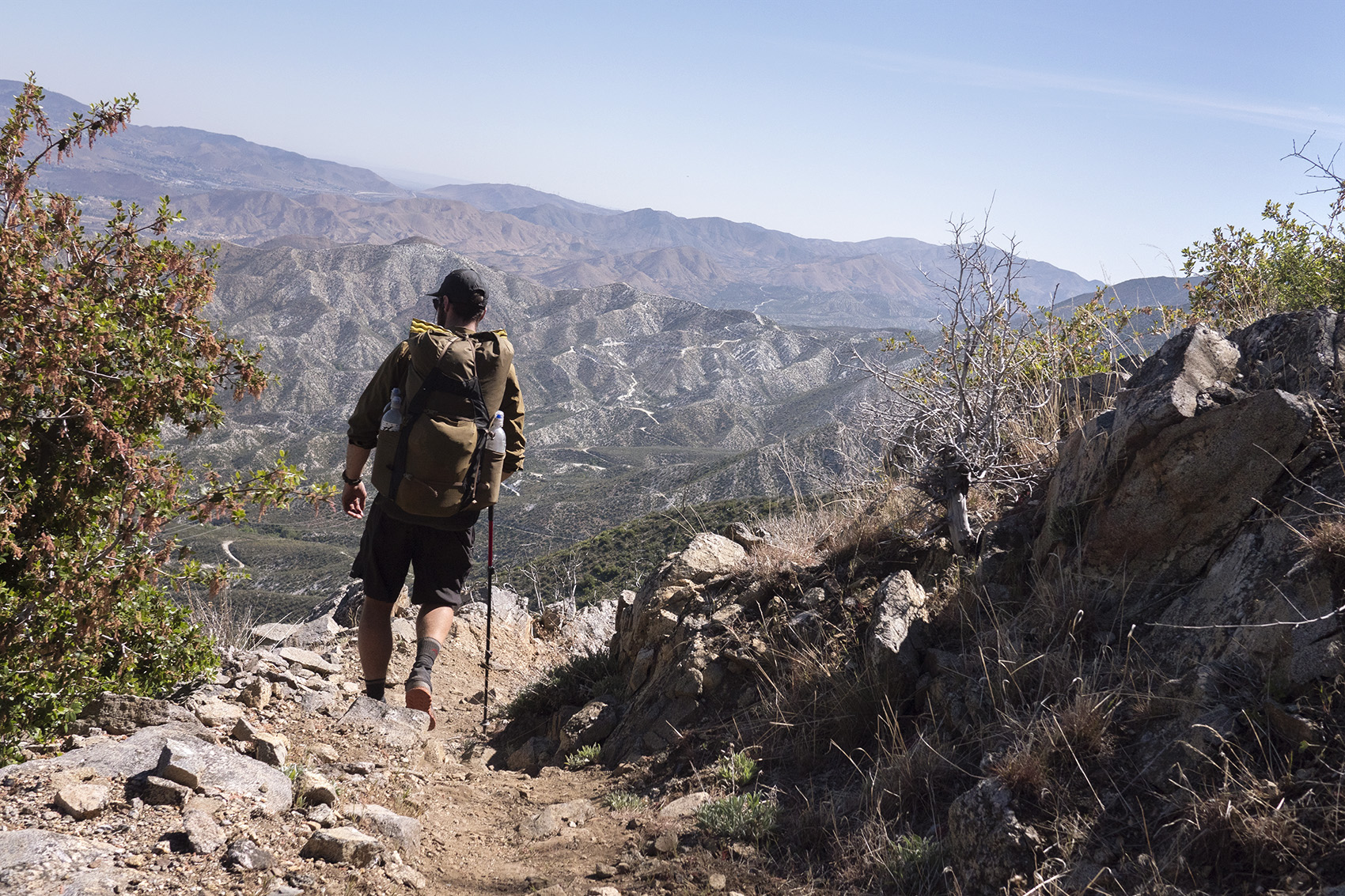
Leaving the lake put us back in the hilly desert where the sun beat down and little changed. The monotony was eventually broken after reaching a hill top with views of Cajon Pass and Angeles National Forest in the distance. The foggy or smoggy rolling hills were some of the biggest we had seen so far. To get to them though we needed to drop down to Cajon Junction a massive valley where a major vein of highways and railways stemmed from LA. At the bottom was a McDonalds that even had its own trail sign. This was a must stop for every hiker because of the burgers but also water. We indulged in big macs and mcflurries before getting back on trail to find a camp for the night.
Day 29
Mile 352 | 10 Hiked
McDonalds wasn’t far from camp so we hiked back to have breakfast and fill up on water. Apparently there was a 20 mile dry stretch ahead so this wasn’t just for the egg mcmuffins. Dad came strolling by as we were leaving with a few other hikers and we did our best to convince him to leave with us. He was too excited about relaxing over a big mac though to agree and we left him to it. He seemed to be doing well now amongst newly made friends and I didn’t feel to bad leaving him to hike his own hike.

For being so close to the highway Cajon Pass was an interesting section of trail. Large rock formations called the Mormon Rocks with flat tops extend out of the ground on all sides. The days were growing warmer and our will to push through the hot afternoons was lessening. Long breaks in the minimal shade that could be found were needed. After a siesta we climbed into Angeles National Forests foothills and were quite high up when we decided to make camp.
Day 30
Mile 363 | 13 Hiked | Wrightwood
The clouds of smog and fog that filled Cajon Pass made for a great view in the early morning light. The trail wrapped around the mountains bringing us further into the Angeles National Forest where the trees grew larger providing much needed shade. A fellow hiker was broke down on the side of the trail and stopped us to ask for water. Apparently he hadn’t planned correctly for this 20 miles dry stretch. We gave him what we could spare, a few liters each. In 4 miles we would be at the side trial into Wrightwood and could re-up there.
Day 31-32 | Zero Wrightwood and LA
The Acorn trail brought us down into the small town of Wrightwood. Our first stop was lunch at the local brewery followed by the Mountain Hardwear store not to be confused with the brand. The Mt Hardware store gives out free PCT buttons and rides to the local REI. Alex and I had decided on going into LA the next morning to hangout with friends and take a brief break from the trail. After 30 days it felt like a fitting celebration. Getting a hitch all the way there proved to be difficult and we ended up taking a Lyft instead. The price wasn’t horrible between the two of us and before we knew it we were out of the woods and in middle of downtown LA.
Day 33
Mile 364 | 3 Hiked
2 Days of indulgence in the city was nice but it was more than enough and I was happy to get back to the trail. Our friends drove us back into the Angeles National Forest and we got back on where we left off. I was still hungover from the night before and the 1,500 ft elevation gain to get back to the PCT via Acorn Trail was not easy. Apparently Alex felt the same way because we both decided to stop and make camp after only 3 miles. Our camp overlooked the San Gabriel Mountains filled with fast moving clouds. It was beautiful but chilly sunset.
Day 34
Mile 383 | 20 Hiked | Mt Baden Powell
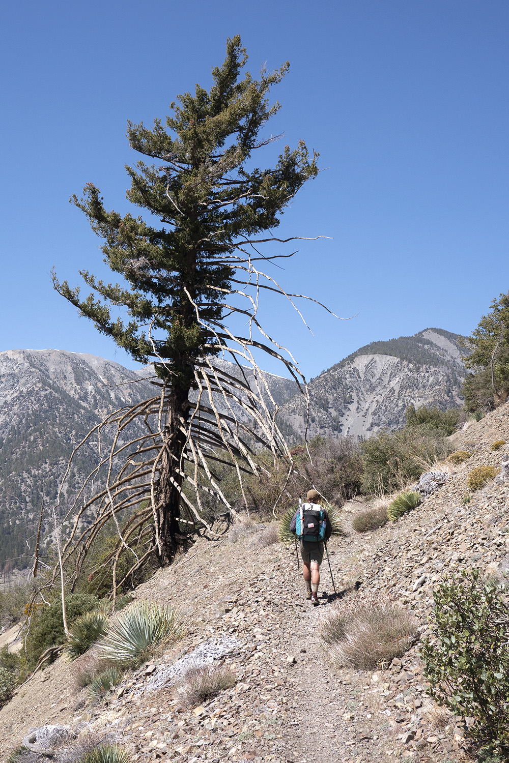
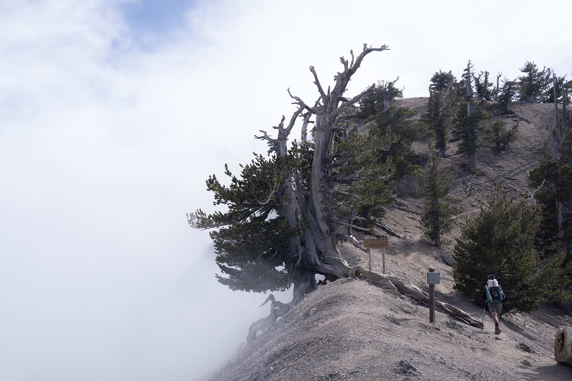
The sun was shining when we awoke but the temputure had dropped overnight. In the valley below the clouds were still moving fast. It was going to be an exciting day to summit Mount Baden Powell. As we started up the base the clouds moved in around us. This made for some tricky layering but at least it was cool. Just before the peak we broke free of the clouds. A ridgeline led to the summit proper. The clouds crashed against the ridge line like ocean waves on the side of a cliff. Holding onto this ridge was a large tree that looked to also be holding onto life. A small plaque indicated that it was over 1000 years old.
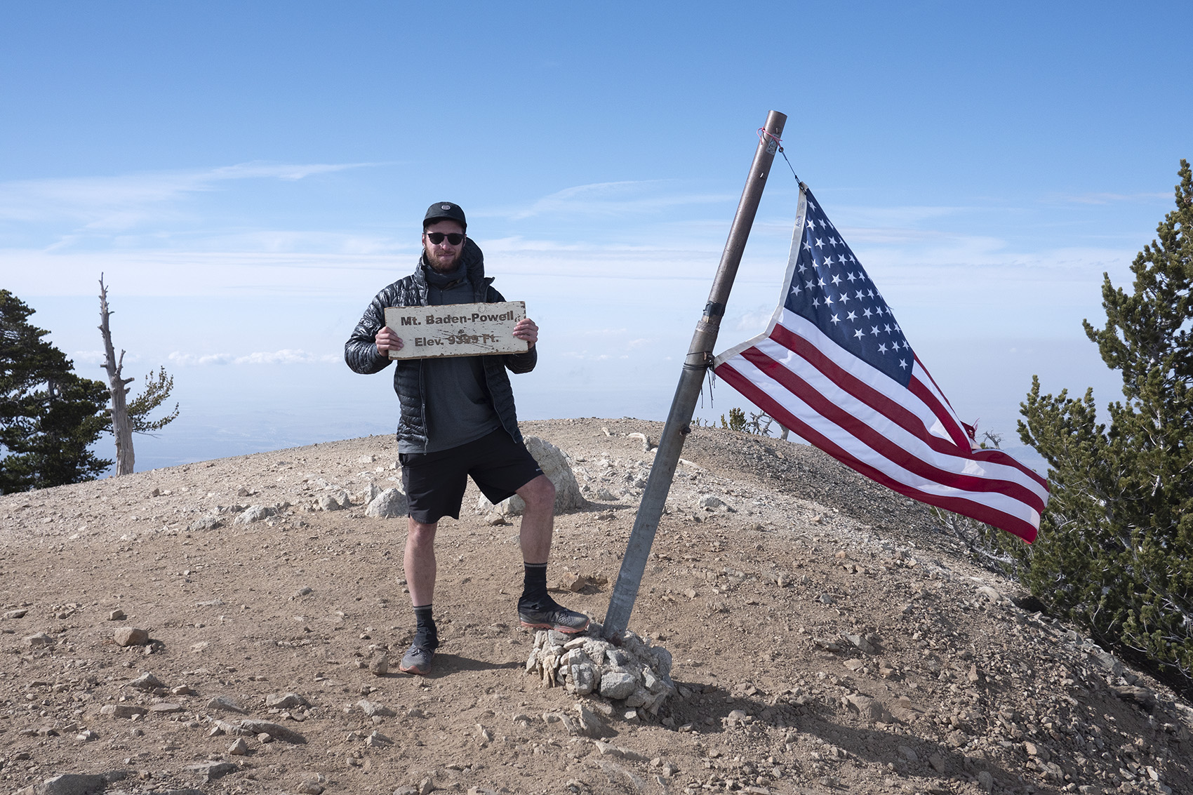
The summit was clear but below us was awash with cloud cover. Mount Baden Powell is named after the founder of the Scouts and the slogans and pledges I recited so often as child were engraved in stone at its summit. The descent was an exciting one as the wind picked up pushing clouds past us at high speeds. One moment would be a total white out and the next clear and bright. When I reached Little Jimmy campground it was downright freezing and I had all my layers on before getting into my tent. I hoped to find Dad here but only found other hikers hiding in their tents from the weather.
Day 35
Mile 395 | 12 Hiked
For the first time on the PCT I awoke to the sound of rain. On top of that it was freezing cold outside. I laid in my bag not wanting to go out into the cold and miserable rain. I could hear other hikers starting to stir in camp. One was actually singing, very loudly in a jolly manner which was very funny given the shitty weather. Later down the trail I would meet this singer who was aptly named Jukebox.
The day wasn’t as rainy as I had thought. What actually seemed to be happening was low wet clouds were passing through the mountains and drenching everything. The trees collected this moisture and when the branches became heavy the water dropped down like it was raining. This made for a miserable day of cold, wet hiking. After 12 miles we decided we had enough. The camps in Los Angeles National forest were massive, complete with old style wood burning stoves. We got a fire going and warmed up before crawling back into our tents.

Day 36
Mile 411 | 16 Hiked
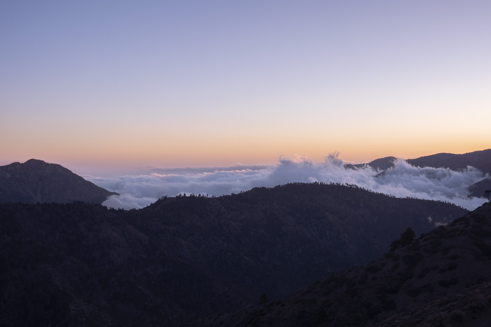
That night had been stormy, waking me up a few times to see ice coating my shelter. By the morning the storm had passed and the sun was shining. We dried out in the warm sun before getting back on trail. Clouds were still moving in and out of the mountains throughout the day but no longer were they soaking us. By mid day we could see the edge of Angeles National Forest and the desert floor below. It was a strange sight to see the desert covered in rolling clouds.
Day 37
Mile 430 | 19 Hiked
Today we left behind the pine covered mountains of the Angeles National forest and once again were in the shrubby low desert hills. I had one mission today and that was to catch up to my dad. We played phone tag between moments of service all week and I knew we were only a few miles behind. At lunch I got a message from him confirming he was close. The day went by fast despite a very long stretch with no water and before I knew it I was walking into camp to find pops waiting. We had a good laugh about how he was right in front of us the entire week and how he dealt with the cold wet weather. I was happy to see he wasn’t alone and with a small group of hikers. He even had a trail name now, Mr Clean due to how anal he was about keeping his gear clean and organized. Knowing my dad it was very fitting.
Day 38
Mile 444 | 14 for the day
The next week on trail was a streak of stops that all hikers know well. Leaving behind the mountains and descending back into the desert led to the first, a well kept KOA campground. After hearing they had a hot tub we practically ran through todays miles to get there. The weather was back to normal, hot, dry and bright but since we had been freezing only two days prior the hot tub sounded amazing. The afternoon at the KOA was a full on party. We turned the hot tub into hiker trash soup and worked on getting rides into town for beer. With beer secured we partied through the night.
Day 39
Mile 454 | 10 for the day
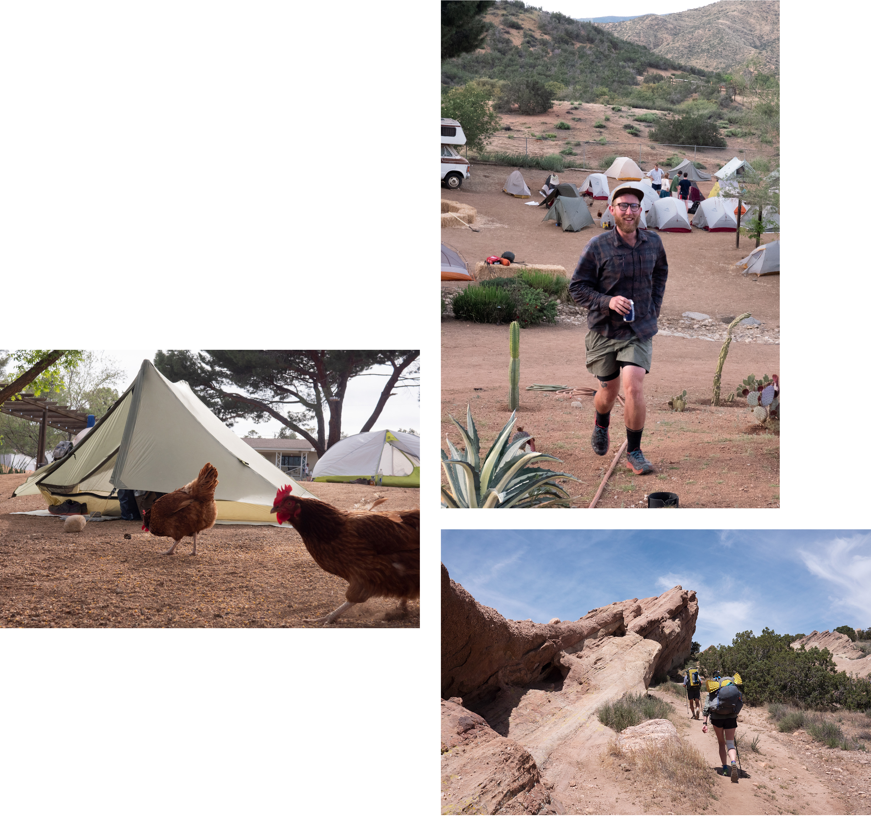
Leaving the comforts of the KOA behind might have been hard if the next stop was not called Hiker Heaven. The day was an easy one as well at only 10 miles with the last 3 going through Vasquez Rocks. The rocks were famous for being the backdrop to many films and tv shows over the years.
Exiting Vasquez Rocks we entered the small town of of Agua Dulce which was home to the famous PCT stop, Hiker Heaven. Before transcending into heaven we stopped in town for mexican food and margaritas. Hiker Heaven like Scout and Frodo’s seems to run on magic and is very well organized. We spent the night relaxing and drinking with fellow thru hikers while evading the aggressive chickens that roam the property.
Day 40
Zero Hiker Heaven
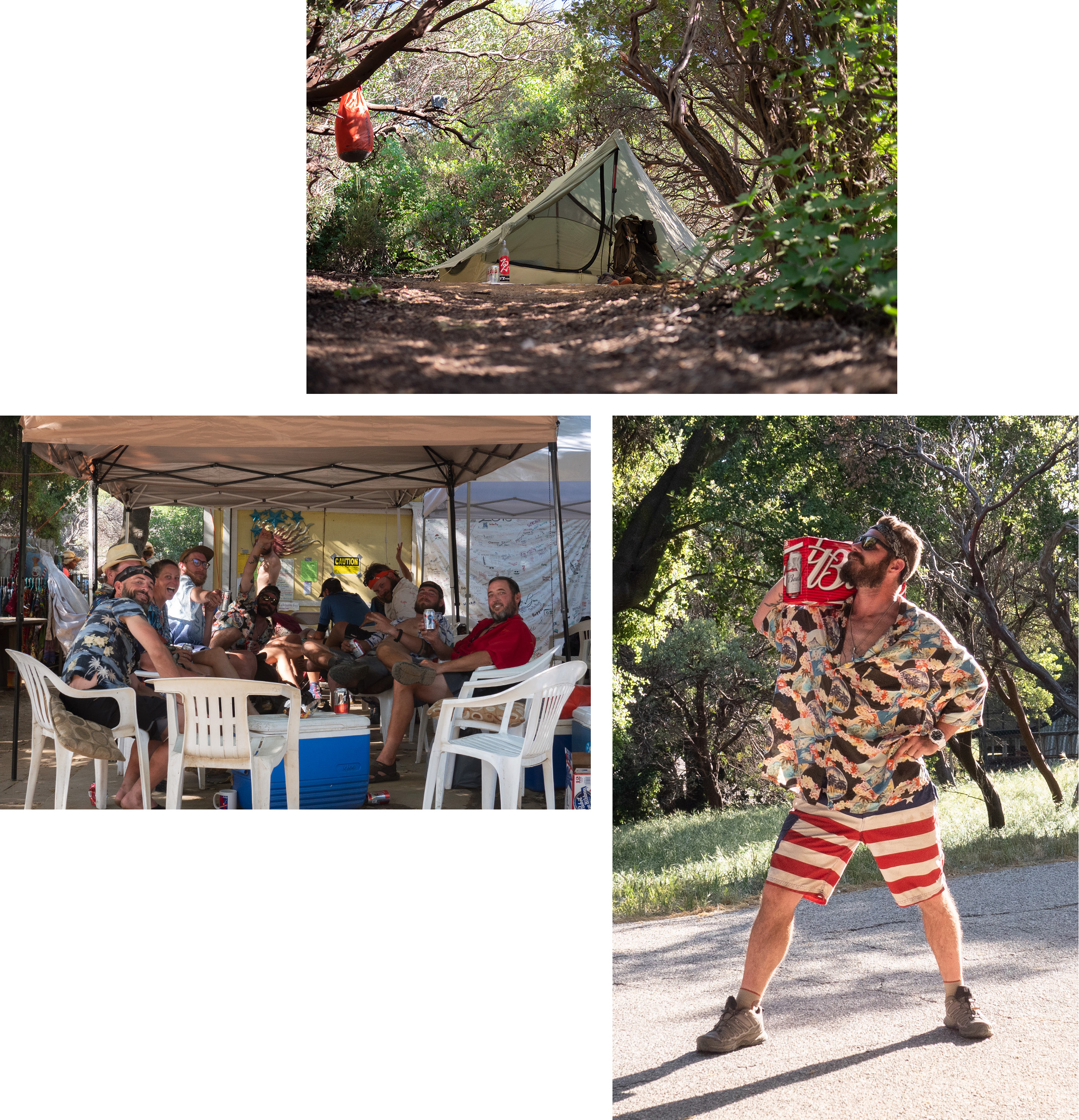
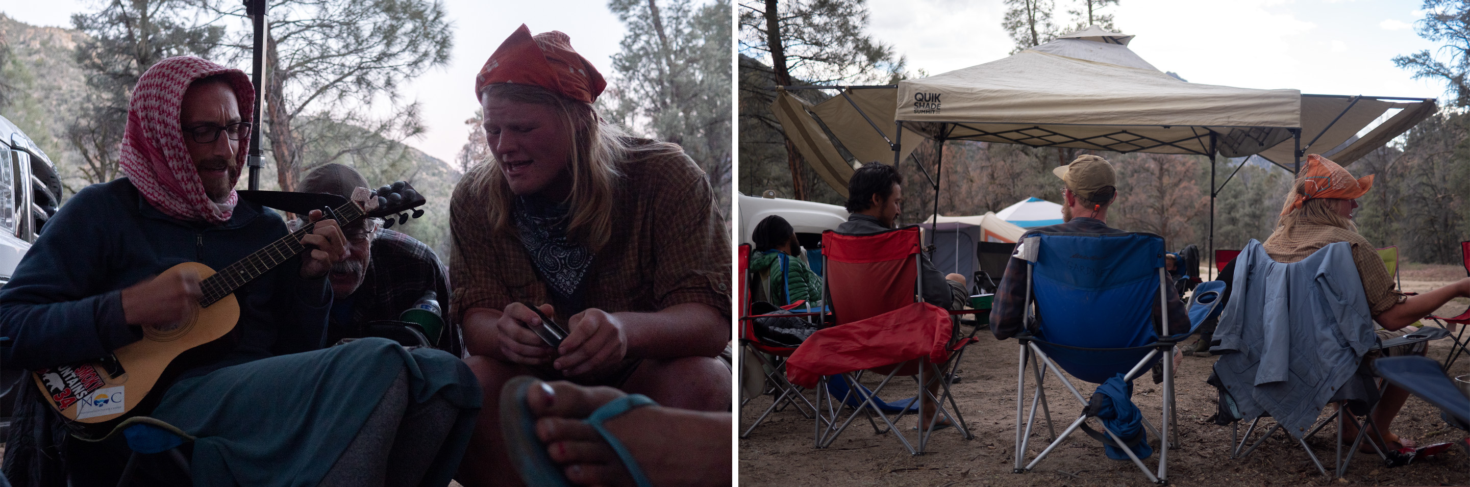
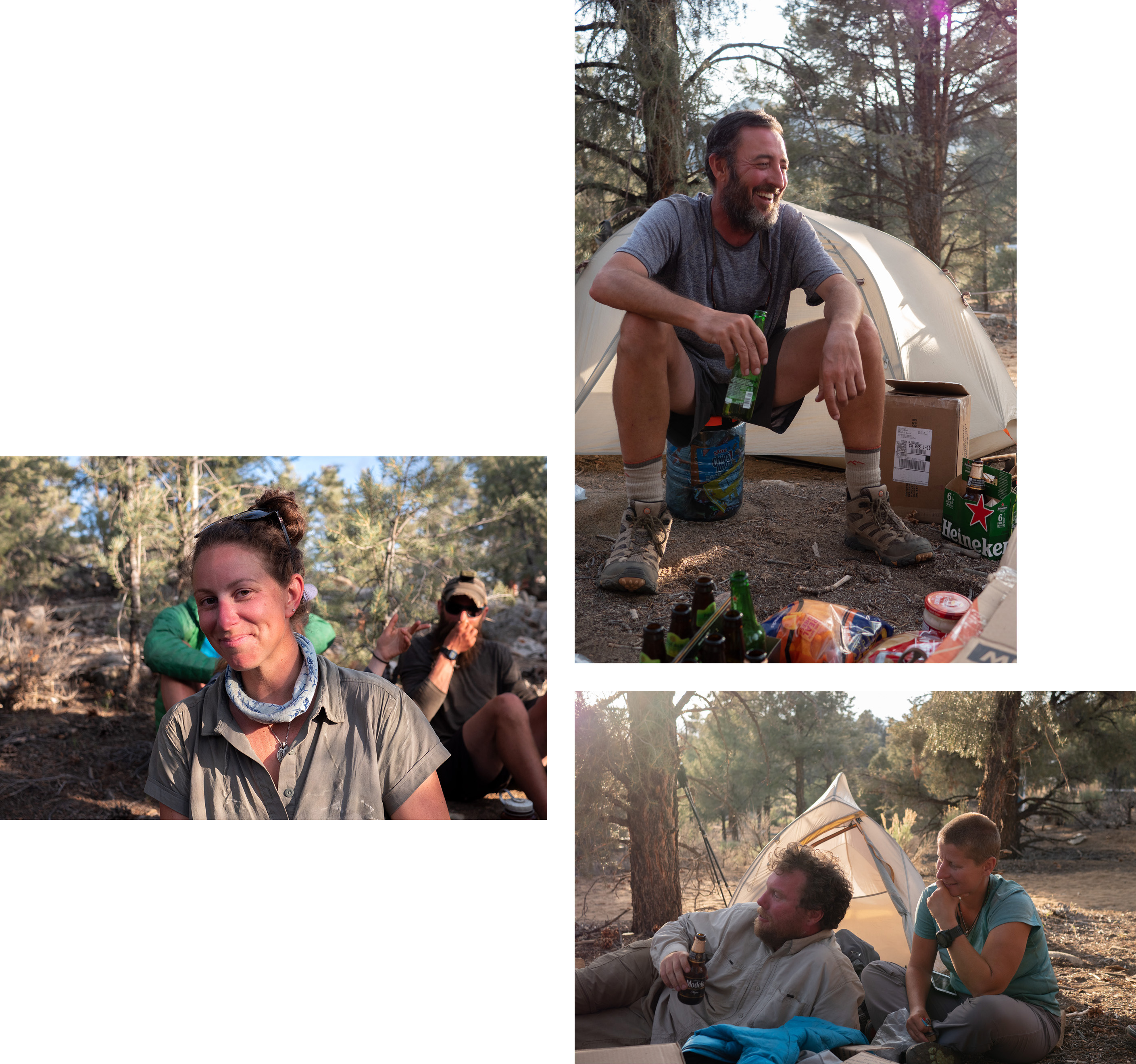
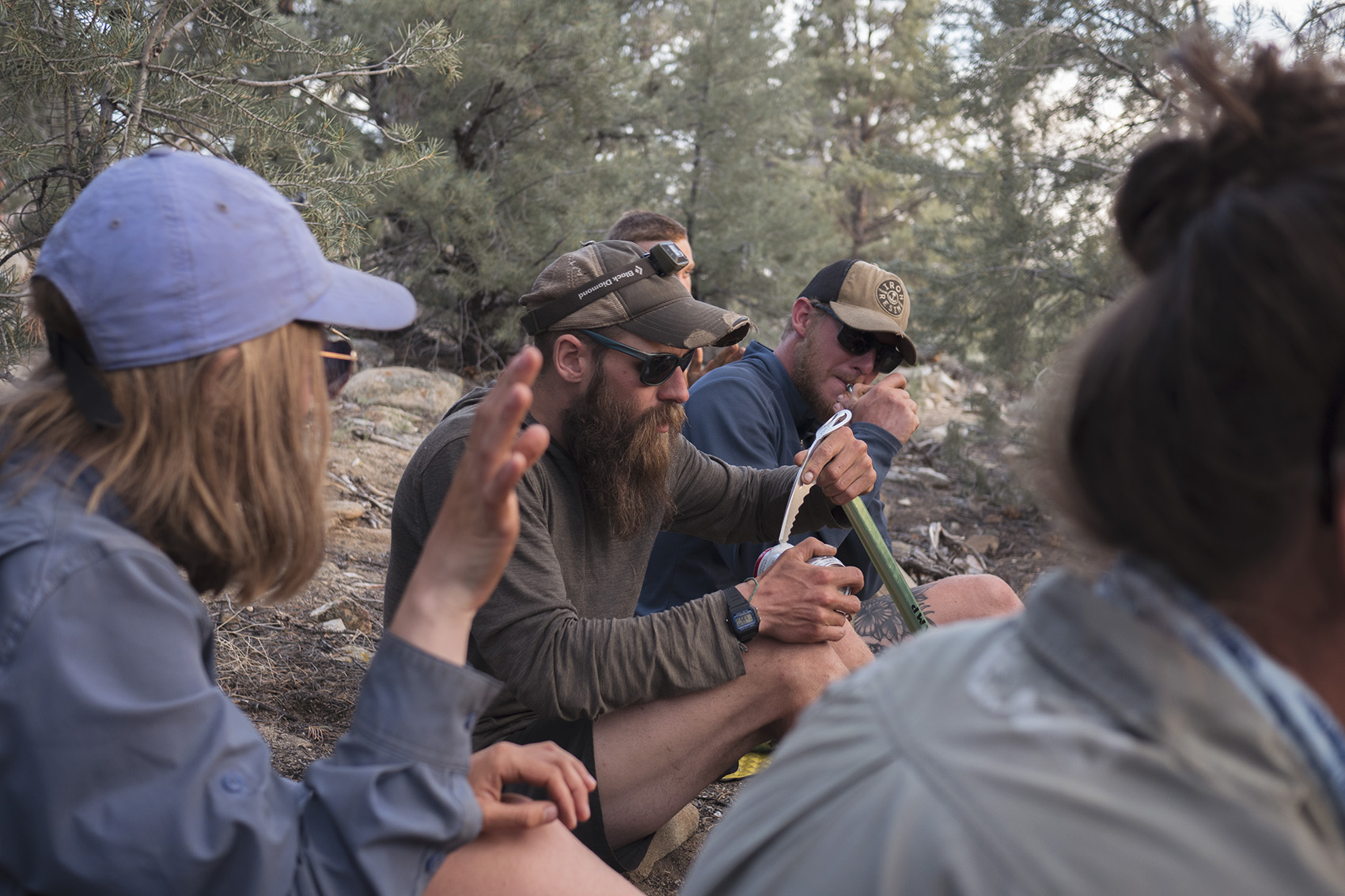
We decided to zero at Hiker Heaven and use our day to go into the larger nearby town that had an REI. With my dad back we were now mobbing with a proper tramily. There was Legs, the long legged women from North Carolina who despite having a nagging foot injury was always bright and cheery. JFC (Jesus Fucking Christ) also from North Carolina who was the opposite. Quick to talk shit and honest enough to tell you that he suffers from multiple mental disorders, he always made for an entertaining conversation. Judith, a soft spoken German girl who tagged along with JFC made for an interesting juxtaposition to his brashness. Irish Tony a lovable thickly accented Irish man that only became thicker with each beer he drank. Two New England brothers The Butcher and Captain America who talked openly about wanting to kill each other on trail. Plus a few more I’m probably forgetting at this point due to the one thing everyone in our group had in common, getting shit faced whenever alcohol was avaiable. I don’t think we were that group of Hiker Trash that parties the hardest and scares others away but maybe on a few nights we were. Regardless, at stops like Hike Heaven and Casa Da Luna everyone was having fun.
Day 41
Mile 477 | 24 hiked
The 24 24 24 challenge is one of the hardest and most honorable achievements one can accomplish on the PCT. Most hikers, like myself are too intimidated by this challenge but Alex rose to it. The challenge is simple. 24 Beers over 24 miles in 24 hours. It typically takes place between Hiker Heaven and Casa De Luna offering hikers the ability to do it with minimal food helping with obvious weight issues.
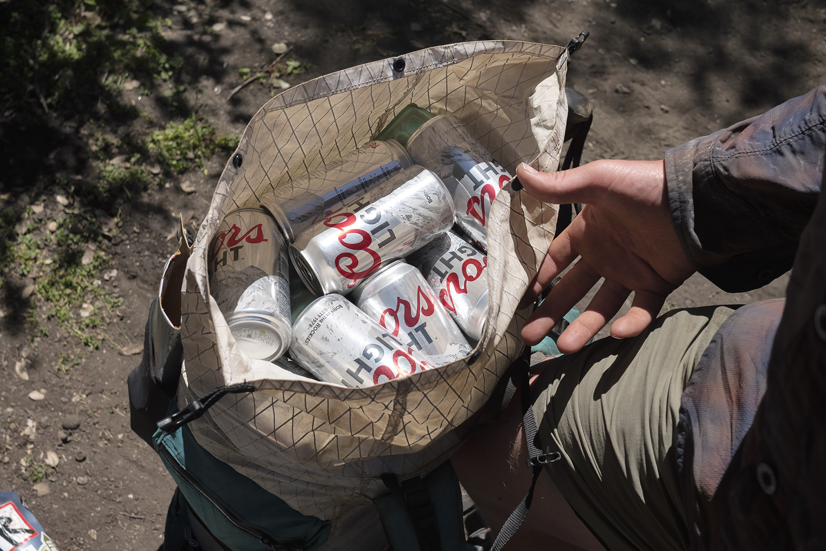
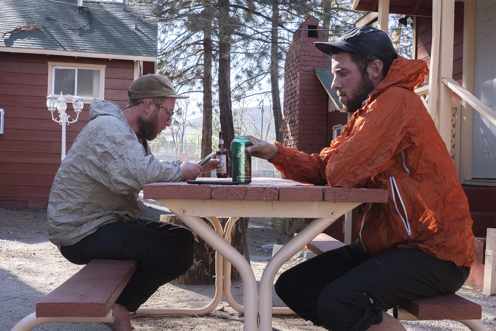
Fogey (Alex’s trail name) started off his morning 2 beers strong while still at Hiker Heaven. Before leaving town we ate a large breakfast. The next 2 miles were a simple road exiting town offering the opportunity to ditch empty cans in the trash before getting back on the proper trail. Fogey cunningly took advantage of this pounding 6 beers before the road ended. The day was very hot making the hike a tough one. The heat did nothing to slow Fogey down and he put away another 4 beers before reaching the high point of the day. 2 more were easily downed over a break in the shade. Other hikers hearing that he had took on this challenge were instantly at awe to be in his presence.
The rest of the afternoon was spent slogging through the heat up and down barren desert hills. Whenever a shady spot was found we stopped to take advantage. Nearing Casa De Luna with the sun setting Fogey had finished 21 beers. Another two were downed as we descended into the Green Valley and hit the road. Luckily for us a volunteer from Casa De Luna was dropping off hikers to get back on trail and we snagged a ride. We arrived to Casa De Luna tired and hungry. A party was raging but none of us felt like staying up much longer. Despite Fogey’s all day drinking binge he stayed mostly sober and crushed the last beer before bed. I was in awe.
Day 42
Zero Casa De Luna
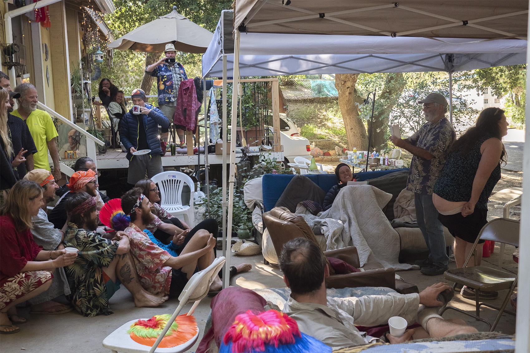
Like Hiker Heaven, Casa De Luna is a property run by trail angels that allows hikers to camp out and rest up. The Andersons who run Casa De Luna have an expansive piece of land with a manzanita bush forest that’s been carved up into campsites. Entering the magical manzanita forest you walk through long tunnels with small nooks where you can set up your tent. Coming in the night before in the dark was a confusing experience. The forest in contrast to the front yard is peaceful. Both nights I spent there were full blown parties that lasted well past hiker midnight (10pm). Terrie and other volunteers cook up pancakes for breakfast and taco salad for dinner everyday. Last year they said about 1500 hikers stayed with them. Do a little dance for Terrie and you’ll receive an awesome kerchief that lists every resupply town along the trail.
Day 43
Mile 489 | 11 Hiked
Leaving Casa De Luna wasn’t easy and we spent a few hours at the cafe down the street before finally getting back on trail. Nothing cures a hangover like hiking through the hot desert with minimal water sources. For obvious reasons we didn’t make it far that day and ended up camping just after the first water source.
Day 44
Mile 508 | 18 Hiked
The Green Valley didn’t start off green but by mile 500 it transformed into a pleasant shady forest. Water was still scare though and I found myself using a makeshift scoop, a stick with a gatorade bottle on the end to scrape water from a trough filled with bees. My first experience with shin splints made for an unpleasant end to the day and flooded my mind with insecurities.
Day 45
Mile 517 | 10 Hiked
Today was an easy short day for good reason. The next stretch of the trail was a notoriously long and dry section, The LA Aqueduct. Plus we wanted to check out the infamous, Hiker Town. We exited the Green Valley and entered a large barren flat area dotted with depressed looking farms. Hiker Town resides directly off the PCT with a few hand painted signs beckoning you to come in. If you look at the comments on Guthook about Hiker Town you will find a mix of love and extreme hate for the place which left us confused on what to expect. What we found was a piece of property containing a home surrounded by many small huts painted to look like a western film set. Hikers can sleep in these huts which all contain a single bed. We quickly secured one for the night and proceeded to explore the compound. I didn’t run into anyone who ran the place but a shuttle to a nearby store pulled in and took us to get food.
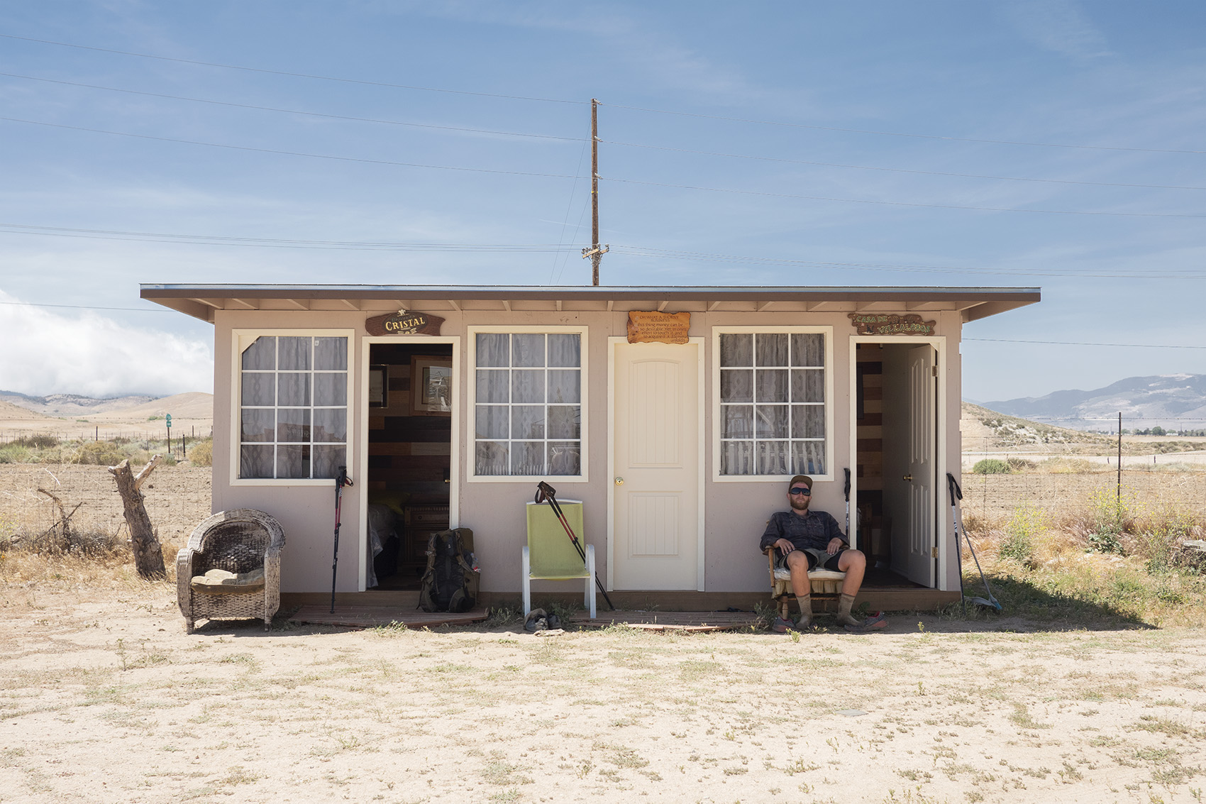
When we got back we found a small film crew had set up to shoot a movie. At this point I was beyond confused. Eventually the owner, an eccentric hustler who was once Newt Gingrich’s environmental advisor appeared and chatted with us for a while. Despite his neo conservative ties he was a really nice guy who seemed to want the hikers who came by to be comfortable and enjoy their stay. The pressure to donate $10 was apparent but seemed reasonable. Jukebox, Alex and I hotboxed a junk yard boat on the property and bummed beers off the film crew.
Day 46
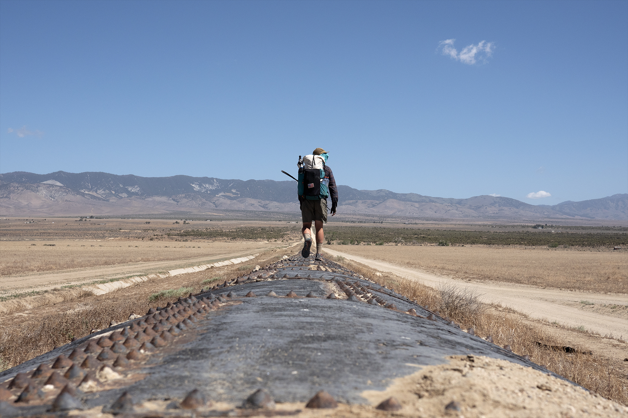
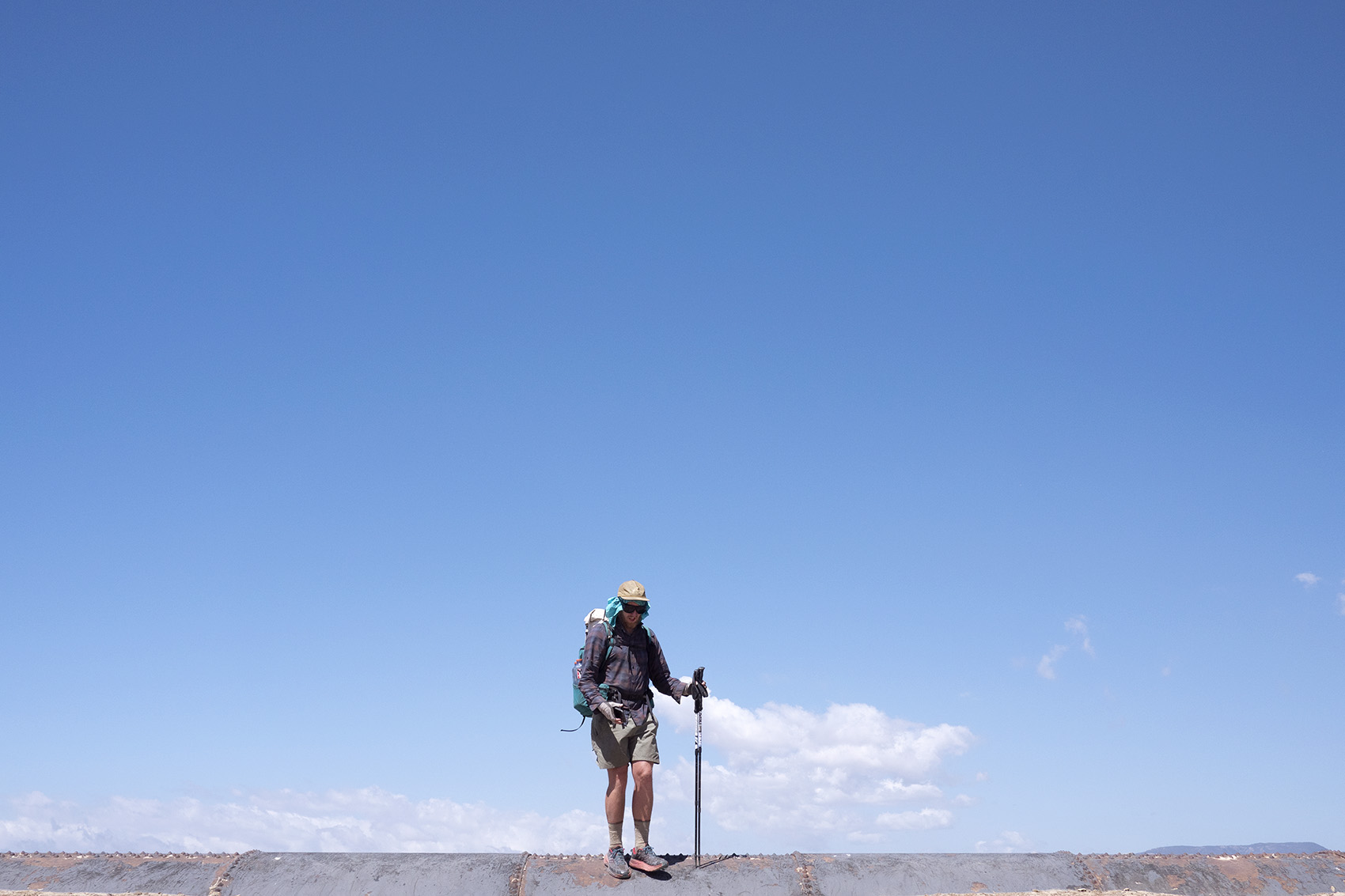
Mile 537 | 20 for the day | LA Aqueduct
The LA Aqueduct walk was notorious stretch of trail many hikers only attempt to hike at night for fear of the days heat. We had cool weather in the 70s though so proceeded to conquer it in the day. You start off walking along a massive pipe that feeds water from the Sierra to LA. Along the way we found an injured sheep trapped in an adjacent ditch that looked on its last days. With no one around we called animal control who after a confusing talk figured out where we were and assured us someone would come out to help. With a long day ahead of us we had to move on before finding out the sheeps fate.
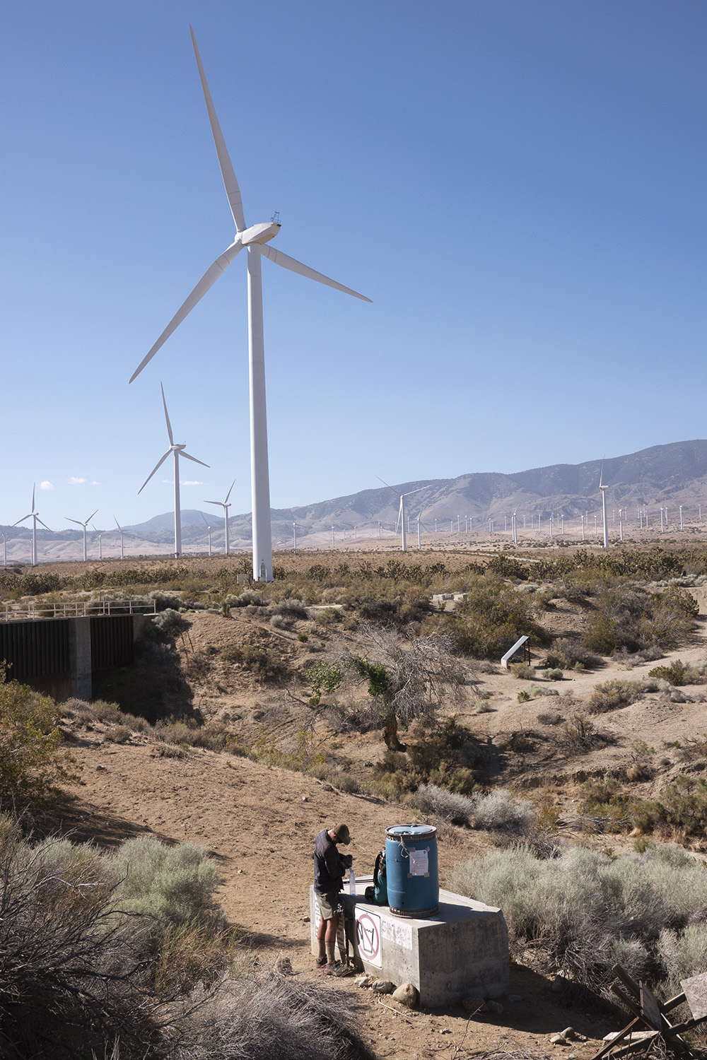
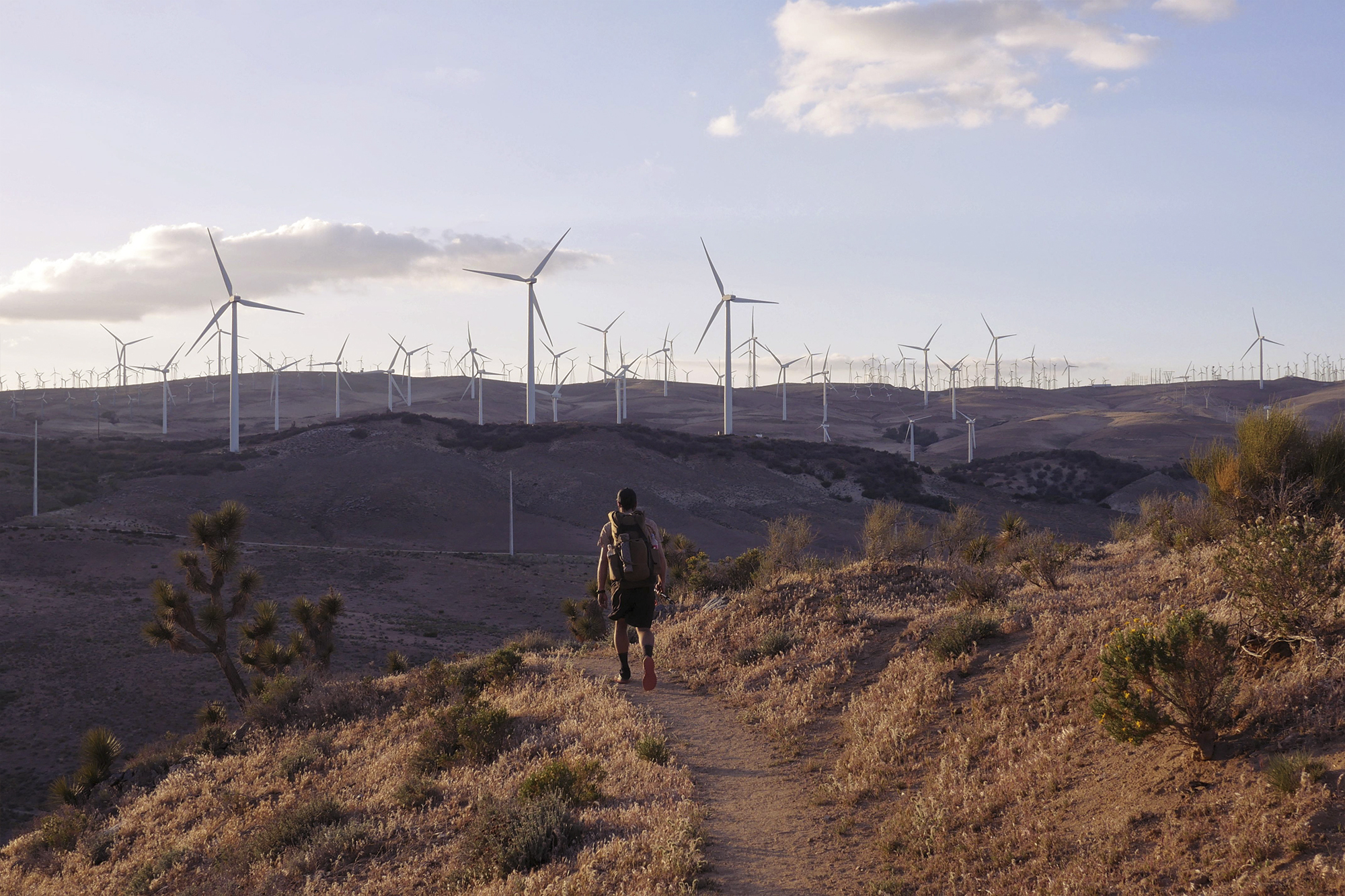
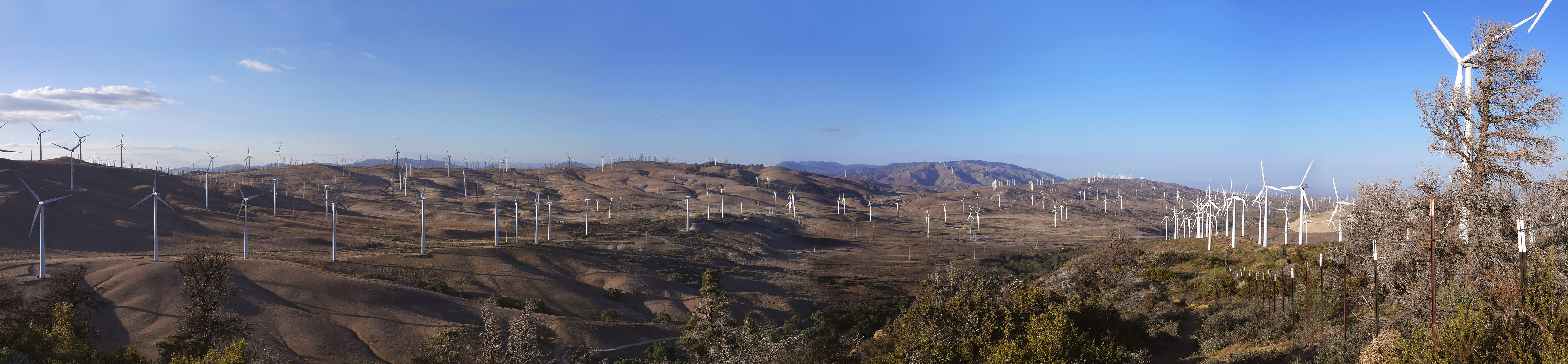
After the pipe you hit a concrete slab that leads to a wind turbine farm. We had seen a few wind farms earlier in the hike but this one was much larger. As far as I could see these giant turbines dotted the landscape turning with the wind creating a hypnotic whoosh as we passed beneath. After 20 flat miles we made camp amongst the turbines and were lulled to sleep as they turned through the night.
Day 47
Mile 558 | 20 Hiked
We hiked back into the high desert leaving the wind farm behind. Now high above the turbine farm we could fully take in how large it really was. Miles and miles of white pillars stretched across the valley. Up and down we went through small desert canyons. At the top of one in what felt like the middle of nowhere was a circle of chairs, beach umbrellas and a water cache. I found Alex and JFC here enjoying cake and shade that the Trail Angel hanging out there offered. Easily the most random trail magic since Mike’s Place. Again we walked into a wind farm populated section of trail. This farm was even larger than the last and stretched in all directions as far as the eye could see. We walked amongst the spinning giants as the sun set and made camp just short of the road that would lead to are next resupply. Two back to back 20 mile days had me feeling strong.
Day 48 & Day 49 | Mile 566 | 8 Hiked | Zero Tehachapi
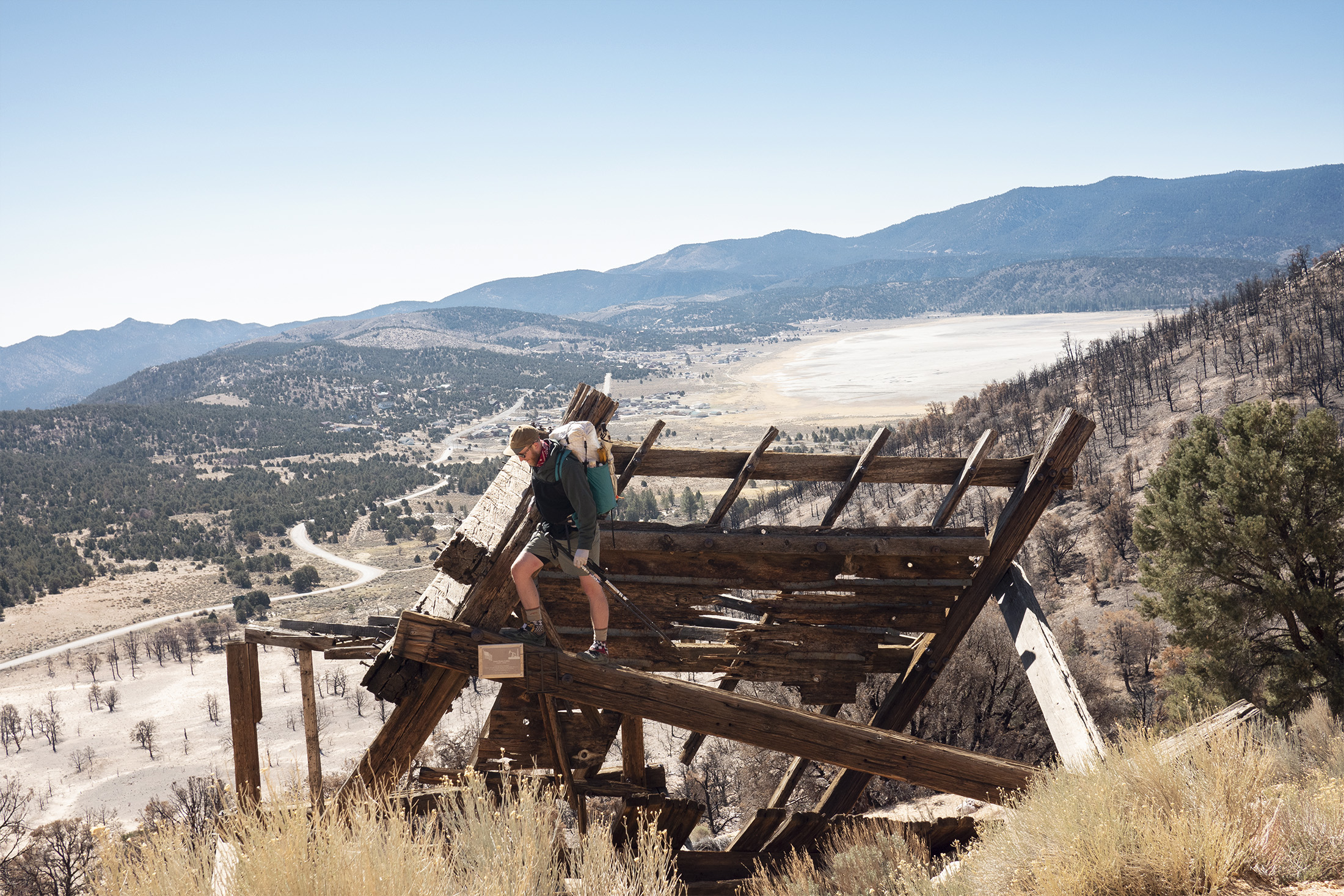
The wind farms led us to the highway where we hitched into Tehachapi. Tehachapi was a cute town famed for its unique railroad and Wind Farms. Dad had fallen behind once again so we took a zero to wait for him.
Day 50
Mile 569 | 3 Hiked
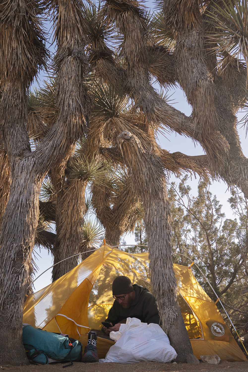
After a refreshing break we got back on trail late in the day. I would later find out this was the section of trail where Cheryl Strayed of Wild fame starts out. Like Cheryl we didn’t hike far that day and took refuge amongst the Joshua Trees for camp. The trees did nothing to protect us from the winds that night and I had my worst night of sleep on trail. Somehow my shelter held up to the violent wind gusts but the noise from it flexing and whipping made it impossible to sleep. I know now why this part of California is covered in windmills.
Day 51 – 55
51 | Mile 569 | 3 Hiked • 52 | Mile 604 | 19 Hiked • 53 | Mile 621 | 17 Hiked
54 | Mile 638 | 17 Hiked • 55 | Mile 652 | 14 Hiked
In and out of sandy desert and through private farm land we walked. Spring flowers were starting to bloom and helped to give the desert some much needed variation. I knew now that Kennedy Meadows was still a week ahead and that we would have to resupply one more time before making the final push. This bummed me out but talk of the high snow still in the mountains was starting to come up in every conversation.
The Bright Star Wilderness gave us a short tease of shady pines before dumping back into the wind swept Joshua Tree covered desert. Water caches made this section of dry trail possible. Without them I doubt you could carry enough to get through. God bless the trail angels. A large climb that took up an entire day brought us back into a forest where we hoped to remain before hitting the road to Lake Isabella. It held out and the next day we were heading into the small Lake town.
Day 56-58
Zero Lake Isabella
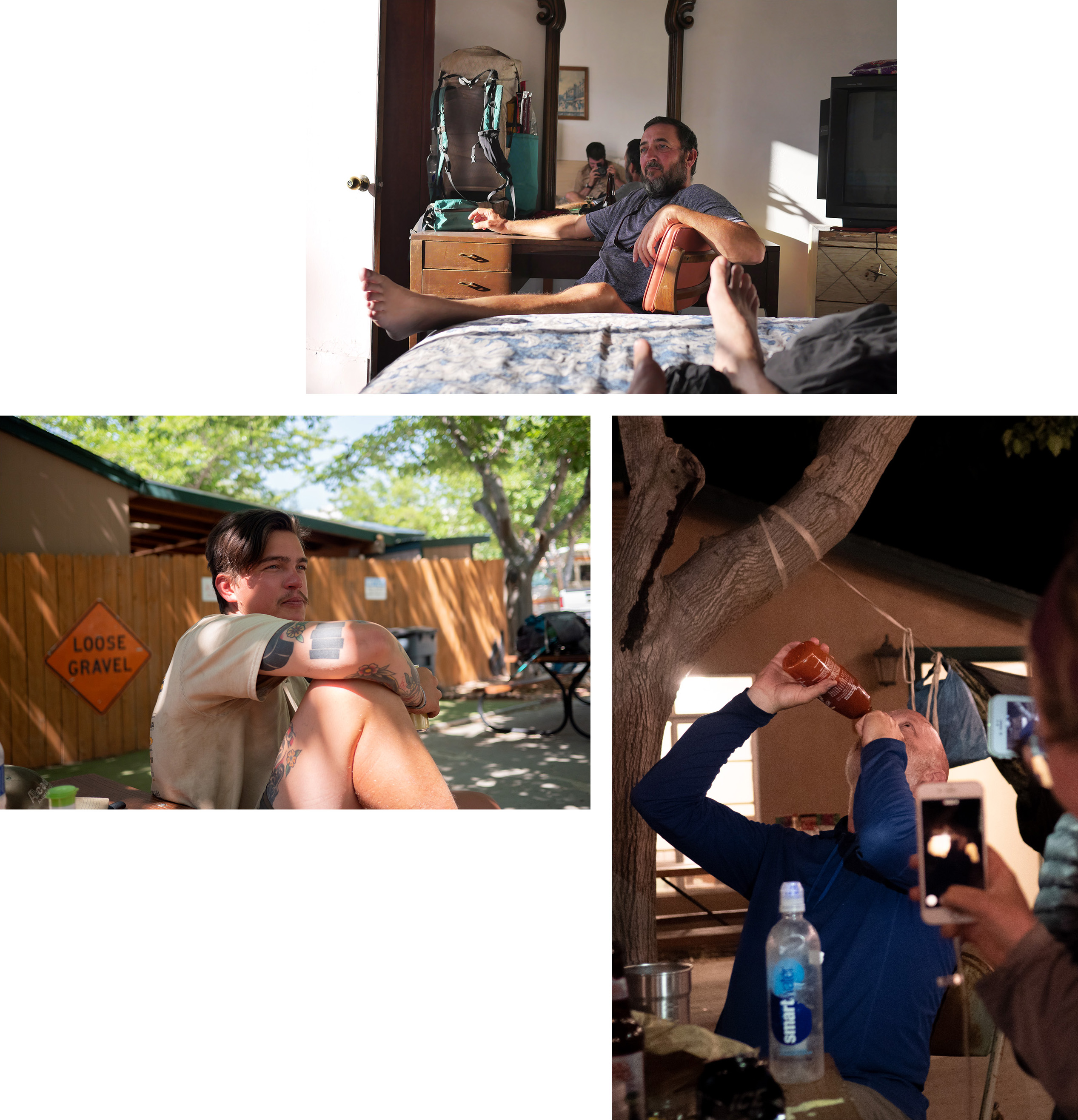
Lake Isabella was one of the more depressed towns we came to in the desert but because of its location it was a must stop most hikers had to take. Dad came into town a day behind us and wanted to take a zero as well so we ended up spending three days here. We walked up and down the highway to the few restaurants and shops located here like worn out desert refugees. An rv camp offered hikers a cheap place to stay and ended up being a fun place to party until the owner became angry with us and shut it down. I guess chanting “One of Us” as we each took turns chugging sriracha was an obnoxious thing to do. Talk of the snow slowing down hikers who were entering the Sierra and making sections impassible was on everyone’s mind. People started planning trips off trail to wait for the snow to melt and proposing flip flops to Oregon. We got caught up in the fear ourselves but ultimately decided pushing forward was the best option.

Day 59
Mile 656 | 5 Hiked
After three long days in town we all got back on trail ready to make the last push to Kennedy Meadows. As usual we were pretty late to the trail and only put in a short day. Not much was needed though to get to an area that started to look like foothills of Sierra. Our camped rested in the notch of two large mountains. Alex and I scrambled up one of the peaks to take in the sunset. The desert was finally coming to an end, the Sierra sounded intimidating but I was excited to take on its challenges.
Day 60
Mile 676 | 20 Hiked
Clouds had rolled into camp overnight and we awoke to lower temps. We followed the edge of the mountains skirting around their peaks. On one side of a peak would be cloud cover and on the other an open view to the distant desert floor still ever present below. These peaks were craggy and covered in trees. We truly were entering a new world. I relished the breezy mountain air and felt good hiking forward.
Day 61
Mile 680 | 4 Hiked
Apparently I had felt a little too good and hiked ahead of my entire trail crew including Alex. I waited around camp that morning waiting for them to catch up. Now reunited we hiked down and hit Chimney Creek Campsite where two hikers who did the PCT in the 70s and their families greeted us with beer and food. This was unexpected. They had set up a large camp where we found familiar faces who had been hanging out there for the weekend. The hospitality was endless providing lunch, dinner and breakfast the next day. Gadget, a fellow hiker played covers on his guitar starting a sing along that lasted into the night.

Day 62
Mile 698 | 18 Hiked
The bubble of hikers during this section truly felt like a funnel into Kennedy Meadows. There wasn’t a mile where a group of hikers didn’t pass you or you didn’t pass them. A short climb from the previous days camp gave us our first glimpse of the snow covered Sierras. I shouted for joy at this sight. Since day one I had been dreaming of the Sierra with it’s mighty snow capped peaks and to finally have it in my sights was pure joy. We descended into a large valley at the foothills of the Sierra. The valley was covered in blooming yellow flowers and massive granite boulders. Just 3 miles short of Kennedy Meadows we decided to camp. I wanted to push forward but it made sense to hold off, wait for my dad and enjoy the large river the trail now followed. Swimming had been absent from most of our hike so the opportunity to take a dip was one you didn’t pass up. Jukebox sparked a small fire that night, another rare treat for this section of trail. We sat around in excited silence knowing tomorrow would mark the end of the desert.
Day 63
Mile 700 | 5 Hiked | Kennedy Meadows
Kennedy Meadows is the last detour and final stop before hikers officially leave the desert and enter the high Sierra. Overwhelmed with the excitement of finally finishing the desert I practically ran the 3 miles there. Grumpy Bears restaurant, Yogi’s Gear Shop and the KM General Store are the only establishments in Kennedy Meadows. Grumpy’s was our first stop where I had sent myself an assortment of fresh new gear that I wanted to pickup. It felt like Christmas unboxing a new shirt, water filter and fresh shoes. Across the street at yogis I picked up an ice axe and bear canister.
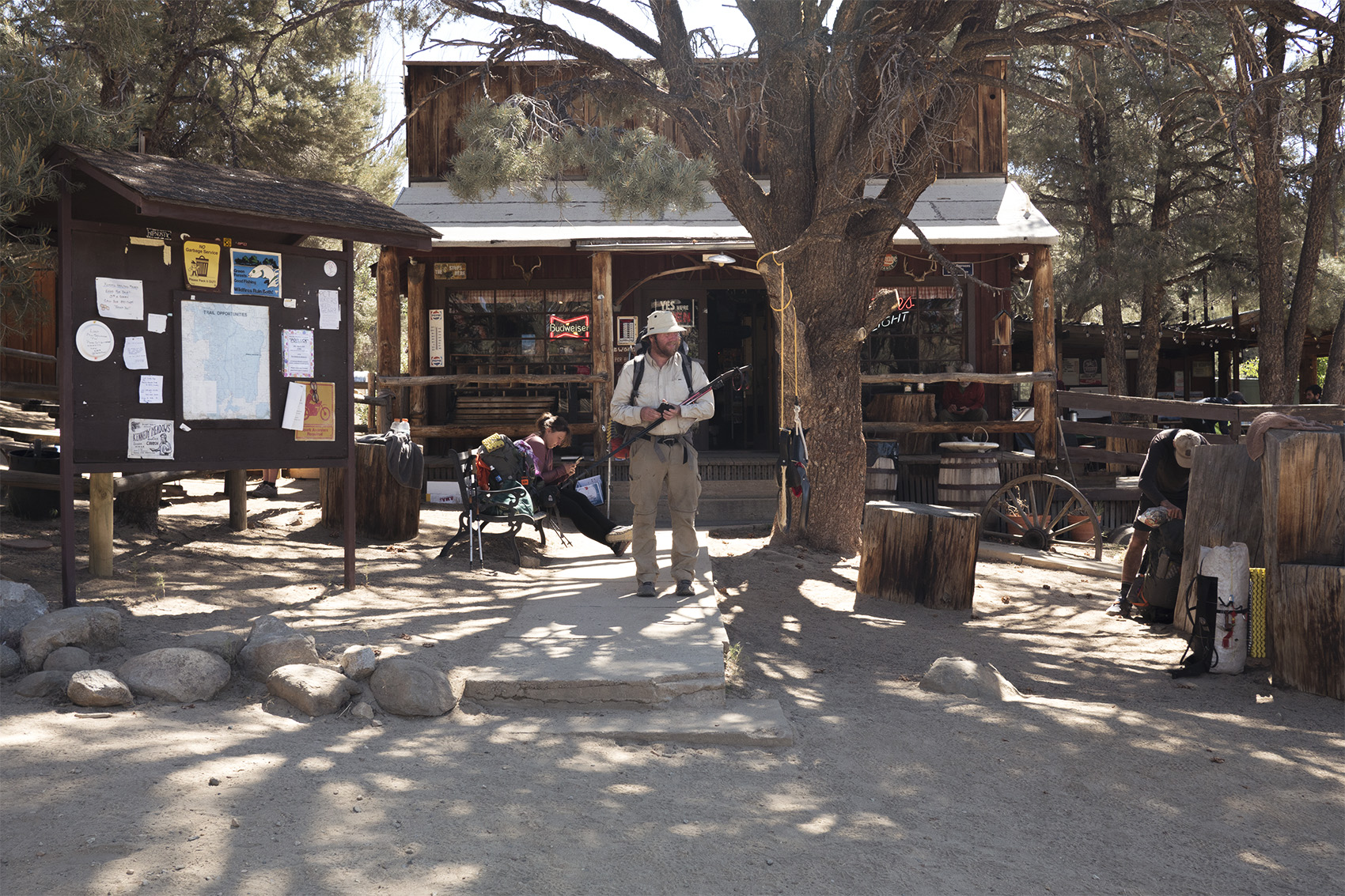
Kennedy Meadows General store was filled with more hikers than I had seen on the entire trip. Snow was on everyone’s mind. Again people were making plans to flip up to Oregon and hike south, take side trips, wait around in KM or just push forward. Beers were flowing strong though and before you knew it people stopped talking about how to use their ice axes and started using them to shotgun their beers. The overall mood was ecstatic and rightfully so. We had all walked 700 miles through arid Californian desert and were now entering one of the most beautiful sections of the PCT. Kings Canyon, Mt Whitney, Yosemite, and the John Muir Trail, legendary locations. That night ended around a large bonfire, 30 hikers singing together in harmony, truly enjoying themselves, reveling in their accomplishments and toasting to the adventure ahead.

When I think back on the desert I think of how carefree it could have been. The trail is almost always moderate. The weather is warm and sun exposure brutal but there’s almost never any irritating factors like rain or bugs. Towns are abundant, trail magic happens often and the stretch from the KOA to Hiker Town feels like one big party. No other place on trail will you cross paths with so many other hikers. Time feels infinite here, issues are small. When I hiked the desert I thought of it as an obstacle to get past. The Sierra was the PCT I had envisioned not the desert. I was determined to not let it break me and in that determination I forgot to completely enjoy it. There were plenty of moments of fun and relaxation but I never could shake the urgency to be past the desert and into the mountains. We hiked this section very slow so it wasn’t time that felt rushed but rather my ability to be present. Of course, it’s easy to think of how relaxed I could be now with the confidence that comes from finishing. Maybe I have my anxieties, fears and insecurities to thank for finishing the Desert.
